
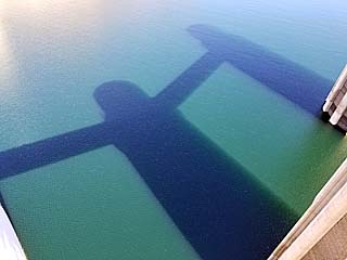
| This area shows any outdoor or boating related events. Pictures of a houseboat vacation in the Florida Keys, Jet Skiing on the fastest Sea Doo watercraft, Boating, world travel, and other outdoor activities. Check out some of the pictures regarding to boating, travel, and outdoor activities on this page. Note - This page may take a while to load on some SLOWER connections! |
|
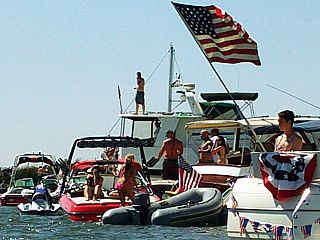
Here is a picture, taken on July 4th in 2009, of a row of many boats, yachts, and partying people in the Sacramento / San Joaquin river "delta" near Stockton, California. More than a thousand boats can be anchored at a given time during the July 4th celebrations near the King Edwards Island area. |
|
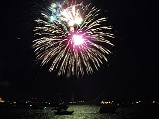
Here is another picture, taken on July 4th in 2009, of the fireworks with anchored boats and yachts in the forground during the July 4th celebrations near the King Edwards Island area. More than a thousand boats and party goers enjoy and celebrate in this area near Stockton each year, not far from Paris Hilton's waterfront property across from King Edwards Island. |
|
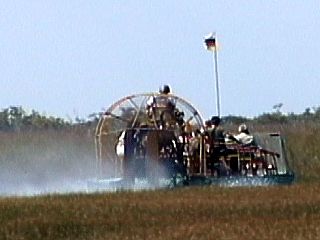
This picture was taken from an Indian camp at the Miccosukee Indian Reservation in the Florida Everglades. We are on a guided tour of the alligator infested wetlands via the airboat pictured here. The airboat is powered by either two Chevy v8 or Lycoming aircraft engines. The noise on one of these things is deafening. |
|
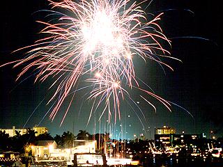
The lead boat in the annual Fort Lauderdale boat parade opens with a finale of fireworks as it reaches Pompano Beach, Florida along the Atlantic Intracoastal Waterway. The picture is a time exposure of about 10 seconds (f5.6 Kodak ASA200) and captures the fireworks brilliantly. Note the "crowd" of boats watching the show in the lower portion of the picture. The bright "white" streak is from the exposure capturing the motion of the lead boat shooting the fireworks. The boat parade is world-famous and takes place each year in Fort Lauderdale in mid December in a Christmas based event called "Winterfest". |
|
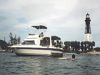
Boating with my family on our cabin cruiser in the cove adjacent to Hillsboro Inlet in Pompano Beach, Florida. |
|
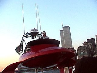
This is a view of captain "Mad Dog" at the helm (bridge) of the "Beast" boat that tours along side the famous "Circle Line" around the New York Harbor. The "Beast" is a large, high performance speed boat that can hold over 100 people and can reach speeds over 50 MPH as its twin 1400 HP turbo diesels power it along. In this shot, the World Trade Center's twin towers loom over the captain's controls as he powers the ocean "rocket" south of Battery Park. The World Trade Centers twin towers you see here were demolished just a week after this picture was taken by terrorist hi-jacked commercial aircraft crashes. |
|
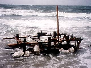
A makeshift and very non-sea worthy contraption washes ashore in Boynton Beach, Florida during a massive exodus in Cuba in the Summer of 1994. This was one of several rafts, called "Balseros", that were along the beach, and were unmarked by the US Coast Guard. Most likely, whoever was on this raft, is living somewhere in the United States without the US Government even knowing. Most likely, this raft was launched several days earlier from near Havana, Cuba, became entrained in the Gulf Stream current, and washed ashore here as the illegal aliens fled. Cubans who land on US soil are eligible for US nationalization via political asylem because Cuba is a communist country. Some of these rafts never reached land, unfortunatly, to follow the Gulf Stream out to see never to be seen again. |
|
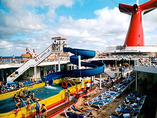
This is a view of the Lido deck of the Carnival Cruise Line's ship "Fascination" enroute to Mexico on New Year's day 2002. The pool area and large sundeck, complete with water slide, make for a fun time at sea. The Carnival red and white logo is painted on the ship's smoke stack (called a funnel) in the upper right hand side of the picture. |
|
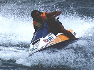
A spinout in a 1990 Sea Doo SP at Boynton Beach, Florida. This is my first Sea Doo Jet Ski, originally 50 HP. Here it has been modified to about 60 HP and I am testing it with its new cylinder heads. |
|
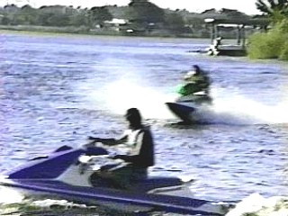
A 52 MPH pass along the side of Lake Ida in Delray Beach, Florida in a 70 HP 1993 Sea Doo Xp. The large jet ski in the foreground is a 1992 Sea Doo Gt. |
|
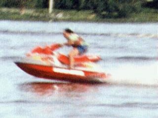
The fastest Sea Doo Jet Ski to date. I am making a high speed pass on Lake Ida in Delray Beach, Florida. The 130 HP machine screams accross the water at speeds up to 70 MPH. |
|
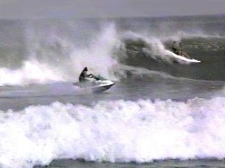
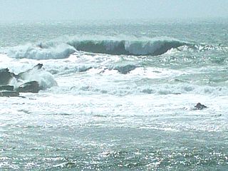
Observing and having fun in a 8 to 10 foot north swell at Reef Road in Palm Beach, Florida. This place is usually the best surf spot for north and northeast swells during winter cold fronts. |
|
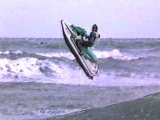
Jumping waves during a Nor Easter off Boynton Beach, Florida in March 1995. The wave being jumped is 6 to 8 feet high with 20 to 25 Knot NE winds. |
|
This picture is a 15 second time exposure (f5.6 Kodak ASA200) of the parade of boats passing by on the Intracoastal Waterway during the annual Winterfest Boat Parade in Pompano Beach, Florida. I am standing nearly still in the right hand side of the picture. The bright streaks from the left to right in the picture's center are the decorated boats passing. One boat, a yacht decorated with lights, pulled into the lake in the foreground (just above my hand). The city light pollution also can be seen lighting up the night sky. The boat parade is world famous and takes place every December in the Fort Lauderdale area during the Winterfest holiday event. |
|
Here is a view of the northern brach of the San Francisco bay which leads to the San Joaquin river / valley taken from a 1963 Owens cabin cruiser a friend of mine was restoring and doing a "sea trial". |
|
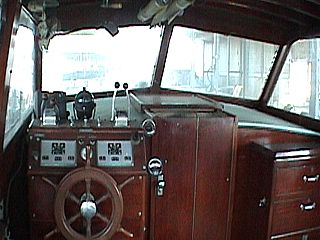
Here is another helm station view of a classic Hunter cabin-cruiser owned by my friend in California. He has the great hobby of restoring these boats on his spare time. In this picture, the original helm (steering and piloting area) can be seen and the original teak wood is in great shape. |
|
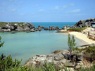
Bermuda is a beautiful semi-tropical island roughly 650 miles east of the US East Coast, and bathed by the warm waters of the Gulf Stream Current. The island is a mere 21 square miles and a British possession. In this picture, the pristine waters of Tobacco Bay (near St George) are lined with limestone bluffs and pink-yellow sand beaches. Believe it or not, this picture was taken only ONE day after the island was hit with a hurricane! |
|
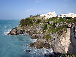
Here is a picture of the rugged limestone bluffs on the north side of the island of Bermuda near Mullet bay. |
|
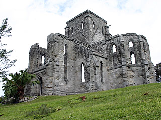
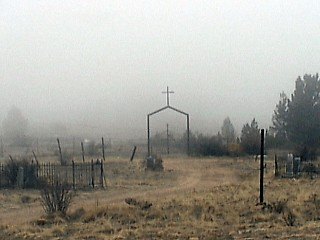
This is an old / unfinished church that stands near Folly Lane in St George. Construction of this church near Government Hill Road begun in 1874 but was never completed. |
|
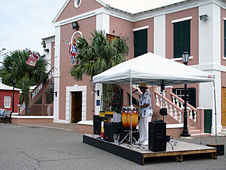
A reggae band plays an infectious tropical beat to a nearly deserted common area in St Gerorge proper near the waterfront and ferry terminal. This was right after hurricane Igor hit the island, and before any tourists returned, but that did not stop the spirits of these folks. |
|
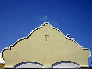
Here is a view of one of the charming pastel-colored roof gables that are a commonplace throughout St George and much of Bermuda's architecture. The roofs are sturdy white / cemented limestone and desighed to collect rainwater for use on the island. |
|
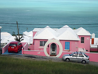
Here is a picture of another residence near St David. Note the white stone roofing (with water collection gutters) and pastel-pink paint. The "moon circle" is also a common stone arch seen gracing many entrances throughout the island. Roadways on Bermuda are extremely narrow, and many homes are perched on high cliffs (about 200 feet here in St Davids). Visitors cannot rent cars in Bermuda, so the preferred modes of travel are by bus, taxi, or even foot. Mopeds are available for hire for the more daring. Oh, and remember that Bermuda is British, so drive on the LEFT side of the road! |
|
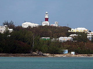
Here is a view across Turtle Bay and at St Davids with the lighthouse above Ruth's Bay on the other side. The St David's Lighthouse is over 200 feet above sea level and burns petroleum for a 30,000 candle-power output. It was built in 1879 and still guides ships to this day. |
|
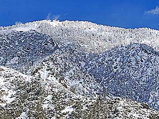
The winter of 2023 was a particularly harsh winter for most of California. An "atmospheric river" of moisture caused heavy rains and mountain snow in early 2023. In this picture, in the San Bernandino Mountains (Angeles national forest near Baldy Mountain), heavy snow blankets the mountaintops at only 3,000 feet elevation after a powerful winter storm clears the area in late February. |
|
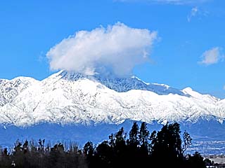
View of the San Bernandino Mountains and Angeles national forest from near Ontario, California in late February 2023. The snow line is very low on the mountain, as low as 3,000 feet MSL after passage of a winter storm. |
|
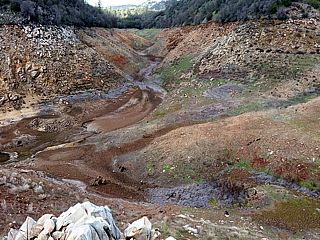
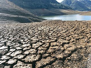
This is a picture of the Don Pedro reservoir in early January 2016 near the Sierra foothills off Highway 108 / 120. The canyon you see here is the actual lake bed, normal covered by 250 feet of water! The California drought has taken its toll on many beautiful mountain lakes like this. |
|
Another picture of the dry and cracked lake bed of the Don Pedro reservoir in early January 2016. The small lake in the distance is all that remains of the reservoir after a devastating drought in California. |
|
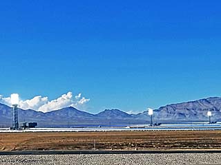
This is a view of the Ivanpah Solar Electric Generating Station from along Interstate 15 near Nipton, California (San Bernardino County). It at the base of Clark Mountain which is close to Primm, Nevada. The planned output is near 377 megawatts and has been completed / commissioned in 2014. Thousands of sun-tracking mirrors, called heliostats, focus the sunlight on each of 3 "receiver" units atop towers. The concentrated light cases the tower receivers to get extremely hot, heating water inside them to high-pressure steam, turning a turbo-generator and generating electricity. The glare from the white-hot tower receivers can be seen for many miles and appear as giant light bulbs. |
|
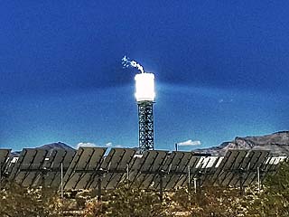
Under-exposed view of one of the receivers atop the tower during operation, glowing white hot. Excess steam is venting from the top (the actual steam turbines and generators are on the ground in a building next to the tower and not visible in this picture). Note the intense solar flux (concentrated sunlight Tyndall scattering in the air near the tower). The mirrors (heliostats) can be seen in the foreground and could be heard "clicking" every few seconds as they slowly move and keep the sun pointed at the receiver towers. There are three of these towers, with a total of 173,500 heliostat mirrors across the facility. |
|
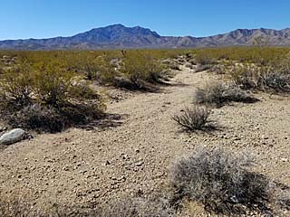
Here is a view of the Mojave Desert flora and terrain near Nipton, California and at the base of Clark Mountain on a sunny October day in 2018 near the Ivanpah Solar facility. The area around the plant is environmentally sensitive, with desert tourtoises displaced by the land used and birds (called "streamers") that can be literally "cooked out of the sky" if they fly too close to the solar receiver towers when operating! |
|
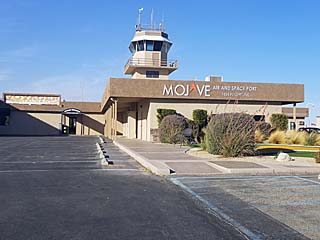
This is the administration offices, restaurant and old tower at the Mojave Air and Space Port in Mojave, California. It is also near Edwards Air Force Base (25 miles to the east) and has been a focus for flight and even spacecraft development / research. Many records were broken here at this seemingly quiet place, including non-stop flights around the world (such as Voyager in 1986) and the "Ansari X-Prize" won by Spaceship One in October 2004. The facility also has some reputable space / flight development firms, such as BAE Aerospace, Virgin Galactic, and Scaled Composites. |
|
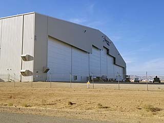
Here is the (unfortunately closed) hangar for the "StratoLaunch" plane, a carrier aircraft being built by Scaled Composites, and serving as a high-altitude launch platform for vehicles into space. The aircraft in this hangar is a massive twin fuselage plane with a wingspan of 385 feet (larger than a football field), 238 feet in length, with 3 large PW4000 series jet engines (from two 747s) on each side, and a service ceiling of over 50,000 feet. |
|
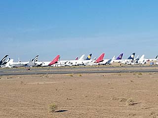
This is a view of the aircraft "boneyard" that is on the far side of the Mojave Air and Space Port. This is basically just a "junkyard" of retired aircraft (with many being the legendary 747) that will be parted out and eventually scrapped for metal. The engines - Being the most valuable part of any airliner - Are usually removed with the remainder of the plane, less valuable components (APU generators, avionics, refurbishables, etc), residing here in the "boneyard". |
|
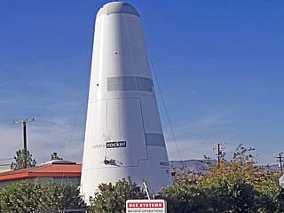
This is the "Roton" or Rotary Rocket that is on permanent display along a street corner in the Mojave Air and Space Port. The ATV (atmospheric test vehicle) of this prototype proved to be unsuccessful, with a helicopter rotor being at the top of the vehicle. The intent of the project was to use a helicopter mode to reach high altitude, then retract the blades and transition to rocket powered flight. When returning and back in the atmosphere, the vehicle would switch back to helicopter mode and land. This concept was abandoned due to lack of funding. |
|
Cockpit (on the right side of the photo) of the Rotary Rocket that is on permanent display at the Mojave Air and Space Port. The restrictive view in this vehicle gave it the name "batcave" by test pilots. |
|
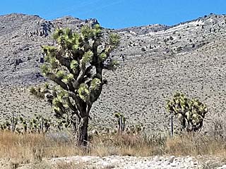
Here is a picture of a Joshua tree that is native only to the Mojave Desert in the southwestern United States. |
|
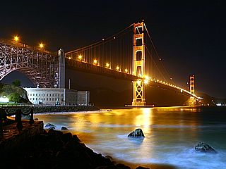
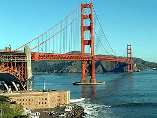
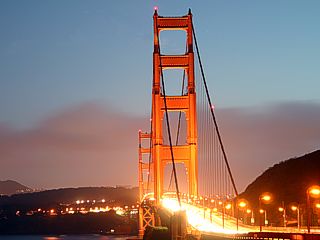
Here is a picture of the Golden Gate Bridge as viewed from near Fort Point at night in nOvember 2010. |
|
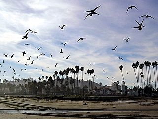
Seagulls fly overhead at the beach in Santa Barbara, California in November 2010. |
|
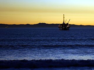
This picture was taken in Huntington Beach, California in November 2010 looking to the west from just nort of the famous Huntington Beach pier on a clear evening. The oil rigs lie offshore and the channel island of Santa Catalina looms near the horizon as a fun swell rolls into the beach. |
|
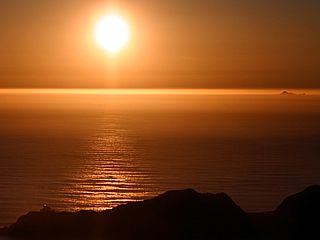
Here is a picture of the Pacific Ocean near sunset from a mountain top near Sausalito, California on a clear day in November 2010. Not only is the color of the sun over the ocean unique, but note the little islands to the far right. These are the uninhabited Farallon Islands, about 25 miles offshore of the mouth of the San Franciso Bay. They are accessible only by boat. |
|
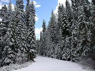
Here is a closed roadway and fresh snowfall near the Sonora Pass in eastern California in November 2010 making for a beautiful "Christmas tree" scene as fresh snow covers the douglas fir trees along the roadway. |
|
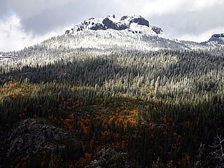
This is the landscape near the Sonora Pass in the Sierra Nevada mountains in eastern California after the first fall snowfall in November 2010. Note the colored trees near the base of the mountain giving way to evergreen conifer trees and eventually a snow cap as one procedes higher. |
|
This picture was taken from the top of a cliff near Pillar Point (near Half Moon Bay, California) showing the dangerous "Mavericks" wave-break during a major northwest swell in March 2010. The rocks to the left are at least 25 feet high, the large breaking wave, is in excess of 30 feet in height. Winter storms between Asia (Japan) and North America over the north Pacific Ocean generate such high swells, and a unique rock formation focuses the swell energy (called a "lensing effect") into the peak break (sometimes which can be over 50 feet high) at Mavericks. |
|
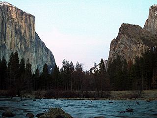
Here is a view of the Yosemite Valley in Yosemite National Park in March 2010. The glacial valley (U-shaped valley) is surrounded by sheer mountainous terrain that rises nearly 3,000 feet above the 4,000+ (MSL) foot valley floor, making for some of the most spectacular and majestic geology on earth. |
|
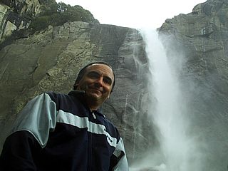
Here is a picture of myself while hiking the lower Yosemite Falls (near the plunge pool) in March 2010. The lower falls is over 300 hundred feet high, and the upper falls, separated by the middle cascades, is over 1,400 feet high. Yosemite falls is the highest waterfall in the United States, with a total drop of over 2,400 feet. The view here ONLY shows the LOWER Yosemite falls. |
|
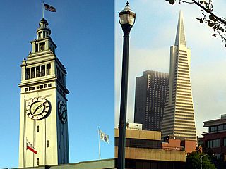
Here is a composite of two pictures, taken from the same location in San Francisco's "Marina District" / Embarcadero in July 2009, showing the city's amazing, and historic architecture. To the left is the San Francisco Ferry Building / clock tower, built in 1898, and to the right is the famous Transamerica "Pyramid" building, built in 1972. Both are a legendary influence to the city's skyline and roughly 75 years of architecural development separates these two land marks. The Transamerica building is 853 feet tall making it the tallest building in the city as of 2009. |
|
Two sailboats come within 100 yards of the wharf at Santa Cruz, California during a warm and breezy Sunday afternoon in April 2007. |
|
This is a view of the hot central valley area of California just west of Stockton during early September 2007. The view is to the west at Mount Diablo. Temperatures in the central valley reached 100 to 105 degrees F on this day. |
|
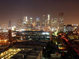
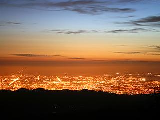
This is a picture of downtown Los Angeles taken from atop a 14 story parking garage off I-10 at twilight. The image is a 10 second time exposure at F5.6. The view is to the north. |
|
Here is a picture of the Golden Gate Bridge near San Francisco, California. The view is in the morning and looking towards the northwest. Also note the 8-12 foot northwest swell breaking in the foreground. |
|
This picture is a time exposure of about 8 seconds at F5.6 of the Golden Gate Bridge taken from the north side of the San Francisco bay. In this self-illuminated shot, the red colors of the bridge are brought out along with its Art Deco architectural theme. |
|
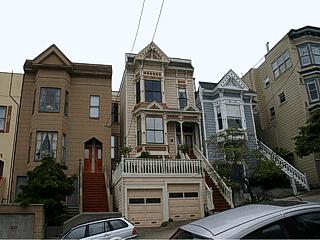
Here is a picture of a row of (extremely expensive) homes along a steep hill in the "Castro" district of San Francisco. Pastel colors and intricate detail create a festive and artsy feel to this part of town. |
|
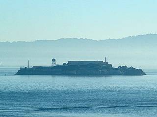
Alcatraz island, a former penial (prison) colony, looms over the San Francisco Bay during the morning just north of the city by the bay in March of 2004. This famous island was a formidable prison in which escape attempts usually ended up in re-capture, death, or drownings. Another name for Alcatraz island is "the rock". |
|
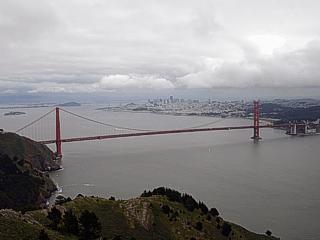
This picture was taken from a high vista point (roughly 1,300 foot elevation) near Sausalito and is looking southeast. Alcatraz Island appears in the far upper left, with the Golden Gate Bridge spanning across the mouth of the bay with San Francisco looming in the background through a break in the low clouds. |
|
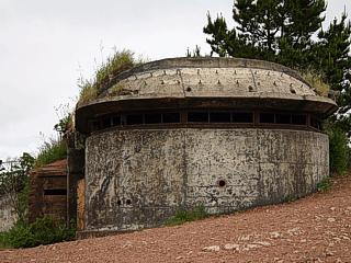
This is a picture of a portion of an abandoned military battery (called a "pillbox") atop the hills near Sausalito. The battery was constructed before and through the start of World War II and has not been in use since 1943. Colonel Mandel coordinated construction of the battery to protect the harbor from enemy aircraft. The battery featured barracks, gun turrets, and had a full operating military base to support it in its day. Here it sits and rusts in the cool salty air. |
|
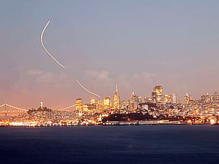
Here is a picture taken at dusk of the San Francisco skyline from the north side of the Golden Gate bridge. The camera setting is F5.6 with a 25 second time exposure to reveal the city by its own light. Note the streak in the sky to the left caused by an aircraft departing San Francisco International Airport. |
|
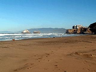
Just west of the city of San Francisco lies the Pacific Ocean. This picture shows the northern sections of San Francisco beach (looking to the north). Seal Rocks can be seen just to the left. |
|
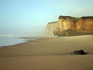
Here is a picture of some sandstone bluffs meeting the shoreline of the Pacific Ocean off the Pacific Coastal Highway - Highway one, also called "Big Sur" - near San Mateo. |
|
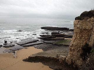
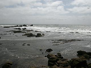
Here is another picture of some interesting features of California's dynamic and rocky shoreline off the Pacific Coastal Highway between Santa Cruz and Pescadero. These rocks are exposed at low tide, and often thrashed with crashing waves. A diverse set of interesting marine life populates this natural world, ranging from starfish and crabs to seals and seagulls. |
|
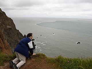
This is a picture of myself crawling, with great caution, to look over the edge of a 500 foot high bluff overlooking the Pacific Ocean near Sausalito. Also note the turbulent tidal boundary (line of whitecaps) in the ocean offshore caused by upwelling ocean currents and extreme tides interacting with a rugged rock bottom north of the entrance to the bay in an area called "Potato Patch". A person falling off one of these majestic cliffs to the jagged rocks below will have no chance of survival. |
|
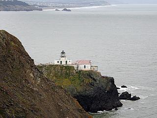
The lighthouse on the north end of the mouth of the San Fancisco continues to guide ships into the treacherous entrance safely as it did for over a hundred years. |
|
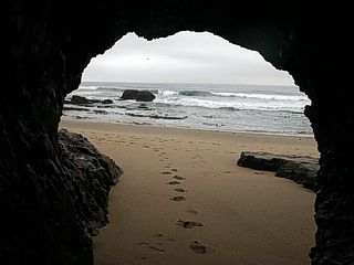
The rocky bluffs of California's Pacific coast are lined with miles of undisturbed beaches. In this picture, I am inside a small cave looking out to the beach and Pacific ocean at lot tide. |
|
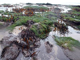
This picture shows a rocky bottom of a tidal pool exposed at low tide. Sea grass and kelp is everywhere, making the whole area look almost like a marsh rather than a wave-beaten terrace of rock. Fish, starfish, shellfish, anemones, and many life forms fill the pools of water between the rocks. Sea birds and seals also frequent the area since food is so abundant. |
|
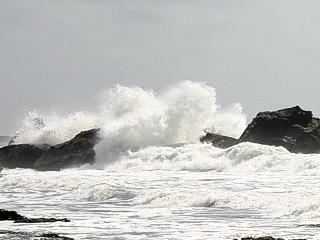
Here is a picture of the surf zone and rocks off Pillar Point that lies outside of Half Moon Bay. The interesting thing about this place is that is is known, with great respect, to surfers as MAVERICKS. The main break occurs just to the right of the farthest rocks in the center of this picture, and is not much given there is a choppy 10-12 foot northwest swell prevailing the day when this picture was taken. On "big" days, a 20 to 30 foot deep water NW swell lights up the break with outrageously insane wave face heights, sometimes reaching 40 or even 50 feet (while most other beaches are "overpowered" by such swell)! As you can imagine, anyone trying to surf such a place on a big day is risking their life, and this place has killed even expert surfers trying to tempt such waves. People attemting to surf Mavericks on a big day are often towed into place with a boat or jet ski from the nearby inlet, catch the fast-moving (un-paddleable) wave, drop in and turn hard right to avoid a trip through the rocks. |
|
This is a picture of a large breaking wave slamming into one of the infamous rocks surfer's call "Mushroom Rock" at the Mavericks surf site off Pillar Point. Still wanna try to surf here? Think it over - Or just have "guts". |
|
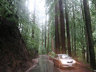
Between the southern end of the San Francisco Bay and the Pacific Coast is an interesting penninsula of high mountains (about 4,000 feet) that is home to the Redwood Forest. In this picture a small road weaves between the tall Redwood trees on a damp, cool, and foggy northern California day. |
|
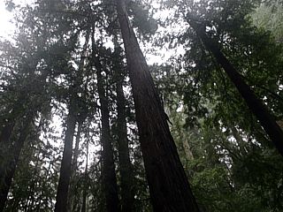
Looking up at the majestic canopy of the Redwood forest. These trees can be hunderds of feet tall, about 20 feet wide at the trunk, and thousands of years old. |
|
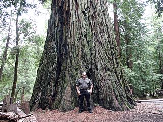
Here is a picture of myself standing next to a trunk of one of these redwood giants. Some of the tree trunks of these trees are about 20 feet in diameter and large enough that if a tunnel was made in one a school bus could drive through it! |
|
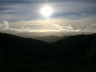
This is a picture taken from near Redwood Terrace looking westward out over the Pacific Ocean and over a valley. The ocean is actually on the horizon and covered with low clouds and fog (called a marine layer), but a majestic view is offered from this height (over 3,500 feet) and across the valley and top of the distant cloud deck of the marine layer. |
|
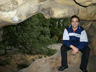
Here is a picture of myself in a small cave in a rock formation known as Castle Rock. This is in one of many hiking and rock-climbing areas in the Redwood forest. |
|
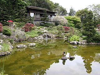
This is a picture of the Koi pond at Hakone Gardens in Saratoga, California (just west of the bay area) with Banzai trees and martial arts / cultural center in the background. Scenes from the movie "Memoirs of a Geisha" was also filmed here. This area of California (San Jose and surrounding cities) has the highest population of people of Asian descent in the United States, and architecture, foods, and people of such culture can be found everywhere. |
|
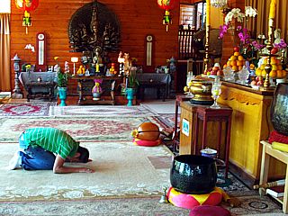
This is a picture of the meditation area (Buddhist Temple) at the Kim Son Monestary near Watsonville, California. The areas and cities in Northern California have high population of people of Asian descent and the main religeon is Buddhist. In this picture, a Vietnamese man is praying in the temple, which is decorated with numerous religeous (Buddhist) statues and instruments used in such ceremonies. |
|
All this magnificant wilderness and scenery in northern California is close to the nearby sprawls of San Jose and surrounding cities which lie in a "valley" between the mountains. In this picture, a time exposure taken at dusk on the foothills of mount Hamilton looking west, the famous "basin" contining San Jose and "Silicon Valley" shines brightly with its orange glow of low-pressure sodium lights. These lights are intended to cut down on light pollution affecting nearby Lick Observatory east of town. The south end of San Francisco bay can also be seen to the far right. |
|
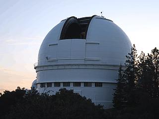
Here is a picture of the main telescope building at Lick Observatory atop the summit of Mount Hamilton east of San Jose at dusk. The observatory is roughly 4,500 feet elevation. |
|
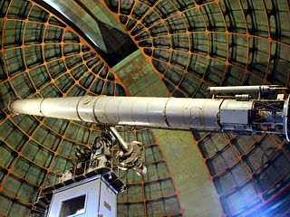
Inside the main telescope building at the Lick Observatory is one of the oldest telescopes, the 36 inch refractor. This amazing piece of astronomical equipment saw its first stars in 1888, has discovered the 5th moon of jupiter, and is still in use today for research at least weekly! The plot of James Lick, in honor, is buried under the pillar of this telescope. |
|
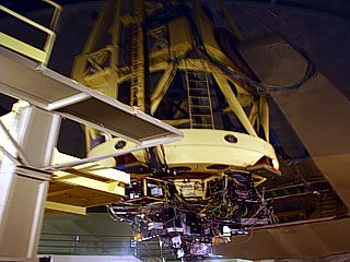
Here is a view of the base and mirror assembly, bristling with imaging equipment, of the Shane 120-inch reflector telescope at the Lick Observatory. The mirror at the end is nearly 10 feet (3 meters) across and is used for supernova / galaxy research. A laser assist also corrects for atmospheric turbulence when observing distant objects. |
|
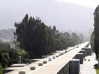
This is a picture of the Stanford Linear Accelerator (LINEAC) that runs west to east and crosses under highway 280. This is one of the longest buildings in the world, and houses magnets to accelerate sub atomic particles (such as electrons) to a target for various particle physics experiments. |
|
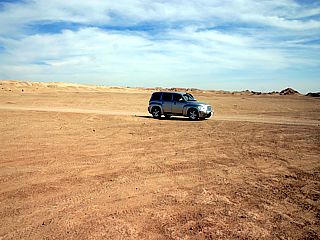
In this picture, taken off Highway 78 about 100 miles or so northeast of San Diego, the scene becomes quite dry and desolate. This is the California desert. Mountains to the west block any rainfall from reaching these arid regions of the desert southwest in the US. |
|
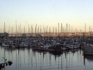
This is the marina at Monterey, california. During the late summer months, this area is a boating mecca, and the marina is filled with sailboats and other vessels. |
|
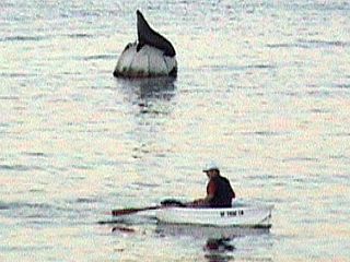
Here is another picture taken at the marina in Monterey, California where a man rows his dinghy (small boat) past a harbor seal atop a mooring buoy. |
|
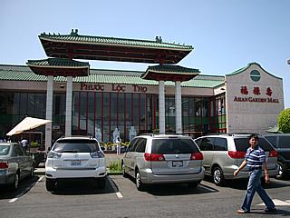
California, being one of the "closest" places to the Far East has a large collaberation of Asian cultures. In this picture, the area of "Little Saigon" is shown, which is to the southeast of Long Beach in Orange County, containing restaurants and shops. This is just one of many communities where california's ethnic background is obvious. Pictured here is "Little Saigon", which is home to a very large Vietnamese community. There is also a large Japanese, Chinese, Korean, Filipino, and Mexican community in Southern California to say the least. |
|
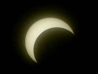
On May 20, 2012, an annular solar eclipse took place from Asia, across the Pacific, and ended in the southwestern United States. This picture shows the eclipse as viewed from the roadside (Paseo del Volcan) near the Double Eagle airfield west of Albaquerque, New Mexico with a special filter about 20 minutes before totality. |
|
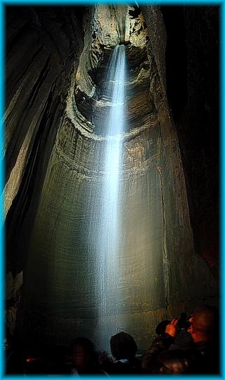
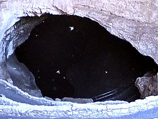
This is the natural entrance to Carlsbad Caverns in Mew Mexico. A winding foot path descends into this gaping hole and follows the cavern system until 850 feet below the desert surface. Note the swooping birds, cave swallows, that inhabit the cave entrance during the day. At night, cave bats make a mass exodus through this entrance. The cave bats hibernate in the entrance during the day. |
|
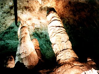
These are the two largest stalegmites in the Carlsbad Caverns system in New Mexico. They are both over 60 feet high and took millions of years to form. They are in a room called the "Hall of the Giants", nearly 850 feet below the desert floor. Note the sillouette of a stalegtite in the upper left of this time exposure picture. |
|
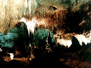
Deep inside Carlsbad Caverns in New Mexico, some chambers are close to a football field in length, with hundreds of feet to the floor and ceiling. Dimly lit, and requiring a camera with time exposure to photograph, a colorful world of stalegtities and stalegmites surrounds you in this underground environment. The temperature is 56 degrees at 100 poercent humidity, year round. |
|
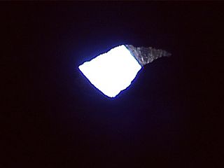
Inside Carlsbad Caverns in New Mexico, already several hundred feet underground, the last view of daylight is visible looking back up through the natural entrance of the cavern system. This little sliver of blue daylight is all that can be seen before venturing deeper into the caverns. |
|
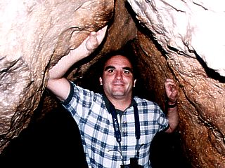
Here is a picture of myself while spelunking (cave exploring) in Carlsbad Caverns in New Mexico. There are many wide chambers in the cave system, bit there are many "connecting" fissures like this one that are rather small. Some paths are only wide enough to crawl through. |
|
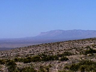
This is a picture of the New Mexico desert from Carlsbad, New Mexico. The famous Carlsbad Caverns are about 700 feet below where I am standing here to take this picture. The plains of the desert southwestern US stretch from the left of this picture and give way to the Guadelope Mountains, over 9,000 feet high. Looking SW in this picture, the Texas / New Mexico border is between the mountains and desert plain. The Guadelope Mountains, with the peak called "El Capitan", are the highest points in the state of Texas. |
|
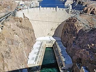
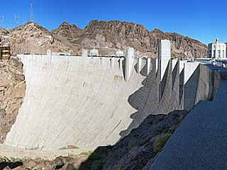
This is a picture of the Hoover Dam taken (in mid October 2018) from the Mike O'Callaghan - Pat Tillman Memorial Bridge (Route 93) which rises 900 feet from the Colorado River below. The Hoover Dam itself is over 726 feet high and is also used to generate electricity with an output of over 2,000 megawatts. The dam began operating in 1936 (taking nearly 6 years to build). Lake Mead, created by the dam, spans up to 247 square miles, with a maximum depth of 590 feet. |
|
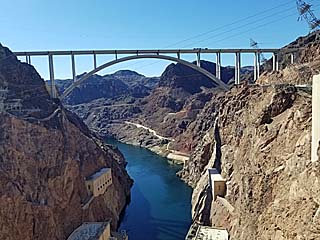
This is a view of the Mike O'Callaghan - Pat Tillman Memorial Bridge which was completed in 2010 so Route 93 can bypass the traffic over the Hoover Dam which is about 1/4 mile upstream from it (this picture was taken in October 2018 from the top of the dam). This impressive arch bridge rises 900 feet over the river below. |
|
Wide view of the Hoover Dam downstream side looking from the Arizona end towards Nevada. The Pacific and Mountain time zones, as well as the Arizona-Nevada border, transect the dam. |
|
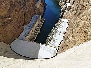
View looking over 700 feet down towards the base of Hoover Dam and hydroelectric stations capable of generating over 2 gigawatts of power (there really is a such term, and it's not from the "Back to the Future" movie). |
|
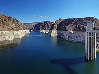
View looking upstream from the Hoover Dam and Lake Mead with one of the large penstock towers to the right. The water level of the lake is very low at the time, caused by years of drought, revealing a scaled lighter rock face below the "normal" lake level called a "bathtub ring". |
|
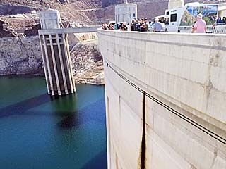
View looking at the upstream side of the dam ... With people atop it showing the immense size of the structure. Note the low water level and penstock water intake tower to the left. The dam is 45 feet wide at the top, and tapers to a massive 660 feet at its base, with a length of 1,244 feet and height of over 726 feet. |
|
A view looking down off the upstream side of Hoover Dam at the surface of Lake Mead (and at least 200 feet below due to low lake water levels). The dam and massive penstock water intake towers (and catwalks between them) cast a shadow on the water surface. |
|
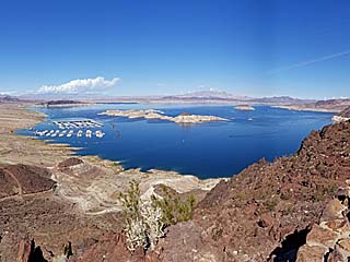
Here is a view of Lake Meade from just west of Hoover Dam and near Highway 93. There is a large marina to the left, and the lake spans to the east - However - The lake water is at a very low level as on-going drought is affecting California and Nevada for years. Normally the lighter colored terrain is under water had the lake been at normal levels. |
|
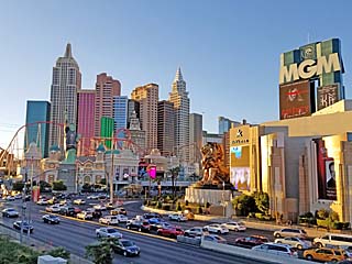
View of the Las Vegas strip (October 2018) and the New York New York Hotel and Casino. There is actually a roller coaster (called the "Big Apple Coaster") built within the architecture of the hotel. |
|
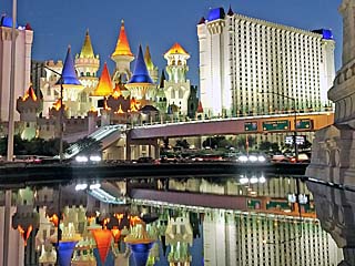
View of the Excalibur Hotel and Casino, across Tropicana Avenue, with reflections in the water near the New York New York Hotel. |
|
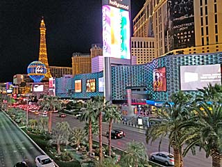
View looking northeastward along the Las Vegas strip towards the Paris Las Vegas hotel with Planet Hollywood to the right. |
|
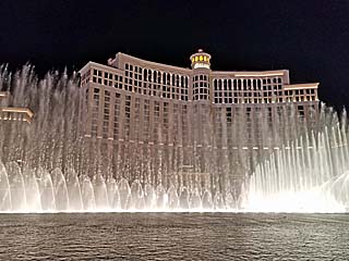
Impressive "water show" of fountains, fog, and music in front of the Las Vegas Bellagio Hotel and Casino after dark in October 2018. |
|
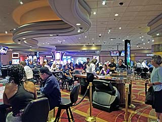
Picture of people playing cards and slots at one of many casinos in Las Vegas. Whether your gambling or eating, plan on spending a LOT of money here! |
|
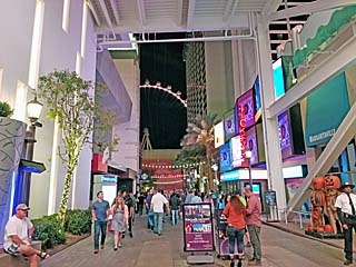
Looking between LINQ and Harrahs at a portion of the High Roller Ferris wheel as tourists mingle and shop. This observation wheel is 550 feet high and is part of Caesars Palace. |
|
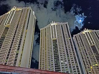
High rise building that are part of the MGM Grand Signature (near the MGM Grand Hotel and Casino) glowing with the moon and lights from the Las Vegas strip nearby. |
|
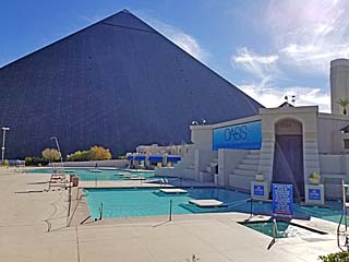
Pool area of the Luxor Hotel and Casino near the southern end of the Las Vegas strip. This hotel is a large pyramid with massive atrium inside. The hotel is 30 stories high, and a unique diagonal elevator system access the upper floors. The hotel (including its additional tower building) contains 4,407 rooms (2,526 in the pyramid structure alone) and 120,000 square feet of casino gaming space. |
|
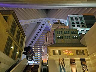
View inside the Luxor Hotel and Casino, with the massive atrium inside. The entrances to the rooms and walk ways can be seen rising up on the inside of the atrium. The floor of the atrium is the second level and has shops, a food court, and large theaters (with shows like the Blue Man Group and Titanic being a mainstay). |
|
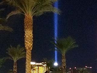
The iconic beam of the Luxor Hotel and Casino shining into the night sky in late October 2018. The beam comes from a 50 foot lamp-house at the top the pyramid with 39 7,000 watt Xenon lights totaling 273 kilowatts and producing a beam visible for 275 miles (pilots flying over Los Angeles during a clear night can see the beam). How about their electric bill? Well, if all 39 lights are lit (after 2008 they use half to save energy), it costs $51 an hour just to keep the lights on and the lamp room becomes hot enough to bake a cake (300 deg F)! |
|
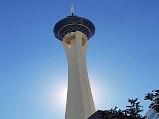
This is the Stratosphere Tower, which is an observation tower that is part of the Stratosphere Hotel and Casino in Las Vegas. It is the tallest freestanding observation tower in the United States, with a height of 1,149 ft. The only tower in the western hemisphere that is higher is the CN Tower in Toronto, Canada (see my link HERE for more information on Toronto / Canada). If simply being up high doesn't scare you, there are 3 thrill rides (one where you can actually jump off the tower) for those who dare! |
|
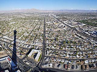
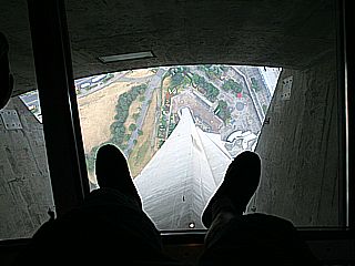
This is a view from the lower (enclosed) observation area at the Stratosphere Hotel and Casino tower in Las Vegas. This is roughly 855' above the street. The view is looking east and northeast. Note the immense shadow cast by the tower. |
|
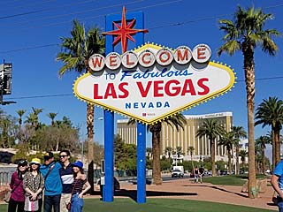
The world famous "Welcome to Fabulous Las Vegas" sign that greets travelers coming in from the south on Las Vegas Boulevard. This is a famous landmark, drawing crowds of tourists in itself. This is typical "Atomic Age" (Googie) style architecture that was prominent in 1959, when Betty Willis designed it. |
|
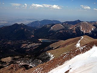
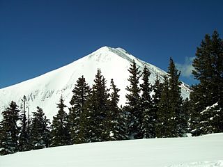
Here is a view, looking to the southeast, from the summit of Pikes Peak in May of 2010. This peak is one of the highest in the 48 states and stands over 14,100 feet above sea level. It has snow all year around and a semi-polar climate at the summit, with very little plant life. The city of Colorado Springs is to the extreme left in this picture. |
|
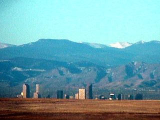
This is a view of the city of Denver, Colorado in early February 2002. I took this picture from the new Denver International Airport about 10 miles east of the downtown area from the American Airlines terminal looking to the west. Clearly you can see the snow in the higher mountain peaks, which are about 14,000 feet above sea level. Denver is about a mile above sea level. |
|
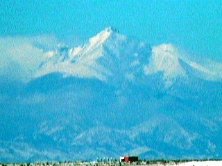
A closer view of one of the high mountain peaks west of the Denver area taken from Denver International Airport with a zoom shot. |
|
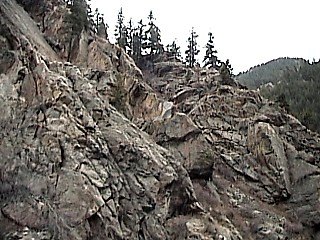
A jagged rockface can be seen looking upwards while driving through a steep mountain pass near 8,000 feet above sea level west of Denver, Colorado. |
|
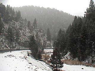
This is another picture of a mountain pass west of Denver, Colorado during a snow storm in February 2003. This pass is about 7,500 feet above sea level. |
|
In this picture, a fresh snowfall of about 6 to 10 inches covers the ground after a snow storm in Golden, Colorado on February 2, 2003. Kirsten Mc Clung is the woman standing to the right. |
|
This is a picture of a small catholic cemetary perched atop a mountain peak in the Rocky Mountains. In this picture, at an elevation of nearly 10,000 feet above sea level, we are in the clouds, so the air appears appears foggy. Some headstones in this cemetary were from times just after the civil war (late 1800's). |
|
Here is a picture of myself standing on a small bridge over a brook in the Colorado Mountains off I-70 in February 2004. Temperature here is about 16 degrees Farenheit. |
|
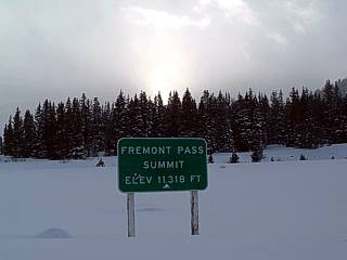
This is Fremont Pass in the Colorado Rockies at an elevation of over 11,300 feet above sea level in February 2004. Just below the timber line near the Fremont copper mine, the effects of altitude begin to affect you. The temperature here is 5 degrees Farenheit. Note the "icy" sun and evergreen trees in the background. |
|
This is the Fremont copper mine in the Colorado Rockies in February 2004. Note the higher peaks in the background, and no trees above the so called "timber line". This picture shows the mining facility with 13,000 foot+ mountain peaks in the background. |
|
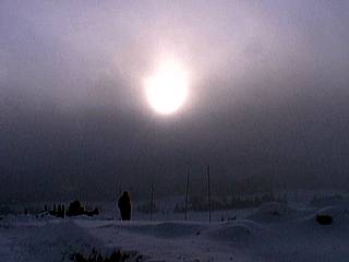
At about 10,500 feet elevation in the Colorado Rockies, a passing snow squall glazes the sun with an icy grey sheen of ice crystals in February 2004. The air temperature is near zero Farenheit. Note the person walking in nearly 3 feet of snow. |
|
A majestic peak rises high above the timber line in the Colorado Rockies in February 2004. This picture was taken near the continental divide at an elevation of about 10,500 feet. |
|
A portion of the continental divide rises over 2 miles above sea level in this fantastic view across a frozen lake high in the Colorado Rocky Mountains in February 2004. Note the orographic clouds. |
|
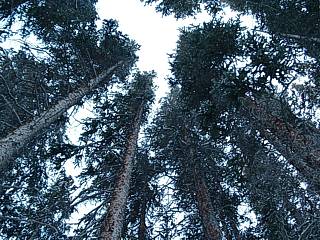
This is a picture looking up through the 100 foot evergreen trees deep in the forest high in the Colorado Rockies. There are only these types of trees from about 6,500 feet up to the timber line, which is about 12,000 feet above sea level. These trees can survive extreme cold and altitude, while deciduous (ones that lose leaves every winter) trees cannot. |
|
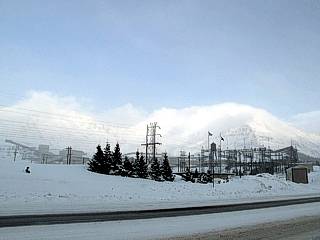
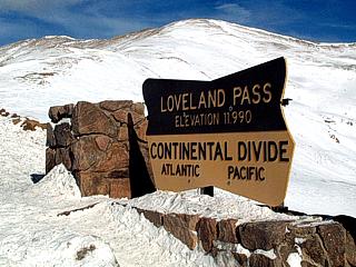
Here is Loveland Pass in the Colorado Rockies. This area is a popular back-country extreme skiing and snow-boarding area but with a risk of avalanches. This is also the continental divide, where water on one side of the ridge eventually finds its way into the Atlantic Ocean (via the Mississippi river system) while the other side it will find its way to the Pacific Ocean (via Colorado River system). Here we are above the tree line at an elevation of 11,990 feet above sea level. |
|
A hike up the continental divide offers a pristine, crystal clear view of the majestic peaks rising to 14,000 feet above Loveland Pass. The highest ski-lift in the world is at the Loveland ski area nearby. This picture was taken at an altitude of about 12,300 feet above sea level with an air temperature of about 15 degrees Farenheit. |
|
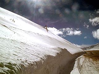
A dense snow pack covers the sides of the roadway leading through the Loveland Pass of Colorado. The snow here is anywhere from 5 to 10 feet deep along the side of the road! Note the intense glare of the high-altitude sun and the clearness of the air at about 11,900 feet elevation. |
|
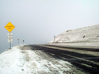
Weather in the mountains changes very fast. In the picture above, near blizzard conditions (50 MPH winds and snow) are approaching the same road as in the pictures above (in February 2010) at Loveland Pass in Colorado. The sign warns motorists passing through this treacherous area not to stop due to the danger of avalanches. |
|
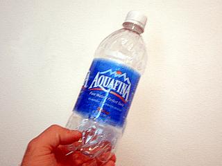
Here is an empty Aquafina water bottle to use as a cool experiment in high-altitude air physics. Here the bottle is shown in its normal fashion. While hiking along the continental divide atop the Loveland Pass in Colorado, I tightly capped the empty bottle of water and packed it away. |
|
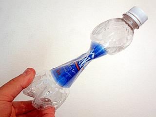
Upon returning to my home in Miramar, Florida, only 10 feet above sea level, this is what became of the empty bottle, now with over 12,000 feet of air (nearly 2 and a half miles) pressing down upon it! The difference in pressure between sea level and 12,000 feet is roughly 1/3 of the sea level pressure, or about 330 MB (~5 pounds per square inch). |
|
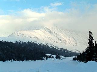
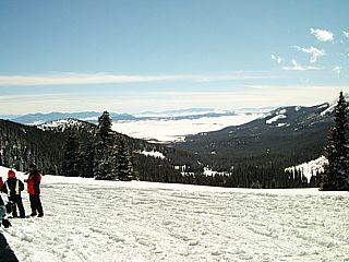
Here is a view from atop the continental divide at nearly 12,000 feet above sea level looking to the southeast on a clear day in February 2008. This area is southeast of Breckenridge, Colorado. Visibility here is 160 miles, and Pikes Peak can be seen to the far-left in the distance. |
|
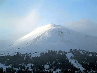
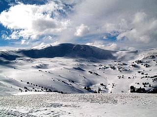
The top of the continental divide offers this majestic view of Bald Mountain, nearly 13,500 feet above sea-level, on this clear day in February 2008. These pictures were taken while on a snomobiling trip along back-country trails in the Colorado Rockies near Breckenridge. |
|
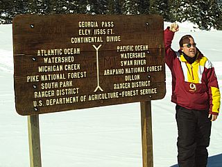
This is storm chaser Tony Laubach (KC0NL) standing beside the marker for the Great Divide. Basically, this ridge separates the two watersheds (runoff leading to rivers, hence to the oceans) that run into the Atlantic and Pacific basins. A cup of water thrown left of the sign will eventually wind up in the Atlantic Ocean, while one thrown to the right will eventually wind up in the Pacific. |
|
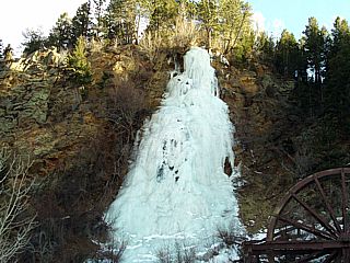
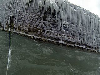
Here is a view of an ice grade (basically a frozen waterfall) near I-70 and Idaho Springs, Colorado. The structure to the lower right its a water wheel from the late 19th century. Small waterfalls sometimes freeze solid, as in this picture, forming the beautiful ice formation seen in this picture. |
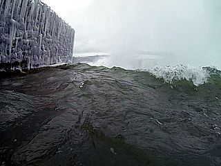
|
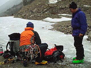
These folks just finished a climb up a frozen stream and frozen waterfall (ice grade) near the old mining town of Silver Plume, Colorado. Tackling ice grades and such frozen terrain requires special shoes with spikes, ropes for climbing, and ice picks in addition to heavy winter clothing. |
|
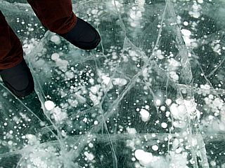
This is a view across a frozen lake near Georgetown, Colorado. The lake is formed by a dammed brook that flows along the beautiful valley and parallels Interstate 70. In the winter it freezes solid, with ice thick enough to drive a car on! |
|
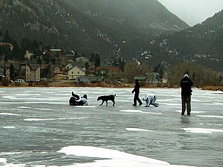
Here is a view of the ice surface of the frozel lake near Georgetown, Colorado. |
|
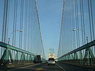
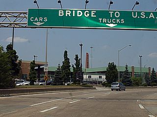
This is a picture of the Ambassador Bridge which is a suspension bridge connecting the United States and Canada. The bridge runs between Detroit, Michigan and Windsor, Ontario and crosses a portion of the Detroit River connecting Great Lakes Huron and Erie. The view here is from the first span tower towards Canada. |
|
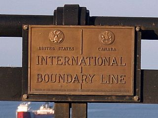
This is a picture of a placard denoting the US / Canada border location on the span of the Ambassador Bridge connecting Detroit, MI (USA) with Windsor, Ontario (Canada). In this picture, the "line" down the placard is the border, with the USA left and Canada right. The view is to the north. Note the ship in the Detroit river below. |
|
This is the Canadian INS / Customs processing center in Windsor, Ontario taken while returning towards the United States but still in Windsor near the Ambassador Bridge. This facility, unfortunately, brings back very bad memories for me as I was detained there when entering Canada because of suspect material on my laptop (pictures) that was mistakingly interpreted. I was kept in a holding cell there 4-5 hours until they (Canadian customs) determined my laptop did not have any illegal pictures on it! A full report of this bizarre mis-understanding can be read in my section on it in AMERICA at the link HERE. |
|
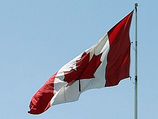
A Canadian flag proudly flies in the cool winds above a local business east of Windsor, Ontario along the Canadian Highway 401. |
|
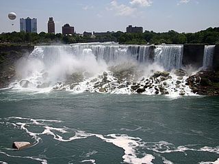
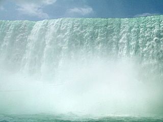
This is the portion of Niagara Falls on the American side (New York, USA). Roughly 75,750 gallons of water spill over this fall each second. The land to the right is Goat Island, and lies between the American falls and Horseshoe (Canadian) falls. The balloon to the upper left is a teathered observation platform operated on the New York side to carry passengers to a height of about 500 feet. |
|
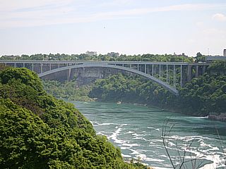
Rainbow Bridge connects Canada (Ontario) and the United States (New York) and crosses the turbulent Niagara River below. It is a 950 feet long arch bridge and is a section of Highway 420. US Customs is the building to the far-right of the top of the bridge. The Niagara River below the falls is very turbulent and has dangerous rapids. The rapids sections are also called "Whirlpool Rapids". |
|
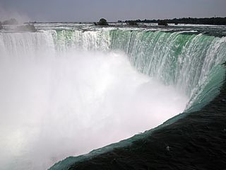
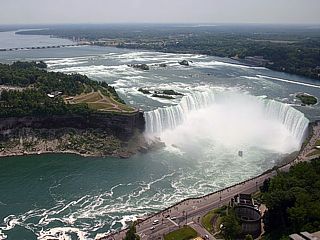
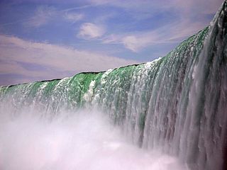
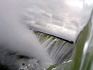
This is picture of much more spectacular Horseshoe Falls on the Canadian side. This picture was taken from a location called Table Rock and is looking downstream and across the "lip" of the massive waterfall. The water flow, estimated to be an average of 681,750 gallons per second, falls about 176 feet, while accelerating from under 40-MPH to nearly 70-MPH in the process, and raises a huge cloud of mist. |
|
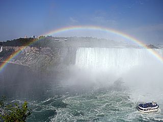
Here is a nice picture of a rainbow created by the large mist plume of Horseshoe Falls. The Maid Of The Mist boat is to the lower right in the plunge pool of the falls. The picture was taken during the afternoon from near Table Rock. |
|
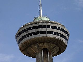
The Skylon Tower is an interesting observation tower and commerce center located on the Canadian tourist strip (Niagara Falls, Ontario). The tower is about 520 feet high (from street-level), and is serviced by three express elevators. The tower's observation area (top section) contains 3 levels. The first two are formal and informal dining areas, one with a rotating turn-table allowing a 360 degree view (rotation takes about 60 minutes) from 50 stories up as you eat. The top third level is the observation deck, with an indoor and outdoor area giving guests a view from about 775 feet above the level of the Niagara River Gorge and falls. This amazing structure was opened in 1965 and also includes a convention center, casino, game-room, and plaza / mall at ground level. |
|
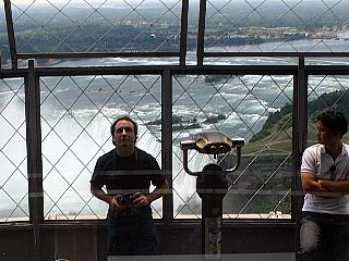
Here is a picture of myself atop the Skylon Tower at the observation deck. I took this picture from the outside ring of the observation deck using the windows of the inside viewing area as a reflector to achieve this picture. The horseshoe falls behind me is about 775 feet below where I am standing. Note the steel fencing around the observation deck to discourage base-jumping / suicide attempts! |
|
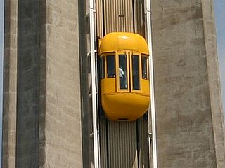
This is one of three express elevators to take passengers up and down in the Skylon Tower. The elevator takes about 52 seconds to reach the 520 foot observation deck at the top of the free-standing structure. The core section of the building also has an emergency staircase as well as infrastructure (electical, plumbing, etc). The yellow color of these external elevators is unique and sometimes referred to as the "yellow beetle" elevators. |
|
Here is a view of Horseshoe Falls at bird's eye perspective from the observation deck atop the Skylon Tower. Goat Island is to the left and Table Rock is to the far right. |
|
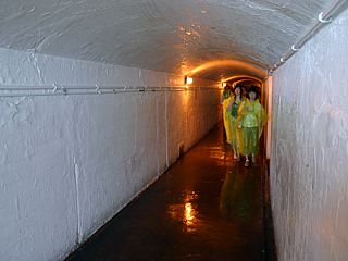
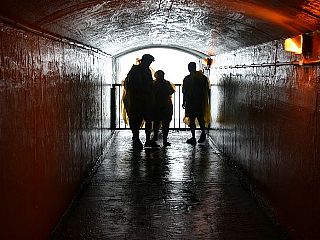
This is a picture taken about 150 feet underground and BEHIND the Horseshoe Falls and UNDER the raging Niagara River. This attraction below Table Rock is called the "Journey Behind The Falls" (formerly the "Scenic Tunnels"). There are about 650 feet of these tunnels, which range in construction dates from the late 1800's to 1925, that allow guests to see two "porthole views" of the backside (behind) the falls in addition to an observation area close and at the edge of Horseshoe Falls's plunge pool. The tunnels were lined in concrete, given lighting, and serviced by an elevator since 1944. |
|
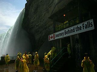
Here is the area for observation at the edge of Horseshoe Falls just above the plunge pool. This area, although soaking wet with mist and strong winds, gives one the humbling experience of seeing that much water crashing down with such force you FEEL the shaking from it. You are given disposable plastic ponchos to keep you (fairly) dry. |
|
This is a picture of Horseshoe Falls taken from the observation area of the "Journey Behind The Falls" attraction. Here we are looking up at the falls, which is about 176 feet above the level of the river and plunge pool below. Try to imagine those brave (and foolish) individuals going over this in a "barrel"? |
|
Here is a picture of one of the observation "portholes" to see the backside of Horseshoe Falls. There are two of these tunnels that extend away from the main "corridor" and end at the backside of the waterfall "cliff". Both portholes are about 150 feet under the riverbed above the top of Horseshoe Falls. |
|
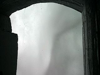
A view out one of these portholes is basically a swirling, turbulent "abyss" of grey mist and spray. In this picture, and interesting "vortex" like swirl crosses in front of the porthole opening. To the upper left, there is a space in some of the blinding mist where you can actually see the backside "surface" of the waterfall. |
|
The "Maid Of The Mist" is a boat tour taking guests on a thrilling journey into the plunge pool of Horseshoe Falls along the Niagara River. In this picture, the boat battles strong currents and "whirlpool rapids" as tourists awe in their blue ponchos. |
|
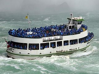
Here is a view of horseshoe falls near Table Rock from the "Maid Of The Mist" tour boat in the plunge pool of the falls in the summer of 2009. You can actually FEEL the roar of the falling water as you are enveloped in a cloud of spray on the boat, which holds in excess of 200 people. |
|
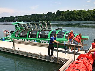
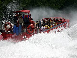
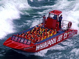
Whirlpool Jet Boat Tours is an interesting and exciting way to experience the true power of the Niagara River. This tour group operates specially designed jet boats that can handle the class five rapids of the lower Niagara River. There are two ride experiences, one called the "wet ride" and another the "dry ride" in a "jet dome" boat, as in this picture. The "dry ride" makes for good photography, with air-actuated "delorean" style (gull-wing) hatches. The boat can hold 48 passengers, is powered by three turbo-diesel engines driving three water-jet drives for a total of 1,500 HP. The boat has a top speed of about 60-MPH. |
|
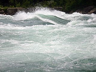
Here is a picture of some of the class six compression rapids near Whirlpool rapids and Devil's Hole on a trecherous portion of the lower Niagara River. The water in this portion of the river is very deep, around 50-70 feet, but the gorge is so narrow that the water flowing through it accelerates to 40-50 MPH, causing extreme turbulence and "compression" type rapids. The "jet-dome" boat is "stationed" near these violent rapids, and has opened one of its hatches to allow this picture to be taken. The wave is about 15 feet high, and the roar of the water was loud enough to feel ... This picture is deceiving and does NO justice - Class six rapids are the highest on any scale, so treat water like that with the respect it deserves! |
|
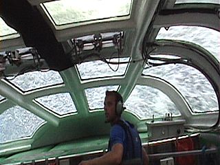
Here is a picture of the inside of the "jet-dome" boat while "punching through" a 14-foot high wave in the class five rapids of Devil's Hole. About 10 tons of water is crashing down atop the large cockpit. The guy in the blue shirt is our tour-guide and narrator. He is not driving the boat, The helm and captain is above and to the rear of the vessel. Although pretty bumpy, like being a "cork in a toilet bowl", it was really interesting how the boat handled water so violent. Look closely, and you might even see a fish OVERHEAD! |
|
The "wet ride" jet boat was also enjoying the class five rapids along side us. Here is a great shot of the open-air and WET ride aboard one of the sister ships of the "jet-dome" boat, also operated by Whirlpool Jet Boat tours. This boat is nearly identical in terms of seating capacity and performance to the drier "jet-dome". |
|
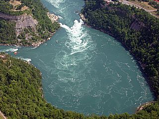
Here is an arial shot, taken from a helicopter at an altitude of about 3,000 feet AGL, of the "Whirlpool Rapids". This unique geological formation allows the class five (and class six) rapids of the lower Niagara River to suddenly turn and create a whirlpool effect in this bend in the gorge. If you look closely to the mid-left side of the picture, you can see a yellow cable tram that crosses the rapids. Also note the jet boat near the whirlpool (up and left of the center of the picture) as well. |
|
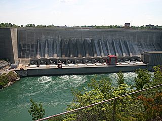
Obviously, the Niagara Falls area, with all that water moving around, is a prolific hydroelectric energy source. Much of the Niagara River is diverted to many hydroelectric generating facilities like the one in this picture, the Robert Moses dam and generating plant. Hydroelectric energy is a clean and renewable resource, low-maintenance, and cheap once initial costs / contruction of facilities are finished. These power generating plants provide about 10% of electrical energy to Ontario, Canada and much of the northeastern US power grids to as far away as Georgia. |
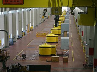
|
Here is a view of the second generator building of the Sir Adam Beck dam and hydroelectric plant (Beck II), which is across from the Robert Moses facility on the Niagara River. There are sixteen generators, powered by a water turbine fed by a penstock. The tops of the generators, which are armature exciters, are the yellow structures extending above the generator building floor. Most of the structure is deep under the floor where removeable panels allow access. The large crane in the foreground is used for maintaining the massive machinery and connects with an adjacent heavy-machine shop. Note the bicycles, as the building is about 1,500 feet long, quite a walk carrying heavy tools. |
|
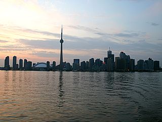
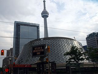
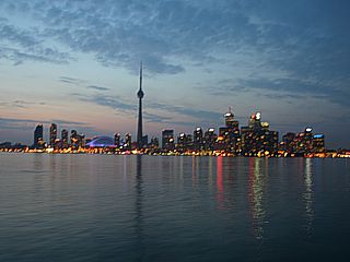
This is a picture of downtown Toronto, Ontario taken from a ferry that runs between the Toronto Ferry Terminal and Centre Ialand. The large free-standing pinnacle structure is the CN Tower, and is over 1,815 feet high. As of 2007, the CN Tower is the World's largest free-standing structure. The tower has two observation decks (one at 1,100 feet and another at 1,450 foot level), a restaurant, and even has a "glass floor" for those who dare to look down! The Rogers Centre skydome is the arena structure to the lower left of the CN Tower. |
|
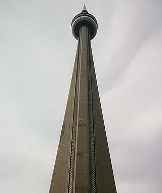
Here is a view of the CN Tower from street level looking skyward. This tower is a massive domination of the skyline of Toronto, Canada, and an architechtural marvel for its time and the future as well. It is a major communications hub, and stands a whopping 1,815 feet high making it the highest free-standing structure in the World as of 2007. You can take a tour of this tower, and there are two spectacular observation decks. One observation area is at the 1,100 foot level, and is the main structure in the center of the tower. This main structure has two observation areas, one inside and another outdoors, a restaurant (called the "360 Restaurant"), and a unique "glass floor". The second observation level is called the "Sky-Pod" and is a smaller observation area at the 1,450 foot level, above which only the antenna supports and spire remain. The tower is constructed from highly reinforced concrete with careful considerations to weight as well. The main "trunk" of the tower has a "tripod" type structure, with glass-enclosed express elevator shafts inside the "legs" of the solid tripod. A central core also contains an emergency staircase that takes anywhere from 20-40 minutes for a fit person to climb. |
|
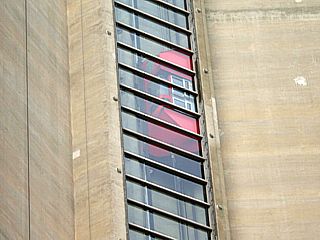
The CN Tower has express elevators to take passengers up to and down from the observation structures. In this picture, the glass-enclosed elevator shaft can be seen, with an express elevator traveling on the right side of the shaft. Another express levator also uses the opposite side of the shaft, so each enclosed elevator shaft has two express elevators inside. The ride to the 1,100 foot level takes less than a minute. |
|
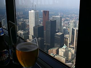
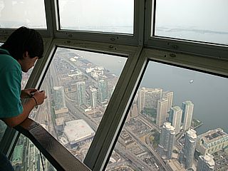
Here is a view of downtown Toronto from the 1,100 foot level of the 360 Restaurant. Quite an experience indeed, eating and drinking with probably the best view of a city on earth. To the left is some "Blue" Canadian Pilsner. If you get queasy from fear of heights, try not to eat here! |
|
On the CN Tower's first observation deck is a unique "glass floor". In this picture, I am standing on one of the high-strength glass panes and looking down with nothing but 1,100 feet of clear air under my feet. My advice - Pass on this one if you hate heights! |
|
This is the second structure on the CN Tower and is called the "Sky-Pod" or "Nacelle". It is accessed by another express elevator from the main observation structure at the 1,100 foot level that rides up the core of the tower to the "Sky-Pod" itself, which is at 1,450 feet. This is that smaller structure you see on the CN Tower well above the main observation / restaurant just before the antenna spire. In this picture, tourists gaze at Toronto from over a quarter mile up in the "Sky-Pod" nacelle. Note the view of lake Ontario and a portion of Toronto Island (which includes Centre Island Park) to the right. |
|
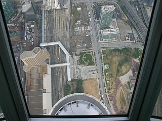
Here is a dizzying view looking down from the "Sky-Pod" nacelle at the 1,450 foot level in the CN Tower. The main structure, at 1,100 feet, lies about 35 stories below us. Beyond that, it's another 110 stories to street level. Part of Union Station, a major train station in Toronto, can be seen towards the upper left. |
|
The CN Tower looms over Roy Thompson Hall in downtown Toronto looking southwest from the corner of Simcoe and King Streets. This unique glass structure houses a major center for concerts and orchestra events. |
|
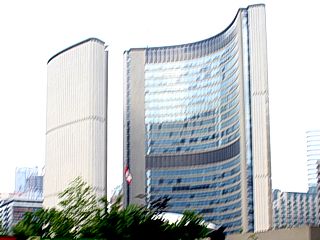
Here is a view of Toronto's City Hall and Government Center. This is one of the most distinctive landmarks of Toronto, and was built in 1965. To this day, it still has intriguing architecture, with two curved buildings of differing heights (20 and 27 stories) surrounding a central saucer-shaped council chamber. |
|
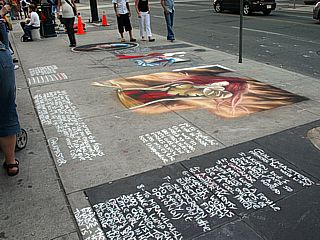
Here is a picture of some interesting sidewalk art along the street-side of Yonge Street near Dundas Square. This artwork was all done with nothing but chalk! |
|
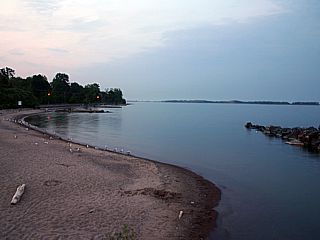
This is one of several beaches in the Toronto area along Lake Ontario. The beach here is on Centre Island, which is a city park located on an island connected via ferry service. This beach has a pier, and jetty / break-water (far right in this picture). Some drift-wood can be seen on the sandy beach, and sea gulls abound. Lake Ontario is fresh water. |
|
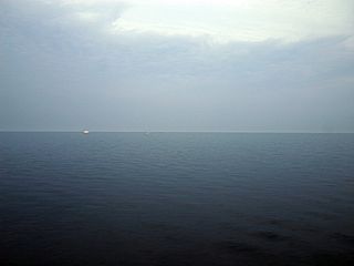
Here is another picture of Lake Ontario, at dusk, taken from the end of a pier on Centre Island. During the summer, the cool lake waters at dusk are calm and smooth. The dot on the horizon is a pleasure boat / yacht. |
|
With nightfall, the skyline of downtown Toronto is illuminated by many lights. This picture was taken from a moving ferry boat going from Centre Island and returning to downtown Toronto's ferry terminal, so it was difficult to get such a clear shot. Not the blue illumination of the Rogers Centre skydome to the left. |
|
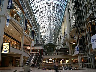
This is the Eaton Centre shopping mall and large full-street like atrium. This shopping mall is also the largest in Eastern Canada and the most popular shopping / tourist destination. This huge mall lies between Yonge Street and Dundas Street West. The complex, notably the glass atrium ceiling, was designed by architects Eberhard Zeidler and Bregman & Hamann. The view here is looking northward from the midpoint of the mall. |
|
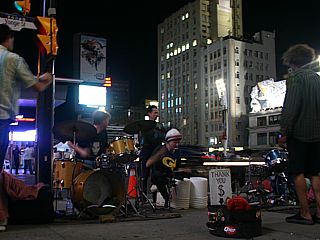
A street band plays an infectious beat along Yonge Street near Dundas Square. This section is basically the "Times Square" of Toronto, where many social and music events, both commercial and individual take place. Yonge street is also lined with any kind of restaurant you can imagine, as well as people from more ethnic backgrounds (mostly Asian) than any other city in the World. |
|
Here is a picture, taken by a photographer alongside the Niagara River, of a jet boat doing a "bull run" through the treacherous "Devil's Hole" Rapids. If you look closely, I am the person on the right-hand side of the boat, in the second row, and to the right-most seat! This boat has three engines driving water-jets for a total of 31,000 pounds of thrust (or 1,500 HP). The open-cockpit layout means you are exposed to whatever the Niagara River has to throw at you, literally. These boats offer tours for those daring enouth to take on class 5 rapids! |
|
Canada has a large Asian population. This is a picture of a Buddhist temple in Niagara Falls, Ontario. The large structure is the temple, and houses a large Buddha statue. To the right is another building with a school and another monestary called 10,000 Buddhas. This is part of the Cham temple along the parkway north of Niagara Falls. |
|
Ready to go! Niagara "Faller" camera setup - March 2013 - Ontario Canada. |
|
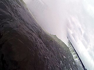
Camera kit just thrown into the top of horseshoe falls off Table Rock (Ontario, Canada) in March 2013. The rope allows it to be retreived after "going over" the edge. |
|
Approaching the turbulent edge of horseshoe falls off Table Rock (Ontario, Canada) in March 2013. Table Rock is to the left. |
|
View (from video) approaching the edge of horseshoe falls off Table Rock (Ontario, Canada) in March 2013. I guess is what a person in a barrel might see? |
|
Camera finally going over the edge horseshoe falls off Table Rock (Ontario, Canada) in March 2013. Gravity does all the work after that! |
|
View (from video) in free-fall over the edge of horseshoe falls off Table Rock (Ontario, Canada) in March 2013. |
|
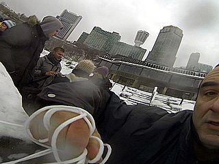
Camera "reeled" in using a 100' rope and back in my hands after going over the edge horseshoe falls off Table Rock (Ontario, Canada) in March 2013. |
|
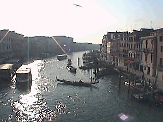
This is a picture of the Grand Canal crossing the city of Venice, Italy from one of three bridges linking the two main portions of islands making up this unique place. Boating is the major transportation mode of choice year round, ranging from large ferry boats and ships all the way to rafts. There are no cars on Venice (except for near the train terminal) and most people get around by foot or water. |
|
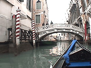
This picture was taken from a gondole (special Venetian boat) while navigating some of the waterways and canals in the heart of Venice, Italy. A gondole resembles a large canoe with flared, narrow edges and plush seats in its center that can hold 4 people. The boat is "driven" by a person standing in the back and paddling. The distinct Venetian scenery such as quaint bridges, "barber-pole" striped poles, and very old buildings is also obvious in this scene. |
|
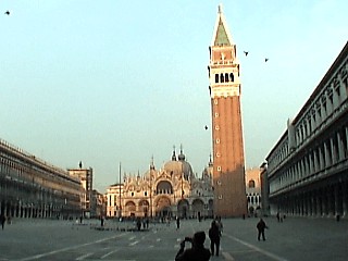
This picture is a wide-angle shot of San Marco (Saint Mark) Square that is the mainpoint of Venice, Italy. This tourist-intensive place has a true Venetian / Roman-Catholic atmosphere and is surrounded by stout windowed walls of shoppes to the left and a museum to the right. San Marco Cathedral is in the far side of the court and the bell-tower is the large tower to it's right. Sometimes high tides flood the entire square with a foot or so of water from the bay. When dry, pigeons come in huge numbers to play with the tourists! |
|
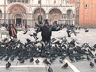
Looking more like a scene from Al Hitchcock's horror movie "The Birds", Here is a picture of myself convered with pigeons in a "feeding frenzy" at San Marco square in Venice, Italy. When you try to feed the pigeons some bird seed (corn) they frantically flutter around you, land on you, and eat a handful of corn in about 3 seconds flat. The women to the left sells the bird seed to the bird-willing tourists. |
|
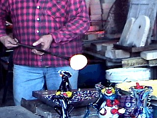
A glass blower holds a hot glob of molten glass, called a "gather", at over 2,000 degrees and covers it with pieces of colored crushed glass while making crystal sculptures in Murano, Italy. This place is world-renowned for its crystal chandeliers, vases, (and very expensive) fine glass art. |
|
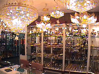
This is another picture of part of the main showroom of glass works at the glass blowing plant in Murano, Italy. Glass blowing is an exclusive family tradition in this part of the world, you cannot go to school for it. |
|
This is a picture of the end of the beach pier in Lido, Italy. Lido is a barrier type island on the Aegean Sea (a portion of the Mediterranean Sea between eastern Italy and Balkan penninsula to the east). The island is only a 15 minute ferry trip from Venice, but is different from Venice, with cars and buses like a traditional Italian village. The beach here has a greenish sand (caused by a mineral called olivine), and calm, blue waters. Note how the sky and sea blend in the late afternoon winter sun in this picture. |
|
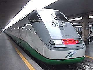
This is a picture of the Eurostar high-speed train used to commute from the Ferrovia train station in Venice, Italy to the station in Firenze (Florence), Italy. The picture here shows the aerodynamically clean front of the power car of this 14-car train that is nearly 1/4 mile long. These are very similar to the TGV trains in France and pick up power from overhead feeds or "third rail" power. Top speeds are around 186 MPH, while fed from 25,000 volt overhead power. The fastest we did on this route was between 100 and 150 MPH between Venice and Bologna. |
|
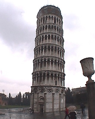
This picture shows the famous "leaning tower" of Pisa, Italy. The tower is a bell-tower called Torri Di Pisa (Italian for "Pisa tower") and stands roughly 200 feet high in the Campo dei Miracoli square. The tower re-opened to the public after it was stabilized by engineers and its lean eased. Built in the 12th century the skewed structure leans at 5.5 degrees due to its sinking into uneven volcanic earth. |
|
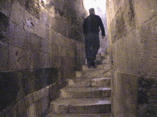
This is a picture taken inside the tower of Pisa, Italy going up a lengthy and narrow staircase that winds around the perimeter of the towers interior. The entire structure is made of marble, even the stairs. Note the "concave" surface of the steps caused by over 900 years of foot steps on the marble. The stairs ascended nearly 20 stories (200 feet) and gave one's legs the ultimate workout (others turned around and gave up on the climb). |
|
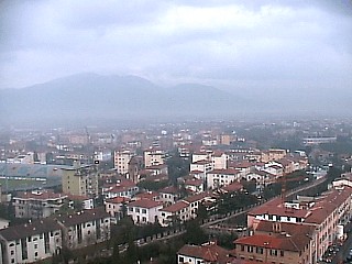
At the top of the tower of Pisa, one is rewarded for the lengthy stair-climb with a beautiful panoramic view of the city of Pisa, Italy and surrounding country / mountains despite the cloudy weather. The tower re-opened after massive engineering attempts to re-stabilize the structure, but one still feels sort of insecure at its top. |
|
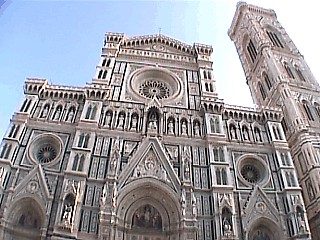
This wide-angle picture shows the intricate and time-consuming architecture of the front facade of Duomo Cathedral in Florence, Italy. The Piazza and bell tower to the right were finished in the 15th century and sets the standard for Renaissance architecture. |
|
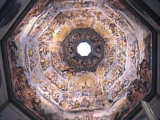
Inside Doumo Cathedral, the view is a sight to behold. Near the altar, one gets the feel of a "superstructure" with vast indoor spaces. The picture here shows the view up from near the altar to the inside of the capola of the cathedral, a vertical distance of nearly 300 feet (30 stories) from floor to "ceiling". Colorful frescoes (Renaissance paintings) cover the dome (capola) ceiling with the skylight in the center. |
|
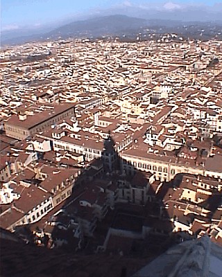
After a long and exhausing hike up a network of spiral and elaborate staircases, one can enjoy a pristine view of Florence atop the capola of Doumo Catherdral in Florence, Italy. The capola, or dome, is actually two domes, one inside the other. The inner one is the dome with the frescoes painted in its inner side. The outer dome forms the structure. Between the domes is where access tunnels and stairs allowing access to its ver top. In this picture, one can see the tight sprawl of Florence and background mountain ranges. Note the shadow of the massive 300 foot capola on the city. |
|
This is a picture of the German Village in Helene, Georgia taken from beneath an old-fashioned bridge with a winding mountain brook running through the village. This is a German-style touristic town outiside of the Atlanta area in the Appelacian foothills. |
|
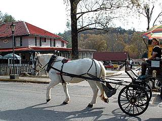
A ride in a nostalgic horse-drawn buggy is also offered in the German town of Helene, Georgia. |
|
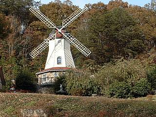
This is a picture of a wind mill style home in the German town of Helene, Georgia taken from a horse-drawn buggy. |
|
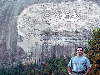
This is a picture of myself and the carvings in the side of Stone Mountain east of Atlanta, Georgia. The carvings are over 7 stories high. Stone mountain is an isolated granite intrusion extending about 10 miles into the earth with an outcrop extending nearly 1,700 feet above sea level. |
|
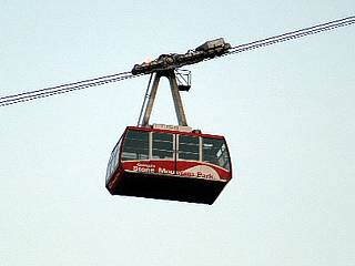
A tram system takes passengers to the summit of Stone Mountain in about 2 minutes, powered by a 500 HP DC electic motor. |
|
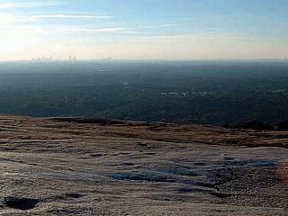
This is a picture of the view to the west taken from the summit of Stone Mountain. The "moon like" landscape in the foreground is weathered-down solid granite. Looking west, at en elevation of nearly 1,700 feet, the skyline of Atlanta can be seen nearly 40 miles away. |
|
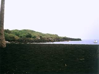
The black sand beach on the big island of Hilo, Hawaii. This picture, taken in 1994, shows the only section of black sand left after Kiluea eropted in 1991 covering it with solid lava rock (background). The sand of this beach is crushed basalt and a glasslike material called obsidian. When wet, the black sand resembles small caviar. |
|
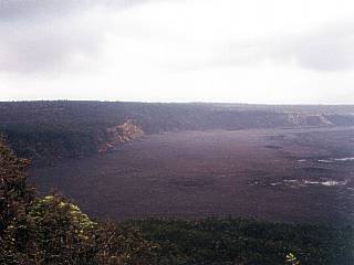
High atop Hawaii's most active volcano, Kiluea, visitors to the Volcano Observatory on the island of Hilo are greeted with a majestic view of the volcano crater, called a caldera. The surface of the crater's bottom is actually the encrusted surface of a white-hot lava lake beneath. The lake surface resembles a newly paved asphalt parking lot. The crater rim is several hundred feet above the surface of the lava lake, and is about 4,500 feet above sea level. The last major eruption of this volcano prior to 1994 was in 1991, which caused loss of many homes near the volcano and nearly all of the famous black sand beach to be lost forever. In this picture, taken in 1994, the volcano is not dormant, but simply in a "slow mode". Lava is still erupting through underground vents into the ocean. Note the white areas on the surface of the lava lake in the right side of the picture. These are steam and gas fumeroles venting into the atmosphere. Note the hazy air over the crater from the sulfur dioxide. |
|
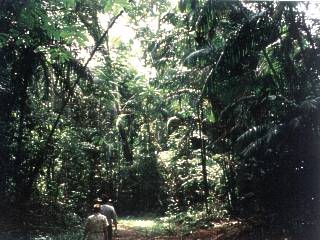
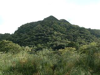
This picture was taken in Panama in Central America near the Camino Real path. The dense jungle constitutes what is known as a rainforest, and is so dense in some places that sunlight never makes it to the ground below. Hiking in the jungle also has its issues. There are poisonous snakes and spiders, and red ants as large as cockroaches. The ant hill from these red ants is barely visible in the low right side of this picture. Despite such diverse wildlife, this wilderness is being excavated and is raising a more serious threat, global warming. |
|
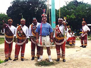
This picture shows a picture of myself and a group of Mayan Indians near the Tulum ruins in Mexico's Yucatan area. These Indians are dressed in the flavorful colors of their tribe as they have been for hundereds of years. These Indians play a flute and tribal music as they descent and spin from a tall tower using ropes attached to their ankles. |
|
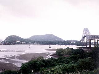
This is a picture of the Pacific side of the Panama Canal in Panama in Central America. Panama City (Balboa) is visible in the background and the famous Pan American Highway with the "Bridge of the Americas" is to the right towards the Pacific ocean. This highway originates in San Diego in California in the US well to the north and snakes its way through Mexico then the jungles and mountains of Central America. It is no way as well maintained in remote areas as you see here, and even has been infamous for guerillas and ambushes for travelers. Note the low tide in this picture, with the markers denoting the channel for the Panama Canal entrance. Tides on the Pacific side have ranges near 15 feet, where Atlantic side times only have a two foot range. |
|
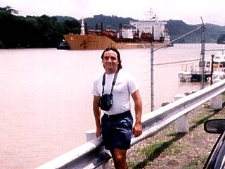
Here is a picture of myself standing on the side of the Panama Canal in Panama during a trip to Central America. This region was owned by the United States until the end of 1999. A fully loaded freighter is heading from Gatun Lake towards the Pedro Miguel locks on the Pacific side of the canal. |
|
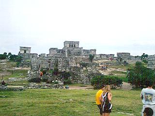
This is the remains of the main temple and observatory from the Mayan Indians. This area is known as the Tulum ruins, where "Tulum" means "Wall" in the Mayan language. The entire site was once surrounded by a large wall for protection, some of which still remains. The observatory is in the foreground, and was important because the Maya paid close attention to the sun, moon, and stars. The large building in the center was the main temple, where rituals and gruesome human sacrifices were performed. The shore of the Carribean Sea is beyond the main temple and a coral bluff. This view is looking towards the southeast. The Tulum tourist site is about 30 minutes south of Playa Del Carmen and about an hour away from Cancun. |
|
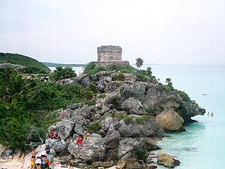
The Mexican land of the Yucatan Penninsula meets with the clear waters of the Caribbean Sea forming 50 foot high coral bluffs at the Tulum ruins site about 30 miles south of Playa Del Carmen. A dangerous walk over the jagged rocks drops you one one of the most picturesque beaches in North / Central America. Note the Mayan temple still standing on the limestone bluff in the center of the picture, remember, these stood tall through some of the worst hurricanes in Atlantic history. |
|
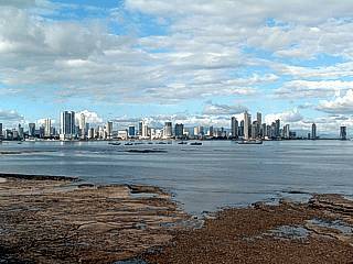
Here is a picture of the coast and capital of Panama - Panama City. This picture was taken from near the Presidential quarters along a sea-wall near a fort (Castillo) on the west side of the bay of Panama. The view is to the east and shows downtown Panama City and hotel (high-class) district to its right. |
|
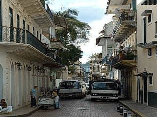
Here is a picture of the narrow and bustling streets near Santana on the west side of Panama City, Panama. Note the cobble-stone streets and Spanish style architecture, including wrought iron rainings and colonial cornices of the buildings. |
|
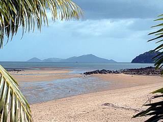
This picture shows the tropical setting of Veracruz Beach, while looking out across the Gulf Of Panama between two palms, Isla De Taboga (Taboga Island) looms over the warm, calm waters. This is on the Pacific side of the Isthmus of Panama, and tidal ranges here can be as high as 15 feet, so the ocean floor becomes exposed at low tide as in this picture. Veracruz is west of Panama City and the canal off the Pan American Highway. |
|
Here is the view to the southwest while traveling to El Valle (The Valley). This area is an ancient volcanic crater at nearly 4,000 feet elevation. In this case, we are about half-way up to the town of El Valle and the view extends down across the coastal plain then well out into the Pacific Ocean. |
|
This picture shows the highest peak near El Valle near the thermal springs park. This peak is about 4,000 feet above sea level and often is in the clouds. It is actually part of the crater rim of an ancient volcano. |
|
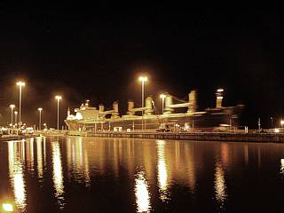
This is a time-exposure shot (about 2 seconds) of the Panama Canal Pedro Miguel locks (Lake Gatun side). A ship is just entering the lake from the Pacific and has just finished passing through the locks. |
|
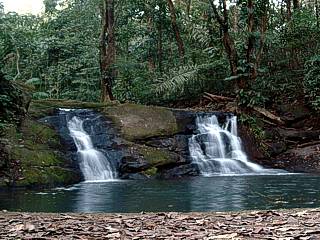
This picture is a 1-second time-exposure of a waterfall within the rain-forest (jungle) near Gamboa, Panama in the interior section. This area is about a 1-mile hike from the main road. This jungle even had monkeys in the tree tops, the sounds were like being in something at 'Disney World', but this is the REAL thing (there are no speakers behind these rocks)! |
|
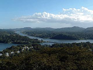
The Panama Canal winds through the rain-forest near the Gamboa Resort in interior Panama. This view was from an obervation tower atop a mountain which was acessible by a special tram. Part of Gatun Lake is to the left, the buildings in the valley are part of the Gamboa Resort. |
|
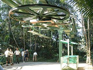
Here is a picture of a special tram operated by the Gamboa Rainforest Resort in the interior sections of Panama just off the Panama Canal. The tram is a 400 meter (about 1200 feet) cable with "basket type" cars, each holding a guide and 5 people, that takes paying tourists up and down a mountain at tree-top (canopy) level. You can literally reach out and touch wildlife, as you brush up against the tree-tops. In this picture, we are at the station atop the mountain near the observation tower, and preparing to board for the ride back down. |
|
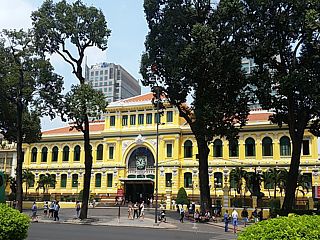
Old post office in Ho Chi Minh city (formerly Saigon). |
|
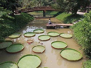
Pond and giant lili pads outside near Cao Lanh, Vietnam. |
|
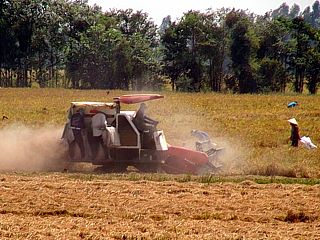
Rice farmers on a field outside of Cao Lanh, Vietnam. |
|
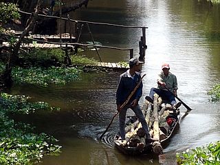
Workers on a canoe at a park outside of Cao Lanh, Vietnam. |
|
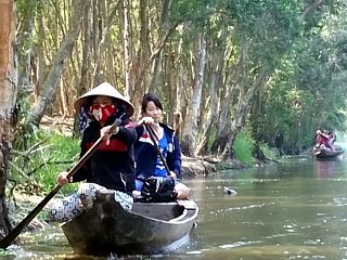
Canoeing at a park outside of Cao Lanh, Vietnam. |
|
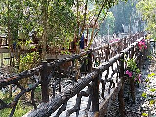
Foot bridge (during dry season) at a park outside of Cao Lanh, Vietnam. |
|
Ferry boat crossing a portion of the Mekong River near Cao Lanh, Vietnam. |
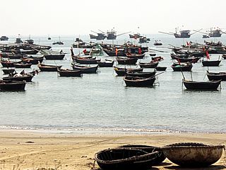
|
Round boats and many other boats off the beachfront in Da Nang, Vietnam. |
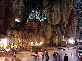
|
Temple inside Huyen Khong Cave in the Marble Mountains in Da Nang, Vietnam. |
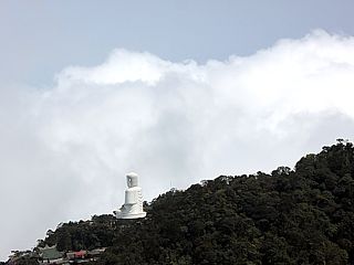
|
View from mountaintop with Buddha statue and cloud tops in Ba Na Hills west of De Nang, Vietnam. |
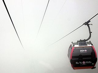
|
Tramway in the clouds headed to the mountaintop in Ba Na Hills west of Da Nang, Vietnam. |
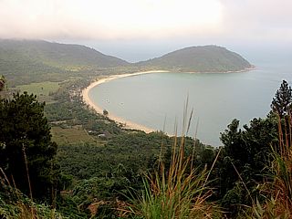
|
Beach viewed from the roadside winding through the coastal mountains during a bus trip from Da Nang to Hue (near Lang Co bay). |
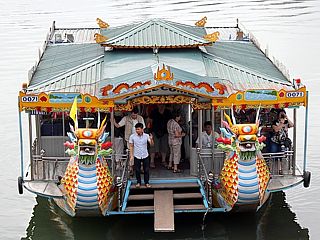
|
One of many tour boats along the Perfume River in Hue, Vietnam. |
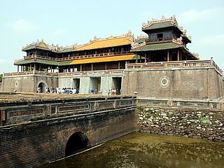
|
Imperial Palace and moat in Hue, Vietnam. |
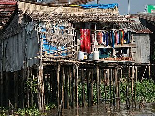
|
Houses along the shore of the Mekong River near Can Tho, Vietnam. The stilts accomodate the rising and falling of the river between the dry and rainy seasons. |
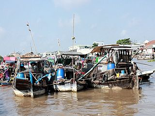
|
Floating market on the Mekong River near Can Tho, Vietnam. |
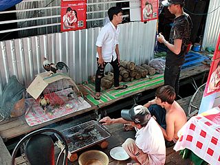
|
Family aboard one of the live-aboard house boats near Can Tho, Vietnam on the Mekong River. |
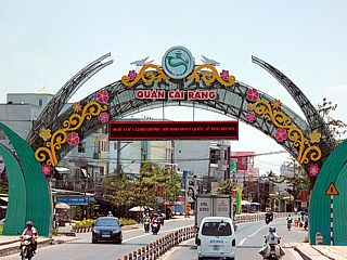
|
Entrance to one of many towns in the Meking region of Vietnam. |
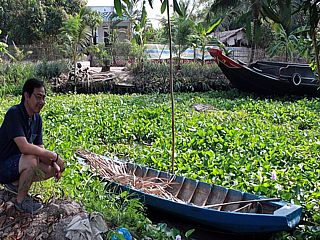
|
River and boat, choked with hyacinths, off the roadside near Cao Lanh, Vietnam. |

|
Poor child in the street near Can Tho, Vietnam. |
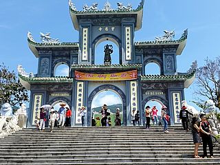
|
Gate and archway at Chua Linh Ung temple near Da Nang, Vietnam. |
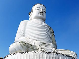
|
Large Buddha statue atop a mountain at Ba Na Hills near Da Nang, Vietnam. |
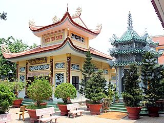
|
Pagotas and buddhist temple near Cao Lanh, Vietnam. |
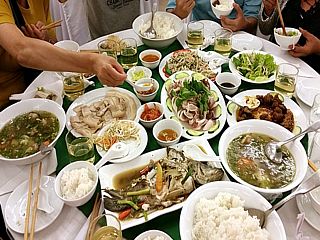
|
Believe it or not, all this food for about 10 people costed a mere $30 USD! |
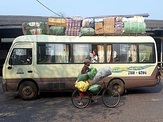
|
One of many buses in Da Nang, Vietnam at the market area. |
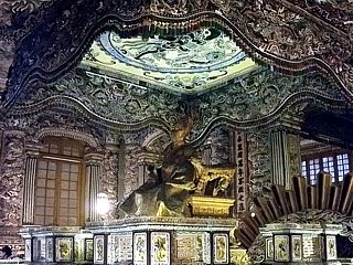
|
Emperor's throne at the imperial palace in Hue, Vietnam. |
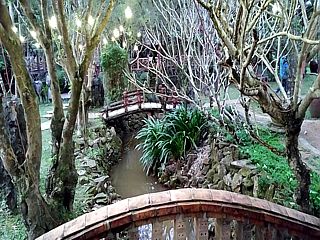
|
Foot path and stream near Hue, Vietnam. |
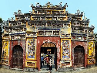
|
Gate on one of the imperial palace entrances in Hue, Vietnam. |
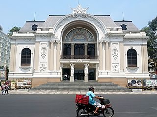
|
Theater of performing arts in Ho Chi Minh city (formerly Saigon). |
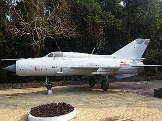
|
Mig-21 jet fighter on static display at the entrance to the Cu Chi tunnels northwest of Ho Chi Minh city. |
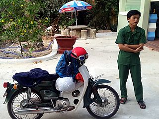
|
Man standing next to his motorbike at the Cu Chi tunnels northwest of Ho Chi Minh city. |
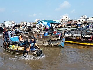
|
Floating market during the morning near Can Tho, Vietnam. |
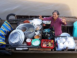
|
This woman was selling goods on her boat for many decades. This is the floating market near Can Tho. |
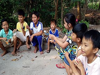
|
Young children on a private rice plantation between Cao Lanh and Can Tho in the Mekong Delta. |
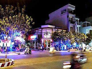
|
Street in Rach Gia, Vietnam on a hot night. |
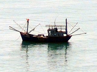
|
Boat off of Da Nang, Vietnam. |
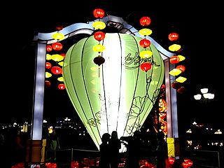
|
Large lantern type sign near Hue, Vietnam. |
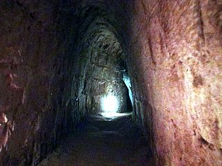
|
One of many Cu Chi tunnels northwest of Ho Chi Minh city. Soldiers can hide and even live here underground during the Vietnam War. There are at least 75 to 100 MILES of these tunnels. |
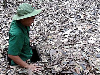
|
Cu Chi tunnels northwest of Ho Chi Minh city. Here a man "emerges" from the jungle floor from the tunnel system, showing how an ambush can easily be carried out. |
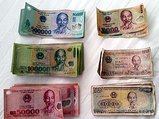
|
Vietnam currency. No coins are used in Vietnam (unit is the VND), just paper bank notes. |
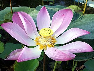
|
These lotus flowers can be found all over Vietnam and southeast Asia. This one was in front of the hotel in Cao Lanh. |
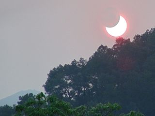
|
Partial solar eclipse (totality was over Indonesia at the time) on March 9, 2016 (viewed from near Can Tho, Vietnam). |
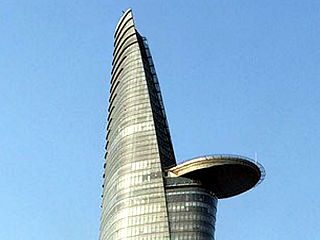
|
Bitexco Financial Tower in Ho Chi Minh city (formerly Saigon). |
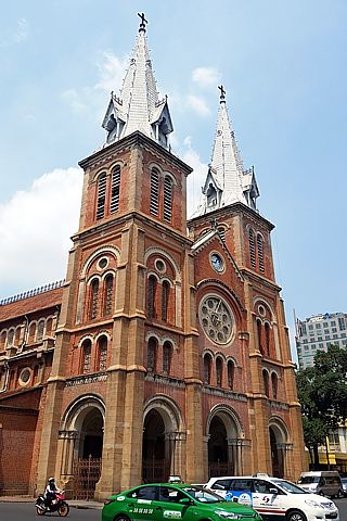
|
Notre-Dame Cathedral Basilica in Ho Chi Minh city (formerly Saigon). |
|
Flying back over the northern Pacific Ocean (Taipei in Taiwan to Los Angeles). Note the fast ground speed due to a 200 MPH jet stream pushing the aircraft! |
|
Ice skating rink at Rockefeller Center in March 2023. |
|
Looking up at skyline near Rockefeller Center in March 2023. |
|
Saint Patrick's Cathedral. |
|
Inside of Saint Patrick's Cathedral looking towards massive pipe organ (to the right). |
|
Empire State Building, looking up from street level. |
|
One of the "ground-zero" memorials for September 11, 2001 near the World Trade Center north tower site on a rainy day in March 2023. |
|
View of the Freedom Tower (One World Trade Center) rising into the low clouds from across one of the WTC memorial sites in March 2023. |
|
Inside of the "oculus" entrance into the One World Trade Center Plaza, mall, and subway terminals. |
|
Observation deck of the One World Trade Center (Freedom Tower) at about 102 stories above street-level. Unfortunately this was within the low deck of rain clouds, with only rain and gray visible out the windows of the observation deck. |
|
View of New York Subway, while exiting the "E" train from the World Trade Center complex to Penn Station. |
|
View looking down towards the street (34th) from my balcony at the New Yorker Hotel. |
|
View of skyline from my balcony at the New Yorker Hotel (22nd floor). The Empire State Building is to the upper-left, with the Madison Square Garden arena to the right. |
|
Kosciuszko Bridge from Queens to Brooklyn near Greenpoint. This is the new cable-stay bridge that replaced the former aging truss bridge. |
|
Old facade and former entrance at Wykoff Heights Hospital in Brooklyn, NY, where I was born in September 1969. |
|
My grandmother and grandfathers (from my mothers side and up until 1986) townhouse in Middle Village / Queens, NY. My great aunt and uncle also lived there until 1987 in the lower basement apartment. |
|
My former house on Shelter Road in Lake Hills / Ronkonkoma, NY. I grew up there with my brother and parents, and moved with them to Florida in July 1985. This house was originally one level, with the second level added around year 2000. |
|
Connetquot High School in Bohemia, NY. I went to school here for 2 years (freshman and sophomore years) in 1984 and 1985. |
|
View across the Great South Bay on a windy morning in March 2023 from the "Lands End" restaurant and Sayville to Fire Island ferry terminal. Fire Island can be seen about 3 miles or so across the bay. |
|
TWA flight 800 memorial with flags flying (each country of the 230 victims aboard) in Smith Point seashore. The 747 exploded and impacted the water about 13 miles offshore of this location in July 1996. There were no survivors. |
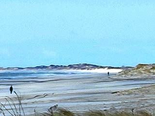
|
View looking to the west along Smith Point / Fire Island from the beach pavilion. Note the break in the island, just right of center, which is called "Old Inlet", as hurricane Sandy in October 2012 opened a new inlet into the Great South Bay. |
|
Another view of the memorial wall of the flight 800 memorial. A wave breaks, releasing 230 white doves, honoring each of the 230 lost when the 747 crashed offshore in 1996. |
|
A winery vineyard along Highway 25 on the north fork of Long Island in March 2023. |
|
Orient Point Lighthouse and Plum Island off the easternmost tip of the north fork of Long Island. This is near the Orient Ferry Terminal. |
|
The north shore of Long Island has quite different beaches than the south shore. Beaches are more rugged, with bluffs and beaches consisting of smooth and weathered stones, like these pictured here. The south shore is much finer sand, as it's an out-wash plain, while the north shore is a glacial terminal moraine, formed about 20,000 years ago. |
|
View of the rugged coast along the north shore of the north fork of Long Island with near gale forced winds kicking up surf in the Long Island Sound on a windy day in March 2023. |
|
Port Jefferson, NY with the ferry terminal (to Connecticut) on the left, and power station to the right across the protected harbor. Port Jefferson was a famous safe haven for many sailing ships since the 18th century. |
|
Stony Brook Grist Mill along Mill Pond road and dam in Stony Brook, NY. This is a functioning 18th century grist mill and water wheel, kept by the National Historic Foundation and is part of the register for historic places. |
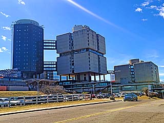
|
Stony Brook University Health Sciences Center, designed in 1965 and 1976 by Chicago architect Bertrand Goldberg. |
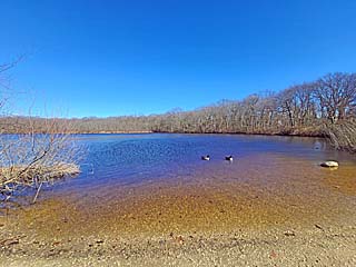
|
Millers Pond in Smithtown, NY. This is one of the sources of the Nissequogue River which flows northward into the Long Island Sound. |
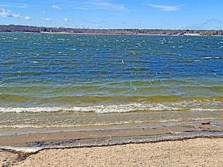
|
View of Lake Ronkonkoma in Islip, NY from the southeastern side, looking west. This lake was once thought to be bottomless, which is of course not true, but many drownings and disappearances over the years were blamed on a Native American curse. |
|
Cherokee Elementary School in Ronkonkoma, NY. This was the first school I attended as a child growing up. |
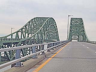
|
Robert Moses Causeway connecting the south shore of Long Island, across the Great South Bay, to Jones Beach Island and Captree. |
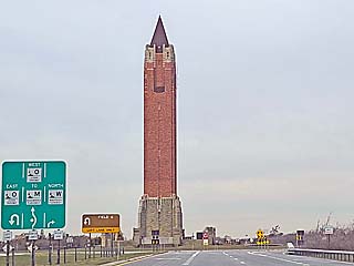
|
Water tower / monument at Jones Beach, NY. This was designed to look like the bell tower in Venice, Italy. |
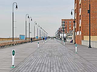
|
View of the boardwalk, looking west in Long Beach, NY. This is where my other grandparents (from my fathers side) lived until 1986 and 1999. |
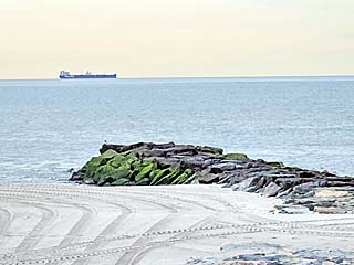
|
Beach and jetty, with a ship offshore, looking south from Long Beach, NY on a cool but calm day in March 2023. |
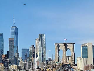
|
View of Freedom Tower (upper left), and Brooklyn Bridge (lower center-right) while heading west toward NYC. |
|
Government centers near Foley Square on the southeastern side of Manhattan. |
|
Section of Chinatown on the SE side of Manhattan. |
|
View looking west at the Empire State Building near Midtown, NYC. |
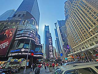
|
Times Square on a busy Thursday afternoon in March 2023. |
|
Penn Station / Moynihan Train Hall. This is where Amtrak trains come into and out of New York City. |
|
View of the new Tappan-Zee bridge looking northwest from an Amtrak train heading north along the eastern side of the Hudson River. |
|
The Amtrak train route cuts right through the Sing Sing Correctional Facility, a maximum security prison, near Ossining, NY, on the east side of the Hudson River. Here a guard watches our Amtrak train pass from one of the guard towers of the prison. |
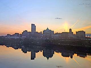
|
A beautiful sunset gloams over Albany, NY, the state capitol with a near perfect reflection on the mirror like waters of the Hudson River in March 2023. |
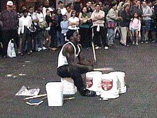
|
A crowd gathers and dances to the infectious beat of a street drummer near South Street Seaport in Lower Manhattan's East side in early September 2001. The only thing missing here is the drums! This talented person uses sticks and empty buckets to play his improvised music. The "bass" drum is emulated with a bucket between his feet and the other two buckets serve as the "snares". This alternative type of music originated in poorer communities and now has evolved to show what can be done using ordinary objects, even trash, as percussion tools. |
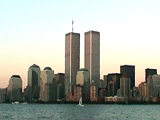
|
This is a picture of the downtown Manhattan skyline in New York taken from a boat on the Hudson River looking east. The majestic view shows the famous World Trade Centers "twin" towers reaching nearly 1/4 mile into the sky. This picture was taken in September 2001 only a week before this area, and this view, was permanently and profoundly changed by terrorists. |
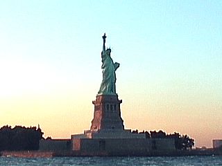
|
This is a picture of the Statue of Liberty from a boat in the New York Harbor looking to the west at sunset. This is a very majestic scene on a fair weather day in September 2001, far from what was to unfold in New York City just a week later (terrorists). |
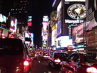
|
Looking south along the famous Broadway near 54th Street in New York City, a spectacular display of lights and signs unfolds at the Times Square area. New lighting technology has literally transformed the sides of buildings into giant TV screens. New Year's eve is celebrated each year at the far end of this view where the famous lighted ball drops and rings in the new year. |
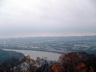
|
Here is a view of the city of Chattanooga, taken from the side of Lookout Mountain. The river is the Tennessee River that snakes around the city. The view is to the east. |
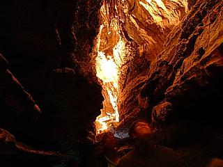
|
This is a view of the cavern leading to the Ruby Falls main "room". This is about 1,000 feet underground inside Lookout Mountain near Chattanooga. An underground river opened this large system of caverns ranging from the size of a foot or two to well over 145 feet. |
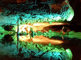
|
This is a picture of a small underground reflecting pool deep within Lookout Mountain near Chattanooga. This cavern system is part of the Ruby Falls underground river. |
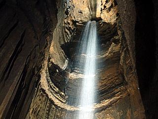
|
The cavern system opens up to a wide "room" with a 145 foot waterfall in it. The "Ruby Falls" was named after one of the woman (named "Ruby") who discovered it. In this picture, the water cascades from the ceiling of the cavern into a pool below. |
|
Here is a picture of myself, but what is it and where am I? This was a unique fish tank at the Tennessee Aquarium which had a small chamber inside it, allowing one to crawl from underneath and stand inside. |
|
This is the view of the 'Big Well' in Greensburg, Kansas in May 2013. This is the largest hand-dug well at nearly 110 feet deep and was completed for the steam railways in 1888. The Ogalla aquifer supplies fresh clear water at the bottom of the well and provided such for use in steam locomotives. It remains an intriguing site in a city devoted to clean energy after being destroyed by a tornado in May 2007. |
|
Here is a picture of downtown Oklahoma City, Oklahoma taken from near Interstates 35 and 235. The large building to the left is the Devon Tower, which was completed in early 2012. The Devon tower is the tallest building in Oklahoma, with a height of 880 feet. |
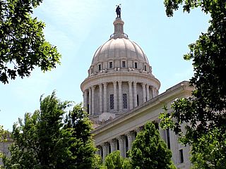
|
This is a picture of the beautiful Oklahoma State Capitol Senate building. The view is from just north of the west facade looking SE through the trees. The Renaissance / Classical style structure was built in 1919 by architect Frankfurt-Short-Bruza. |
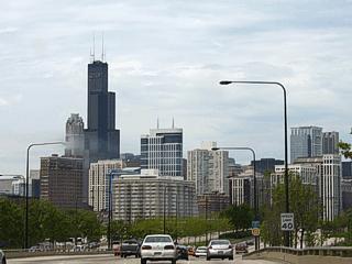
|
Here is a picture of downtown Chicago, Illinois taken from near Lakeshore Drive. The large building to the left is the Sears Tower, and held the record for the worlds tallest building for some time. The city's name, "The Windy City" is just a mere expression, and is actually less windy statistically as the city of Boston. Chicago is located on the southwest side of Lake Michigan. |
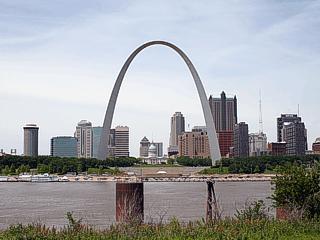
|
This is a picture of Saint Louis, Missouri taken from the Illinois side (east side looking west) of the Mississippi River just north of the Interstate 44 bridge. The Arch Monument stands 630 feet tall and represents the "Gateway to the American West", which actually is America west of the Mississippi River. The Mississippi River can be seen in the foreground and is flowing from right to left (southward). |
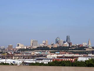
|
This is a picture of Kansas City (on the Missouri / Kansas border) taken from Interstate 70 on the Kansas side. |
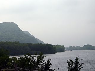
|
This is a picture of the upper Mississippi River near Winona, Minnesota during the spring time. The mountains to the left are actually "bluffs" created by the Mississippi river carving a valley into the upper plains. The Mississippi river begins in far northern Minnesota as a small stream and runs all the way to the Gulf Of Mexico. |
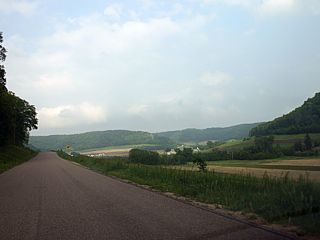
|
This is a picture of the countryside in the rural areas of Wisconsin. The beautiful landscape and rolling hills is also known as Americas "Dairy Country". Many pastures and structures in this part of the United States produce milk, cream, and ofcourse, cheese. |
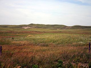
|
This picture is looking west from Highway 183 in Nebraska at the landscape of the "Sandhills". The sandhills region lies in north-central Nebraska and was originally an arid desert with sand dunes. Climate change over the years caused the desert to transform into grass covered hills that still resemble the shape of the original sand dunes. This area now is a desolate region of northern Nebraska postulated with cattle ranches and rural farmsteads. |
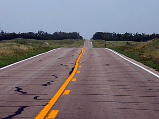
|
Here is a picture of Highway 183 in north-central Nebraska's "Sandhills" region stretching to the horizon. Highway 183 runs from South Dakota through Nebraska, Kansas, and Oklahoma, and ends in Texas. It is a very popular road for storm chasers. The trees on the horizon are not native to this region as they were put there as wind-break by farmers in the past. |
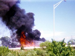
|
This is a picture of a fuel fire from an exploded and overturned gas tanker truck on Interstate 95 in Broward County, Florida in September 1987. The fire is being sprayed with foam from local fire fighters. The accident was caused by a motorist driving intoxicated at high speed that cut-off the tanker truck. Both collided and overturned, exploding in the process. Unfortunately, the drivers of both vehicles involved were burned to death. |
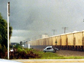
|
Rail road crossings can be DEADLY. The mangled vehicle in this picture WAS a large Lincoln Town Car that attempted to cross a rail-road crossing in Broward County, Florida in June 1992. The freight train, traveling northbound on the CSX railway west of I-95, struck the vehicle, breaking it in half, and dragged the flaming remains of it nearly one mile north until it came to rest jsut north of Atlantic Boulevard in this picture. Tragically, the 87 year-old male driving the vehicle was killed instantly, and burned so bad that his sex could not be identified easily by accident investigators. This picture was taken as the car and train passed me as I was waiting for the train to pass. I had my camera on my car seat (going to a get-together nearby) and took the photo before getting out and trying to help (there was NOTHING anyone could have done)! |
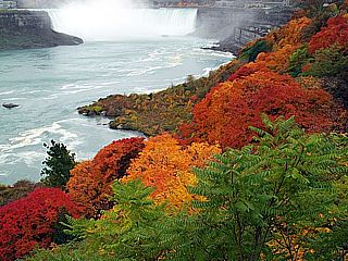
|
Here is a picture taken of the colors of the trees as well as Horseshoe Falls in Ontario, Canada in Niagara Falls in the fall (late October) of 2009. This is along the Canadian side of the Niagara River. |
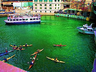
|
Here is a The picture of the Chicago River taken in Chicago, Illinois during the St Patricks day celebrations in March 2007. A tradition of dying the Chicago River a bright Irish green is a unique sight as boats disperse about 40 pounds of non-toxic fluorescent green dye into the river. The water stays green for about a day or two, or sometimes a week! You are probably wondering how this started? Back in the 1960's, a plumber was attempting to trace the flow of liquid through a pipe that emptied into the Chicago River. He used a green dye that allowed him to trace the "unknown" outlet of what he poured down a drain in order to stop polluting the river. This is how the "Green River" celebration and tradition was born! |
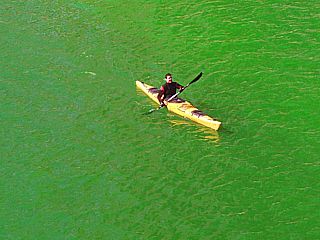
|
This is a kayaker on the Chicago River in Chicago, Illinois during the St Patricks day celebrations in March 2009. This year the river retained an incredible shade of green as a crowd of many rowdy and proud Irish cheered on. |
|
Here is another picture of the intense green color of the Chicago River in March 2009 during the St Patrick's day celebrations and parade. |
|
What's Saint Patrick's day celebrations 2009 without a view of the GREEN Chicago River and some good ole' Guiness lager? I'm not Irish, heck - I am not even wearing green - shame on me ... The river made up for it though! |
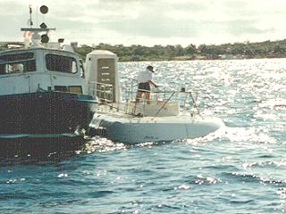
|
This is a topside view of the Atlantis III submarine operated by Atlantis Submarine Tours in Cozumel Mexico. The tour company brings paying tourists for a 45 minute submarine ride to depths of over 100 feet featuring a "flyover" of the edge of the continental shelf near the end of Cozumel island. Ths submarine is a real mini-sub or "submersible" (retired from the US navy) that holds about 28 people. The attendant in this picture is closing the main hatch for the next group of tourists to begin their dive. Communication between the service boat (to the left) was constant throughout the tour and was 48 kHz longwave while diving and marine VHF at the surface. |
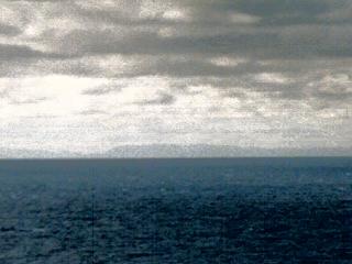
|
This is a picture taken about 20 to 25 miles off the Cuban coast from a cruise ship steaming southwest towards Cozumel, Mexico. The mountainous terrain and flat coastal plains can be barely seen over the horizon. This is about as close as one can get to the island of Cuba if respecting the US trade embargo ... The "political lines" are not visible in this picture. |
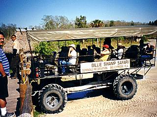
|
This is a picture of a special vehicle designed to travel through the mud and swampy waters of the Florida Everglades. It is operated by the Billie swamp tours of the Seminole Indian Reservation. Holding about 20 tourists, it grudges its way through mud, chest-deep water, over grass, through brush, and other in-hospitable terrain. This is much different than an airboat and can safely get up-close and personal with many forms of wild life. The boarding area is to the left and enters the front of the swamp buggy. |
|
A brush fire burns out of control in Glades County, Florida to the Northwest of Clewiston. The fire was in the brush and swamp areas on the western side of Lake Okeechobee that were bone-dry from an ongoing drought. The dense smoke plume from this fire spreads southwest across highway 98 and canceled a yearly skydiving event in the area. Regions under the smoke plume were covered with white ashes. |
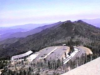
|
This is the highest point in the eastern United States in the Southern Appalacian mountains. This picture shows the visitor center from the summit of Mount Mitchell in North Carolina during late winter of 1995. The weather in NC in the foothills was about 65 degrees F. Here, at about 6,500 feet above sea level, the temperature is 25 degrees with 40 MPH winds. Note the snow in the parking lot. Note the dying evergreen trees in the foreground, victims to high-altitude acid rain. |
|
This is a view from over 100 feet below the ocean surface out the starboard side of the Atlantis III submarine. At this depth, we can safely view the sea floor and a myriad of marine life such as coral and sponges. Sponges are most obvious at this depth as well as the deep-blue color of the water. Beyond the "edge" in this picture, the continental shelf drops to 600 feet, then to 3,000 feet, a long way down! The submarine carries about 28 passengers (paying tourists) to the depths on a 45 minute submarine tour, one of a few offered anywhere in the world. |
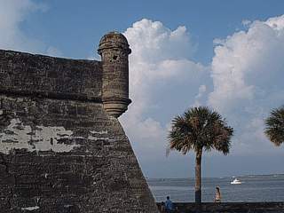
|
This is a view of the southeastern side of San Marco Castillo (castle type fort) in Saint Augustine, Florida. The walls, withstanding nearly 500 years of storms and attacks, are made from coquina, a form of conglomerate (shells, coral, and sand cemented together naturally) quarried from the area by the Spanish settlers. This type of Castillo is also common in other areas of the Caribbean, such as Puerto Rico and Panama. |
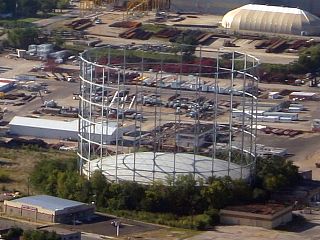
|
Occasionally in some of America's cities you see these structures, like this one (taken from an aircraft over Saint Louis, Missouri). These are natural gas "holders" or "gasometers". These structures are for storing natural gas as well as maintaining pipeline pressure (just how a water tower does so with water). The metal "cage" guides a mobile sealed upside-down can-shaped cap, which rises and falls with the quantity of gas inside the reservior it forms. It is sealed by water that fills the pit the cap rises and falls into (as deep as it is high). The one here is empty (cap is all the way down) and is no longer in use (pipeline advances made these obsolete and many were demolished). Natural gas was also difficult to compress in the past, so these gas holders were a common site back in the day, especially in Europe. Many still stand in many cities. |
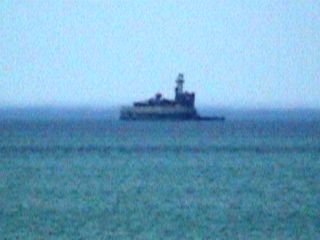
|
This is a structure about 2-3 miles off the lakefront of Chicago, Illinois in Lake Michigan. This is an INTAKE CRIB, where water flows into the structure and into a tunnel system supplying the city of Chicago with water. These structures are common on the US Great Lakes, this one has a lighthouse as well. |
HTML File "outdoors.htm" - Developed By Chris Collura
To Return To The HOME Page Of This Site Click The "INDEX.HTM" Link Here!