
| The storm chase in the Midwestern Plains from May 19 through May 29 of the year 2000 is completed. Out of the 10 day trip, 7 out of them were great chase days with many supercell encounters. A total of seven team members conducted this long chase in Texas, Oklahoma, and Arkansas with over 6000 miles logged. Myself, Jeff Gammons, and David Cornwell of the former "Weathervine" Storm Intercept Team. Along with us were 4 others for documentary purposes were part of this chase expedition. There was Jesse Snyder, Tom Fitzpatrick, and Michael Neumann for additional documentation and observation. Amos Magliocco, local to the Dallas, Texas area, also joined us for some of the chases. There has been hail, lightning, strong winds, and a tornado touching down just feet away from the chase team! Keep in mind that this chase log is scientific evidence and portrays my on-going storm chasing research. It has been placed on this page for easy reference and meteorological interests. Please do not plagiarize or copy this document to other sites for distribution. Note - This page may take a while to load on some SLOWER connections! |
| CHASER NAME | HOME CITY | CALLSIGN | CHASE DATES | OCCUPATION |
| AMOS MAGLIOCCO | DENTON, TX | KC5VPD | 5-24 TO 5-27 | WRITER |
| CHRIS COLLURA | MIRAMAR, FL | KG4PJN | 5-19 TO 5-29 | COMPUTER ANALYST |
| DAVID CORNWELL | WPB, FL | KG4PGD | 5-19 TO 5-27 | DSL TECHNICIAN |
| JEFF GAMMONS | WPB, FL | KG4PGA | 5-19 TO 5-27 | WEB DESIGNER |
| JESSE SNYDER | DETROIT, MI | N/A | 5-19 TO 5-28 | PHOTOGRAPHER |
| MICHAEL NEUMANN | DETROIT, MI | N/A | 5-19 TO 5-28 | PHOTOGRAPHER |
| TOM FITZPATRICK | INDIANAPOLIS, IN | N/A | 5-19 TO 5-27 | STUDENT |
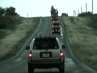
The following entries are all storm chases and interceptions performed in the Midwest United States from a period from May 19, 2000 to May 29, 2000. This log is based on a joint effort of a storm chasing team. There is myself - Chris Collura (Skywarn storm spotter code B036), Jeff Gammons, and David Cornwell for the main chase team from Florida. This is jointly with the Weather Information Network or "Weathervine". The main chase vehicle was a 1996 Chevy Blazer.
The remaining documenting chasers were Jesse Snyder and Michael Neumann from Michigan and Tom Fitzpatrick as an observing apprentice from Illinois. These three were in a 1999 Ford Ranger Pickup and carried extensive camera gear. A third chaser, Amos Magliocco from Denton, Texas, also joined us for several vital chases while providing some important target area suggestions and forecast help. He was in his own 1998 Toyota 4-Runner. April Swimm remained at the home base in West Palm Beach, Florida for updates some administrative work.
Communications employed were HAM radio, CB radio, FRS hand-held radios, and cellular phones and / or modems. Extensive camera and video equipment was also on board along with GPS and a laptop computer for navigation. The main chase duties were shifts in navigation using the GPS, radio communications, driving many miles, and preparing forecast data. More than 6000 miles were logged on this chase, NOT including the drive of the main chase vehicle with Jeff and David from Florida to the Midwest. Other members including myself flew into Dallas, Texas on the first day of the trip. The chasing involved Texas, Arkansas and Oklahoma sometimes in the worst driving conditions imaginable, in very remote regions.
All chases and observations are in chronological order and a chase number is assigned to each entry. Please bear in mind that all observations adhere to modern storm analysis standards and do not include all storms that occurred in a given area for a particular chase period. The chase log is also augmented with a small chart at the conclusion the log showing types of observations.
Any kind of storm such as a thunderstorm, tornado, waterspout, tropical cyclone, and extratropical storm can be chased or observed. I have tried to keep this log of any storms that I have observed as accurate as possible, while using terms and expressions to abide by those used by most meteorologists and storm spotters today.
Storm chasing and observation can be extremely dangerous and may result in serious injury or death. I have received intermediate and advanced training for storm spotting in 1996. I strongly urge anyone who is to try their hand at storm spotting to get training before doing so. You must also have a good understanding of meteorology and storm dynamics. "If you don't know what you're doing, Don't do it!" Contact your local National Weather Service office for information on storm spotting and about training to become a Skywarn storm Spotter. It is also advised that chasing in the Great Plains is to be done only be experienced people as a group.
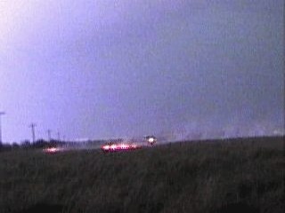
1). May 20, 8:30 PM - Direct penetration of a severe thunderstorm in Ellis County, Oklahoma near Highway 283 and Highway 60. While traveling south after photographing lightning and two tornadic supercells (over Kansas) from a 50 mile distance, an outflow boundary fired a multi-cell cluster of severe thunderstorms near our area. One severe cell was penetrated containing frequent lightning with close hits, torrential rains, and winds gusting 65 to 70-MPH. Some tree debris was noted, some of which hit the driver side door of the chase vehicle, causing a dent. Power was also knocked out in a small town in the area. The storms were caused by a low-pressure trough with a slight dry-line bulge coupled with surface heating. A 1996 Chevy Blazer and 1999 Ford Ranger Pickup was used to chase the storms. Documentation was still photos and camcorders.
2). May 21, 7:30 PM - External observation of high based type severe thunderstorms in Motley County, Texas near FM 94 and Highway 70 in the cap rock country southeast of Amarillo. Some moderate to heavy rains and 30 MPH winds were encountered followed by one of the most spectacular lightning displays that lasted well after sunset. The high elevation storms developed along a bulge in the dry-line and an upper level low, which was actually visually revealed by a swirl in the high clouds left over from some small elevated LP supercells. After dark, the storms evolved into a large multi-cell cluster of severe thunderstorms containing golf ball sized hail, which raced eastwards with the dry line punch. A 1996 Chevy Blazer and 1999 Ford Ranger Pickup was used to chase these storms. Documentation was camcorders and still photos of the spectacular lightning from these storms.
3). May 22, 7:00 PM - External observation of a tornadic and very severe thunderstorm moving into Arkansas near Fort Smith in Scott County. The storm began as a classic supercell which evolved into a low-top storm that back-built into a large LP / HP hybrid supercell near the Ozark Mountains, where the chase was aborted due to the poor road network. A large hail shaft and small funnel cloud was observed on the upwind side of the storm. Tennis ball sized hail and damaging winds were reported with this storm, but not intercepted. The Doppler On Wheels trucks, Weather Channel truck, and several other chasers were also converging on this storm. Our chase vehicles were a 1996 Chevy Blazer and a 1999 Ford Ranger Pickup. Documentation was still photos and camcorders. Intense surface heating (3500 CAPE) and a low-pressure trough caused the storms. A tornado watch was also in effect for this area until 8 PM CDT.
4). May 24, 7:30 PM - Direct penetration of an extremely dangerous severe and tornadic thunderstorm in Canadian county, Oklahoma near the town of Bridgeport west of El Reno. The storm was also near Interstate 40 and Highway 270 where an attempted track to go east then southeast of the explosively developing storm was attempted. The core of this HP supercell was punched from the north and had to be aborted because of the severe hailstorm and winds encountered. The storm developed from nothing to 74 DBZ in less than 15 minutes! During the core punch, although not intentional, winds gusted well over 70-MPH and golf ball sized hail fell sideways in zero visibility. Lightning was frequent with some close hits and visibility was zero. Power was knocked out by the storm and tree debris was observed in the road. When aborting the core punch, the chase path continued back to Interstate 40 and refuge was seeked at a Loves truck stop. Here, hail up to quarter sized covered the ground as 60-MPH winds shifted from south to north as the circulation of the storm mesocyclone passed to our south. The tornado was not intercepted. Hail cracked the windshield of the 1999 Ford Ranger Pickup and chipped some paint on the 1996 Chevy Blazer used in this chase. A third chase vehicle, a 1998 Toyota 4-Runner, was not damaged in the chase as refuge was seeked under an overpass. A region of convergence, intense surface heating, a strong low-pressure trough, a 130-MPH jet streak aloft, and a punch in the dry-line caused the storms. Documentation was camcorders. A tornado watch was also in effect for the area until 10 PM CDT.
5). May 25, 8:00 PM - Direct penetration of regions of severe thunderstorms and observation of a tornadic HP supercell storm in Crosby and Dickens counties in Texas near Crosbytown. A well-developed wall cloud was first observed beneath a rotating HP supercell that also had a tornado warning associated with it. Funnel clouds were observed but nothing touched down near us. The storm's hail shaft, greenish-black with softball sized hail that could actually be heard hitting the ground miles away, prompted us to retreat along FM 2794 to the East. The storm cycled a few times with several wall clouds and funnels before evolving into a large multi-cell storm cluster. The east and north sides of the remaining HP storm were penetrated and 75 to 100 MPH outflow winds were observed. This blew tumbleweeds and tree debris all around. Nearly continuous CG lightning was observed with many close hits, one of which started a fire near Spur. Power was knocked out and one building had all its windows blown out by the straight-line winds. The sky at 8:30 was like night with zero visibility, which gave way to ¾ inch hail and a brilliant green as the chase track punched the storm. Some letters of the "Weathervine" logo on the side of the 1996 Chevy Blazer were stripped off. The 1998 Toyota 4-Runner and 1999 Ford Ranger Pickup faired well in this chase. The storm also caused flooding. Documentation was camcorders, still photos, and audiotape. Conditions causing the storms were a deep layer of low level moisture and very high surface heating (CAPE over 5000), a jet stream aloft, and a punch in the dry-line. A tornado watch was in effect in the area until 10 PM CDT.
6). May 25, 11:00 PM - External observation of severe thunderstorms in Stonewall County, Texas, north of Aspermont on Highway 83 near Highway 380. The storm began as a high-based thunderstorm that evolved into a multi-cell cluster of low base storms as outflow boundaries from the initial storm developed. The primary focus on these storms, which contained golf ball sized hail, was lightning photography and video. Analysis of the video revealed a funnel cloud and large wall cloud illuminated by the lightning. Another chaser, Eric N., used mobile radar to pinpoint the storm during a small convergence of chasers. By about 12 AM, the storm evolved into a single HP supercell with baseball sized hail. This cell was not penetrated, neither was a tornado spotted by our team. Chase vehicles were a 1996 Chevy Blazer, 1999 Ford Ranger Pickup, and a 1998 Toyota 4-Runner. A persistant layer of warm low level moisture, a jet stream aloft, and a punch in the dry-line caused the storms.
7). May 26, 7:00 PM - Indirect penetration and observation of an extremely dangerous tornadic supercell in Haskell and Throckmorton counties, Texas near Highway 380. This storm explosively developed in Haskell county and had a rather long track with a tornado observed during its later stages! The first encounter was north of Haskell County, where a well-developed HP supercell was observed with a rotating wall cloud. A second low base, with apparent rotation, developed on the north side of this cell, moved north, and dissipated. This was a splitting storm. The southern cell began back building to the south and reached a classic supercell structure with funnel / wall clouds. Large hail, ½ to ¾ inch, began falling from the storm anvil well away from the main core, with inflow winds up to 50 MPH. To avoid the hail shaft, with grapefruit sized hail, we tracked South to Throckmorton and East on Highway 380. The storm cycled as a right moving HP storm and had a violently rotating wall cloud. A funnel quickly spun up and a debris cloud formed on the ground just a few hundred yards away. About 200 chasers converged on this storm, including the two DOW Doppler On Wheels trucks, jamming the roadway. The tornado did some damage in Haskell and Throckmorton counties. The inflow to the tornado circulation, as well as the storms powerful winds, kicked up large amounts of dust and debris. One car was hit by a flying license plate while others had missing windshields from hail. The storm evolved from a long-track supercell into a multi-cell cluster of severe thunderstorms which raced eastward. Conditions around the storm had hail to ¾ of an inch, wind at least 75-MPH, torrential rains, and frequent lightning with close hits during the indirect penetration. The outcome of this storm could have been much worse. Our chase vehicles were a 1996 Chevy Blazer, 1999 Ford Ranger Pickup, and a 1998 Toyota 4-Runner. A low-pressure system, 100-MPH jet streak aloft, a deep layer of warm and moist low level air (6000+ CAPE), dry-line punch, and winds that veered with increasing altitude caused the storms. Documentation was still photos and camcorders. A tornado watch was also in effect for the area until 10 PM CDT.
8). May 27, 5:00 PM - Direct penetration of a very severe thunderstorm in Wise County, Texas along Highway 380 near the town of Bridgeport. This was yet another tornadic HP supercell. The storm was penetrated from the East side during its late mature or "gust out" stage. Winds gusting over 70-MPH, frequent lightning with close hits, and hail at least ¾ inches was observed. Tree debris was observed blown down in Bridgeport, along with power knocked out and signs down. Tornado warning sirens were also activated for this town. The storm gusted out and a large outflow dominant squall line type storm developed along the gust front. This produced a multi-cell line of strong thunderstorms that moved rapidly eastwards. The tornado for this supercell was not observed by any chasers in the area, but softball sized hail was associated with this storm. A 1999 Ford Ranger Pickup was used to chase the storms. Documentation was a camcorder and still photos. A low-pressure trough, dry-line, weakening jet stream aloft, and high surface moisture and heat (3000 CAPE) caused the storms. A tornado watch was also in effect for the area until 7 PM CDT.
This concludes the Midwestern United States Chase Log. The summary includes a total of 8 severe thunderstorms, several funnel clouds, and a well-documented tornado touchdown. The main chase vehicle conducting and leading the first 7 chases was a 1996 Chevy Blazer. The secondary vehicle was a 1999 Ford Ranger Pickup and was used in all the chases. A third vehicle, a 1998 Toyota 4-Runner, was used as a third vehicle in several of the chases. This information was prepared exclusively for the National Weather service and the team of Skywarn storm spotters.
|
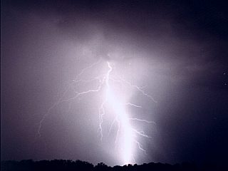
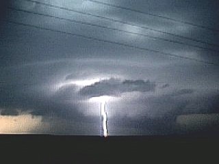
During one of our first chase days, my first cloud to ground, or CG, lightning was captured using my new Canon Rebel 2000 still camera. This bolt is a few miles away and is associated with a cluster of severe thunderstorms in Western Oklahoma on May 20, 2000. This picture was taken at night using a time exposure. |
|
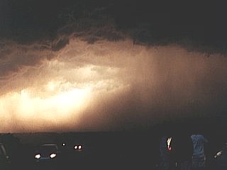
Illuminated entirely by a flash of lightning, this picture is our first severe thunderstorm encounter on May 20, 2000 in Western Oklahoma. The storm here was a cluster of severe thunderstorms with winds over 65 MPH. A piece of tree debris hit the drivers side of the chase vehicle, causing a dent. |
|
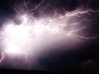
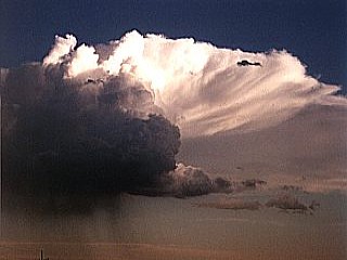
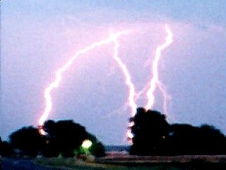
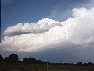
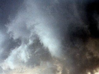
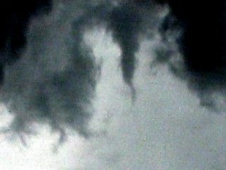
During a Western Oklahoma chase on May 20, 2000. Two tornadic supercell thunderstorms fired in southwest Kansas to our Northwest. One storm with a well developed anvil can be seen in this picture. Outflow from these storms eventually caused more severe thunderstorms closer to our area, with frequent lightning. |
|
Using a time exposure, a spectacular anvil-crawler cloud to cloud ligthning strike is captured. Also, some chain lightning cloud to ground hits are visible. This was taken in West Texas on May 21, 2000 near a cluster of high based severe thunderstorms that formed along the dryline. Note the white appearing precipitation in the picture which spreads out near the ground. This was probably large hail. |
|
Small supercell near the dryline in Western Texas on May 21, 2000. These storms have a persistant updraft and rotation but produce only light precipitation, usually in the form of large hail. The storm here is high based, or elevated, but clearly shows some twist in its structure with a well developed anvil. Note the inflow tail to the lower right of the updraft, as well as the precipitation beneath the storm. |
|
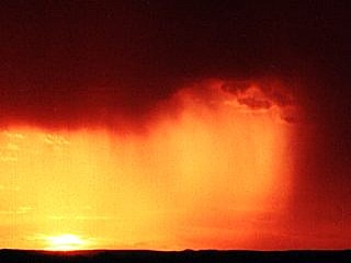
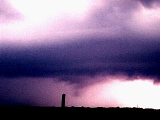
In West Central Texas southeast of Amarillo on May 21, 2000. The high base, or elevated, thunderstorms provide a breathtaking view of the sunset. The hot, dry, desert air is stained crimson red by dust in the air. This boundary, called a dryline, has 70 percent or more relative humidity in front of it and only 20 percent or less behind it. This boundary is a key player in severe storm development in the Great Plains. Note the rain shaft to the right of the picture. |
|
A time exposure of high elevation severe storms along the dryline in West Texas on May 21, 2000. The twilight from the sunset can be seen to the far right, as well as the anvil and storm structure in the center. Lightning illuminates the storm on the left side of the picture. The small point of light in the lower center of the picture is a car along the roadway in the distance. Note the precipitation fanning out in the lower left side of the picture, as well as the mammatus on the underside of the storm anvil. |
|
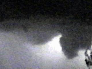
A field of high altitude mammatus clouds appears on the back sheared anvil of a cluster of severe thunderstorms on May 21, 2000 while shooting lightning photography in western Texas southeast of Amarillo. This picture was taken in bare twilight using the night vision "Niteshot" feature of a Sony camcorder. The storms were developing near a dryline. |
|
Several cloud to ground lightning strikes are captures in Western Texas using time exposure on May 21, 2000. The several bolts here were from a cluster of severe thunderstorms with spectacular lightning developing along the dryline. |
|
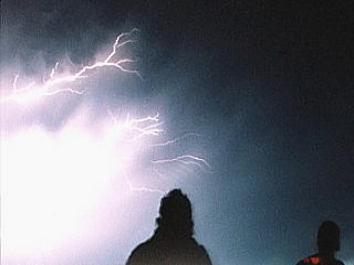
Myself and others watch a dazzling display of cloud to cloud lightning from an elevated, or high base, severe thunderstorm along the dryline in Western Texas on May 21, 2000. The time exposure captures an anvil crawler, or dendrite, cloud to cloud lightning strike as we stand in the foreground. |
|
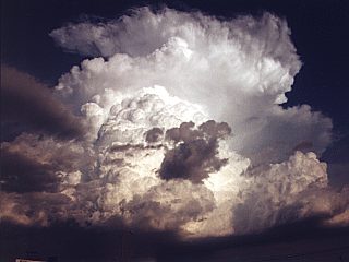
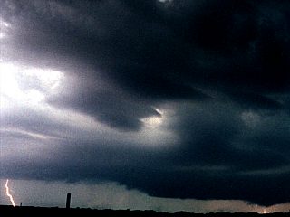
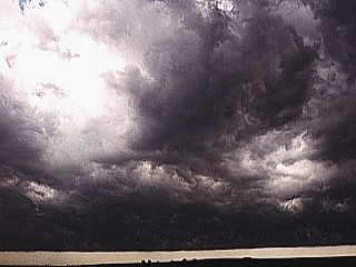
The classic supercell phase of a tornadic storm northwest of Fort Smith, Arkansas on May 22, 2000. The storm anvil here is a classic storm anvil with an overshooting top called a dome. The storm is about 50 miles to our east as we are near Mc Allaster, Oklahoma and explosively developed producing hail up to the size of tennis balls and eventually a brief tornado. The supercell evolved into several other supercell variants thereafter. |
|
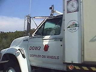
The front of one of the DOW or doppler on wheels trucks operated by scientists at the NSSL at the University of Oklahoma. Alongside this truck, we and several other chase vehicles are racing eastwards along I-44 in Oklahoma to catch a supercell thunderstorm near Fort Smith, Arkansas. Note the high anvil clouds in the sky to the left of the picture. |
|
The low top phase of a tornadic supercell near Fort Smith, Arkansas on May 22, 2000. This phase of the storm still had a strong updraft and some rotation, but was not very high into the atmosphere. This low top cumulonimbus cloud eventually exploded into a full supercell storm through a process called back building. |
|
A tornadic supercell updraft is nearly mature near Fort Smith, Arkansas on May 22, 2000. The storm is back building and starting to move southeast into the Ozark Mountains. The hail shaft is barely visible in the extreme lower center portion of the picture below the base of the storm. Note the clear slot to the lower right of the updraft tower denoting storm rotation. |
|
A closeup of the hail shaft from a tornadic supercell on May 22, 2000 near Fort Smith, Arkansas. The whitish streak is hail up to tennis ball sized. Note the left to right wrap with the space to the right. That is the rotation around a tornado embedded in the storm, which is visually blocked by the precipitation "hook". |
|
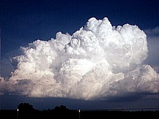
On the northwest side of a tornadic supercell thunderstorm a well developed updraft billows like cauliflower. This storm was near Fort Smith, Arkansas on May 22, 2000. Note the clear-cut and solid appearance of the developing storm as well as a clear slot in the lower center of the cloud base caused by the rotation. This stage of the storm occurred when a classic supercell evolved into a low top storm, still rotating and severe, then regenerated into a tornadic supercell by a process called back building. |
|
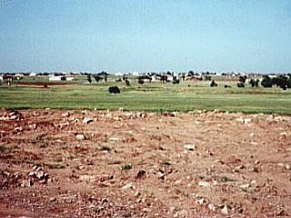
During our off day on May 23, 2000 we took a visit to Moore, Oklahoma. This is a view looking East where houses and a shopping center once stood. Now green with grass and part of a make shift golf course, the damage path is still unmistakable after an F5 tornado tore through the area over a year earlier on May 3, 1999. Note the mile-wide path where there are no trees. Note the torn up ground in the foreground. |
|
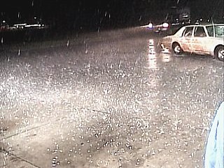
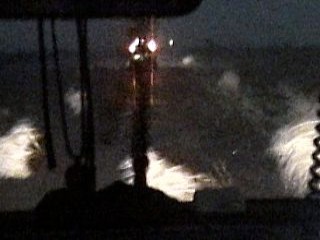
Marble sized hail covers the ground while taking cover at a Loves truck stop near Bridgeport, Oklahoma. The hail here is about 3/4 inch but is coming down is large volumes, enough to accumulate before melting. This was during a tornadic supercell on May 24, 2000. The winds were also observed blowing from the south and quickly changing to east, then to the north as the mesocyclone center passed south of us. |
|
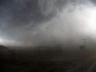
During a tornadic supercell thunderstorm near Canadian County in Central Oklahoma on May 24, 2000. The chase team tried to go north of the storm core, which contained giant hail, and got too close. The intention was to go to the east side of the storm, then south, and back to the west to view the tornado, if any. Instead the road took us into the northern side of the supercell core, into zero visibility, 70 MPH plus winds, and golfball sized hail. The chase track had to be aborted because of this, with one vehicle cracking a windshield. If we did not turn around, tennis ball to baseball sized hail would of hit us. Core punching is extremely dangerous and not a good practice for storm chasing ... Scared the heck out of me! |
|
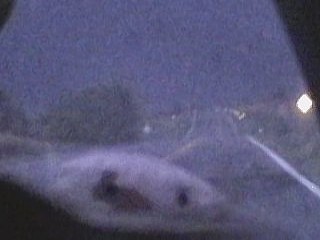
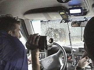
During a storm chase near Canadian County, Oklahoma on May 24, 2000. The chase team seeks cover from hail and high winds at a Loves truck stop off the highway exit while another chaser seeks refuge near an overpass. Here a tornado warning alarm sounds as driver Jeff Gammons video tapes the tense moments. Navigator David Cornwell is to the right and myself, the videographer, is in the back seat. Note the zero visibility outside. Note the cellular and radio equipment. The hail and high winds was part of a tornadic supercell which produced giant hail cracking a windshield of another chase vehicle behind us. |
|
In total darkness from a monster supercell storm, a wheat field is ignited by a cloud to ground lightning strike. Here the fire is partially extinguished by fire fighters as lightning illuminates the sky for this picture. This was during a storm in West Central Texas near Spur on May 25, 2000. Lightning causes many fires anually in the US. |
|
During a penetration of a supercell thunderstorm near Spur, Texas on May 25, 2000. The sky becomes an errie green color on the northeast side of the storm core. Here there is frequent lightning, torrential rains and hail, and winds gusting over 75 MPH. Note the trees on the side of the road downed by the straight line winds. The sky is green due to the way light refracts through the storm clouds above, and is enhanced by the reflective properties of large hail aloft. This is often the green sky tornado victims usually report before a tornado hits. The storm core to our southwest contained baseball sized hail. |
|
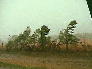
Outflow from a tornadic supercell thunderstorm, from 75 to 100 MPH, whips across the road as we try to get out of the path of the storm. These straight line winds blow tumbleweeds across the road in front of us not far from Spur, Texas. This picture was taken during the AFTERNOON of May 25, 2000. Note how dark it is, trust me, it was still afternoon ... Not night! |
|
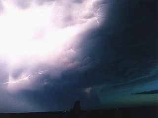
Near midnight on May 25, 2000 north of Haskell County, Texas. A severe thunderstorm cluster, currently evolving into a supercell thunderstorm illuminates the sky with frequent lightning. Time exposure captures the storm structure as lightning illuminates the storm clouds. Note the lowering to the lower right of the picture, possible a developing wall cloud. Note the inflow banding of the low clouds into the storm updraft and possible wall cloud along the upper portions of the picture. |
|
A brilliant cloud to earth lightning bolt strikes the ground very close to the inflow notch of a tornado producing supercell thunderstorm. This picture was taken in West Central Texas on May 25, 2000. Note the cloud formation to the right, that is a major inflow band. Note the flanking line to the far left and circular shape to the cloud base in the upper portion of the picture. That is the circulation of the mesocyclone. The wall cloud is just behind, and right of the lightning bolt. Minutes after this picture was taken, the chase team needed to leave to avoid giant hail. |
|
I am standing in the foreground taking still pictures of a developing tornadic supercell in West Central Texas on May 25, 2000. The storm structure is clearly visible with a flanking line to the left, at least two major inflow bands in the center and right of the picture, and a huge wall cloud in the center of the notch or "Bears Cage". The core of the storm is to the right and has hail up to baseball and grapefruit sizes. Note the slight rotation in the storm updraft in the upper part of the picture. This was the last picture of this storm taken before having to get out of its path, and damaging hail shaft. |
|
Illuminated by lightning during a severe thunderstorm north of Haskell County, Texas, a suspicious lowering resembling a funnel cloud appears on the southwest side of the storm on May 25, 2000. The storm produced golfball sized hail but evolved into a supercell with rotation producing baseball sized hail shortly after. Such cloud lowerings may be only low scud clouds or even a shelf cloud from outflow air. Others can be wall clouds, funnel clouds, or tornadoes, illuminated only by lightning. Storm chasing at night is also extremely dangerous. |
|
This video frame grab, illuminated by lightning shows a funnel / wall-cloud like feature from a severe thunderstorm (undergoing evolution to an HP supercell) north of Haskell County, Texas. This lowering (next to the tree in the lower-right side of the picture) resembed a funnel cloud and appeared on the southwest side of the storm on May 25, 2000. Also note an interesting clearer air "slot" feature to the left of the lowering. |
|
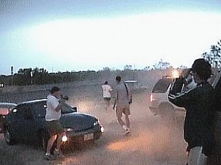
A traffic jam of chase vehicles jams the road during a trek to the Throckmorton, Texas tornadic supercell on May 29, 2000. The DOW or Doppler On Wheels is the large truck in the front of the chase "caravan" and is scanning the developing storm to the right. About 200 chasers flocked to this single supercell in the cap rock country of west Texas. |
|
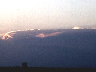
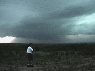
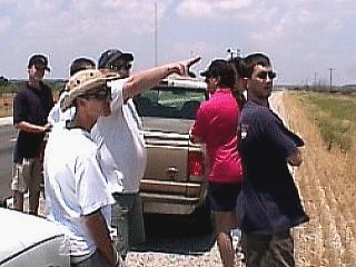
Before a successful day of storm chasing, the chase team looks at the sky, maps, and scientific data. Here we are looking at some billowing clouds called towers on the horizon. Storms are still hours away and the biggest challenge is planning where to go so that we would reach the storms when they begin. This is called our target area. Here we are pulled over along the side of the road in Western Texas near Lubbock on May 26, 2000. |
|
The entire chase team waits for the atmosphere to de-stabilize in West central Texas on May 26, 2000. Here we are watching The Weather Channel using a satellite dish mounted on top of the Chevy Blazer. We are also downloading hourly updates using a lap top computer, modem, and cellular phone. This is about an hour before storms began to fire. We are about 50 miles north of Throckmorton, Texas. Storms develop usually late in the day because of what scientists call a cap. This is a lid of warmer air aloft which does not get overcome until late in the day, when thunderstorms explosively develop. In the meanwhile, we can even catch a movie on HBO! |
|
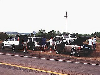
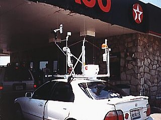
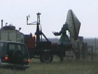
Before a productive day of storm chasing, a group of chase vehicles stops for a quick bite to eat and a fuel tank top off. In this picture, taken at a Texaco station in West Central Texas, Eric Nynugen's chase vehicle waits for gas behind our chase vehicle. Note the advanced instrument package atop the car, containing a full weather station including a radar! This picture was taken on May 26, 2000. |
|
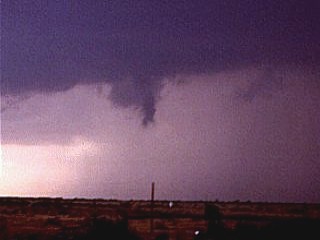
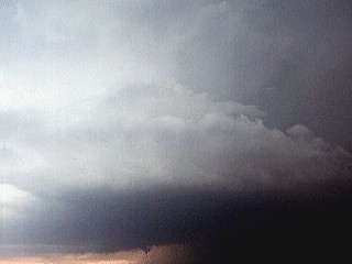
Near Throckmorton, Texas on May 26, 2000. Less than a mile away, a tornado quickly develops from a violently rotating wall cloud under a supercell thunderstorm. With a dust cloud on the ground, indicating a touchdown, the condensation funnel looms ominously overhead. Presence of inflow jets kicking dust up all around us prompts us to get in our vehicles and race to the East. The tornado makes a right turn and crosses the road. |
|
During the later stages of a tornadic supercell east of Throckmorton, Texas on May 26, 2000. The storm has a spectacularly dark updraft base on its southwestern side as violent downdrafts to the right of the picture slam into the ground and fan out to the left, kicking up dust. This is what is called a dust, or debris, foot or curl. Winds in this storm probably were gusing over 100 MPH. Note the precipitation to the right as chasers stand with their vehicles along the side of the roadway. |
|
Parked on the side of the road along with dozens of other chase vehicles, the DOW or doppler on wheels truck scans a developing tornadic supercell not visible to the right of this picture. Doppler radar can often see what the eye cannot, such as rotation and precipitation inside the storm. This was on May 26, 2000 just northwest of Throckmorton Texas. |
|
East of Throckmorton, Texas on May 26, 2000. A tornadic supercell gusts out with a very strong blast of cold air. The gust front, often preceding large hail and high winds, raises dust and sends the chase team scrambling back to their vehicles. Winds in this picture are gusting over 60 MPH on the southeast side of the storm. |
|
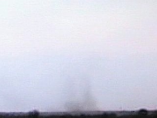
A funnel cloud develops on the updraft base of a developing tornadic supercell thunderstorm northwest of Throckmorton, Texas on May 26, 2000. This was the beginning of a long track supercell storm that eventually produced a tornado. |
|
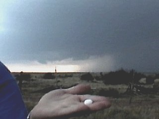
Hail up to 3/4 inch falls from the storm anvil overhead while observing a developing tornadic supercell northwest of Throckmorton, Texas. This occurred well away from the storms core, which contained hail the size of a grapefruit. This was our cue to move out of the path of this storm to avoid getting caught by giant hail. The picture was taken on May 26, 2000 as I hold a piece of hail in the foreground with the updraft base of the supercell in the background. |
|
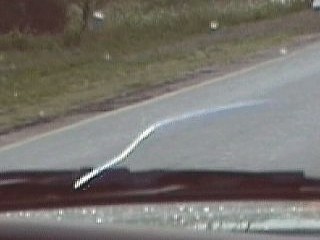
A horizontal vortex developing along an inflow jet associated with a tornado, left of the picture, near Throckmorton, Texas on May 26, 2000. The air flows into the base of the tornado inside the inflow notch of the supercell. As we are racing southeast to get away from the storm path, I capture the inflow jet vortex as I look back with my camera. |
|
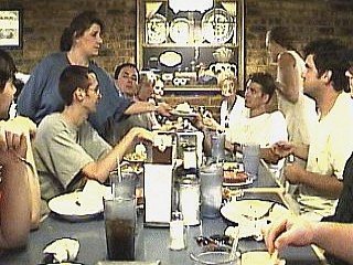
Nothing like a nice hot meal after a long day of productive chasing! Here the entire chase team along with many others has a great meal at a hospitable country restaurant. This was after the chase through Throckmorton, Texas on May 26, 2000. There were as many as 200 chasers jamming all restaurants and hotels after this chase in the area, including the two DOW trucks. |
|
While racing southeast to get out of the way of a tornado and its parent supercell storm, a violent inflow wind sweeps over us and feeds into a tornado on the ground to the left of the picture. This picture was taken, maybe too close, near Throckmorton, Texas on May 26, 2000. These winds are what scientists call inflow jets, and are clearly marked here by the presence of dust and debris that gets picked up. Winds here are gusting well over 60 MPH. |
|
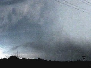
This picture was taken just minutes before a tornado was produced by a supercell storm near Throckmorton, Texas on May 26, 2000. The storm updraft base here is clearly rotating and symmetrical, in what is called a mesocyclone. Note the updraft tower structure higher up in the picture, including striated banding in a lower "space ship" looking cloud. Note the small funnel in the updraft base and flanking line to the left. The core is to the lower right and contained hail up to grapefruit sized. Large hail was even falling from the anvil overhead when this picture was taken! |
|
During a tornadic supercell near Throckmorton Texas on May 26, 2000. The associated tornado touches down a few miles away and raises a small cloud of dust and debris. Even if there is no visible, or condensation funnel from the cloud to the ground, the tornado circulation, which is only invisible air, can still be on the ground and cause damage. The dust or debris cloud confirms a tornado touchdown, not the visible funnel. |
|
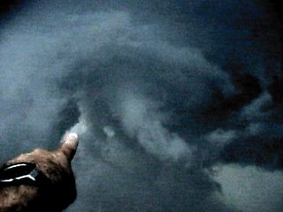
Near Throckmorton, Texas on May 26, 2000. Looking directly over my head and still shooting video as I am screaming at other chasers, I point to the tornado condensation funnel of the tornado just about to hit us. We fled seconds later and the tornado crossed the roadway right were we were. Grapefruit sized hail also was behind the tornado and had to be avoided. |
|
Near Throckmorton, Texas on May 26, 2000. A small funnel cloud appears high in the vault or bounded weak echo region of a tornadic supercell thunderstorm. This is part of the updraft and downdraft interface and was just north of a tornado touchdown. The funnel in this area is not part of the tornado, just another vortex in the complicated dynamics occurring inside the supercell. Grapefruit sized hail also was reported with this storm and several chase vehicles lost windshields. |
|
After more than a week of storm chasing, one of the chase vehicles, a 1999 Ford Ranger, has a large crack in its windshield. This picture was taken on May 27, 2000 but the crack probably came from punching the core of a supercell with large hail on May 24, 2000. |
|
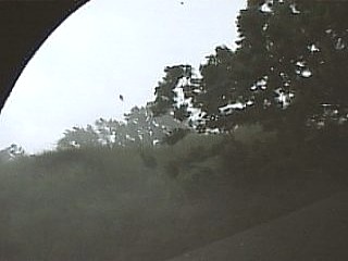
West of Fort Worth, Texas on May 27, 2000. A previous tornadic supercell thunderstorm dissapated and produced a powerful gust front which raced to the southeast. Looking towards the East, the backside of this gust front, called a shelf cloud, contains tremendous amounts of turbulence. Note the actual boundary separating the outflow air from the clear air near the horizon. |
|
Pulled beneath an underpass during a tornadic supercell near Bridgeport, Texas on May 27, 2000. The storm was during its gustout stage and we are on the eastern side of the storm core. Tornado sirens blair as a tornado warning was also in effect for the area. Winds here gust over 70 MPH and hail at least 3/4 inch pelts with lightning and heavy rains. Note some flying tree debris in the top of the picture. This was the late stages of this dying supercell which produced a tornado and hail as big as grapefruits earlier. |
HTML File "mwcl2000.htm" - Developed By Chris Collura
To Return To The HOME Page Of This Site Click The "INDEX.HTM" Link Here!