
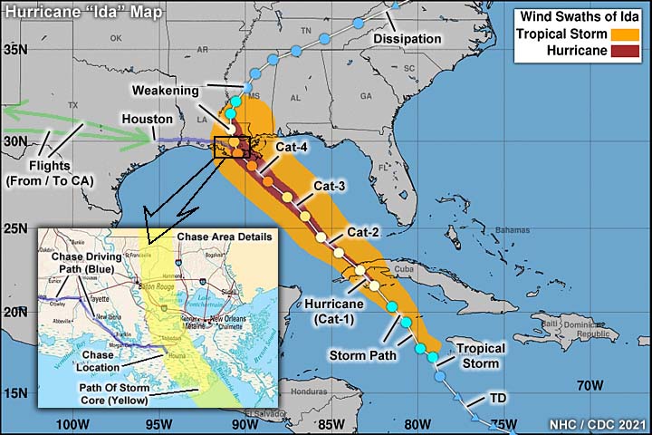
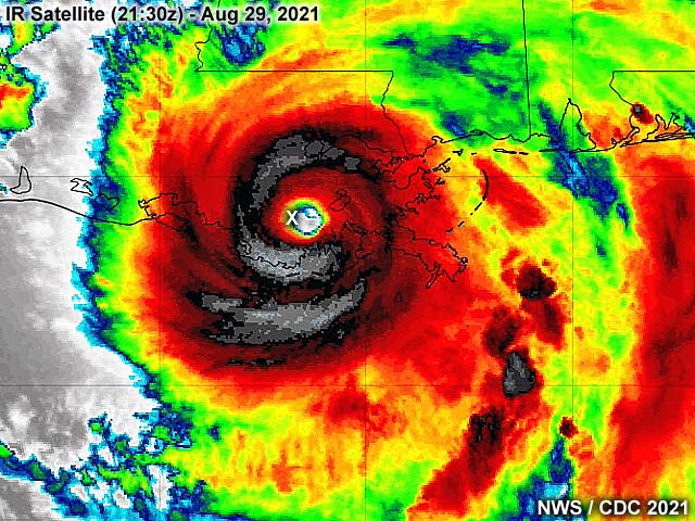
| Hurricane Ida was a devastating high-end category 4 hurricane that slammed into southeastern Louisiana on August 29, 2021 - Marking a 16 year anniversary of hurricane Katrina (16 years prior) in 2005 on the same date. This storm began as a tropical wave moving off Africa and making its way into the southern Caribbean sea during the week of August 22. This system festered in the southern Caribbean and eventually formed into a tropical depression on August 26. The system intensified into a tropical storm, and eventually a minimal hurricane, while southeast of western Cuba, on August 27. The storm crossed over western Cuba, and re-emerged over the southern Gulf of Mexico. Once back over water, Ida began rapidly intensifying on August 28, crossing a warm eddy in the Gulf of Mexico "loop" current. This rapid intensification spree continued all the way up until landfall on August 29, where it came ashore near Port Fourchon as a high-end category 4 hurricane, with maximum sustained winds of 150 to 155 MPH. Sporting a double-eyewall structure, hurricane Ida continued northwest, with only gradual weakening, and devastated the areas near Houma, Raceland, and Golden Meadow (among others). My area in Houma was clipped by the western portion of the eye, and fully exposed to the violent inner eyewall of hurricane Ida. The storm jogged east as it began weakening, and moved more north - Crossing near Baton Rough during the night of August 29 / 30. Rapidly weakening, hurricane Ida weakened to a tropical storm during August 30, and eventually a tropical depression by August 31 near northwestern Alabama. After that, Ida continued east and northeast as a remnant / post-tropical low, and across the northeastern USA, and dissipated thereafter. Observations of hurricane Ida were made mainly in Houma, Louisiana, which took a direct hit from th core of this hurricane. This chase involved flying out of Long Beach, California to Houston, Texas on August 28, and driving east to Lafayette, Louisiana for that night. The following day, August 29, I headed to the mail target area of Houma, Louisiana - Which had a parking garage near the government center for observing the core of the hurricane. On August 30, I made my way carefally out of Houma, which was devastated by the storm, and back through Lafayette and west into Texas and was back in Houston by the evening. I spent a few days in Houston, mainly working on my IT job there remotely, and flew back to Long Beach, California on September 2. Total mileage was 683 miles. Hurricane Ida did over 65 billion dollars in damages and at least 115 deaths during its rampage across the Carribean and southern to northeastern United States. In the NE USA, deadly flooding became the destructive force, not wind, mainly from the extratropical stage / remnants of Ida. Note - This page may take a while to load on some SLOWER connections! |
HURRICANE IDA - ANOTHER DEVASTATING BLOW FOR LOUISIANA
| CHASER NAME | HOME CITY | CALLSIGN | OCCUPATION |
| CHRIS COLLURA | DEERFIELD BEACH, FL | KG4PJN | COMPUTER ANALYST |
|
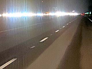
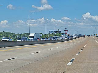
Evacuation traffic on the opposite (west bound) side of the roadway (Interstate 10) while heading east from east Texas and into southwestern Louisiana during the night of August 28, 2021. This massive traffic jam is evacuation traffic, and was many miles long, as people scurry to get out of the "danger zone" of hurricane Ida. Almost no traffic on my side, as I'm heading east and into the storm path and towards Lafayette, Louisiana for the night. |
|
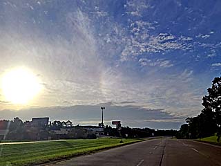
Looking southeast along Highway 90 to the southeast of Lafayette, Louisiana on August 29. The high altitude outflow appears overhead, as cirrus clouds stream out of hurricane Ida in a clockwise fashion (upper air anticyclone). The hurricane was off southeastern Louisiana at the time and reached category 4 strength (with winds over 140 MPH). Note the sun dog in the middle of the picture from the high cirrus outflow clouds. |
|
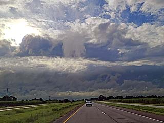
Closing into the storm along Highway 90, and near Morgan City, the denser fast-moving low and mid-level cloud decks of the hurricane appear over the horizon to the southeast. This is known as the "bar" of the storm (dark band over horizon). |
|
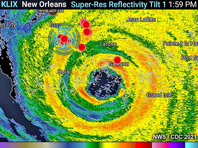
The storm was observed at a reinforced concrete parking structure near the hospital and government center in Houma, Louisiana for most of the day on August 29. Several other storm chasers and news reporters were also at this parking structure. Hurricane conditions arrived by late morning. |
|
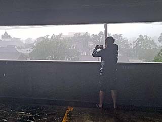
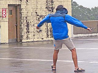
Storm chaser standing in winds gusting near hurricane force at the top of the parking garage in Houma, Louisiana. |
|
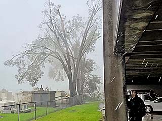
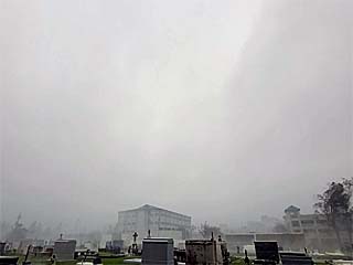
A tree breaks apart in strong wind gusts between a cemetery and the parking garage. |
|
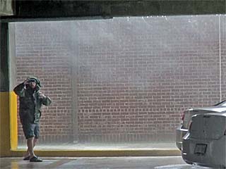
Strong winds and horizontal rains blow through an alley way on the east side of the parking structure. |
|
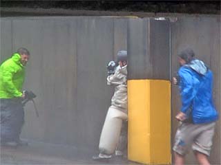
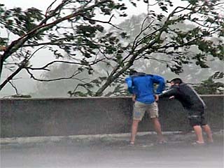
Storm chasers and reporters being blasted by hurricane forced winds blowing through a car ramp in the parking garage. |
|
Storm chasers braving the hurricane forced winds, and perilously close to a tree top thrashing in the winds, on the top level of the parking garage. This was about the time the outer eyewall arrived near and after noon. |
|
Debris flying off one of the government buildings and landing in front of the parking garage. Part of the roof was torn off the building to the right. A mangled satellite dish and roof material is falling into the foreground while under the outer eyewall. |
|
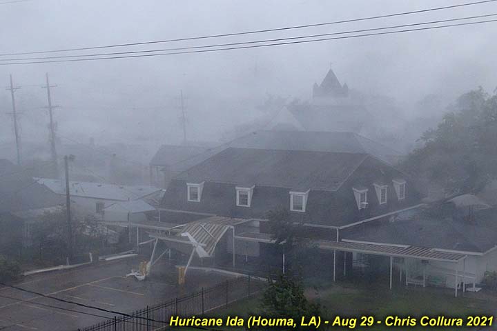
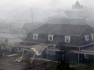
Low visibility and horizontal rains as the inner eyewall of hurricane Ida comes into Houma by early afternoon. Homes and businesses are being damaged or destroyed at this point. Winds are gusting over 150 MPH at this point. |
|
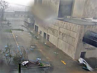
View of government building and debris looking down from the parking structure under the inner eyewall during the afternoon. |
|
View of sky looking eastward and while just inside the worst part of the inner eyewall as the calm eye made its closest approach to the east of Houma and was nearing Raceland. The rain and wind let up a bit, and sky has become much brighter. These "milder" conditions did not last long, and quickly gave way to the brutal backside of the hurricane and white-out conditions minutes later. |
|
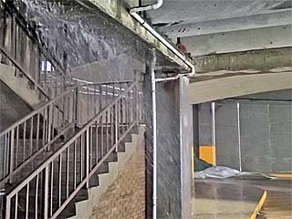
The violent rains of the hurricane caused water to penetrate every crack and crevasse of the parking structure, with "waterfalls" coming around cracks and / or near stairs. Sheet metal is also blowing against the structure in the background. |
|
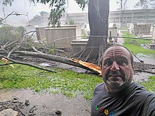
Myself standing next to a fallen tree by the cemetery next to the parking structure late in the afternoon. |
|
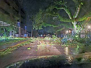
Damage and debris along the street in front of the parking garage as night falls over Houma and the storm gradually departs the area. |
|
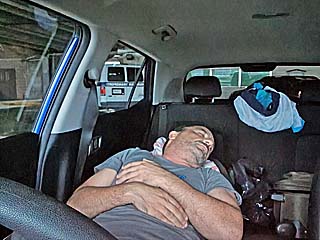
It made no sense attempting to leave Houma until the following day (not daring to drive in debris and blocked roads at night). I managed to sleep in my car after the storm, planning to leave during the morning of August 30. |
|
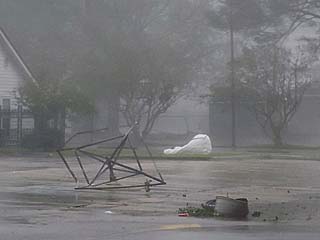
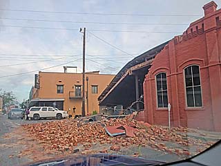
Major structural damage to a business in Houma during the morning of August 30. |
|
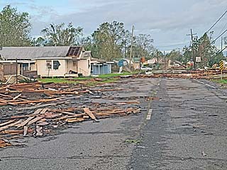
Damage and blocked road in Houma with destroyed homes and residences. Not the water mark too (left side of picture), as the storm surge actually made it this far inland (15 miles)! |
|
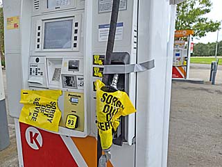
There was no open gas stations and no fuel all the way from Houma and back through Lafayette. The only way to refuel was to bring extra fuel in gas cans. In this picture (in Lafayette) the gas station is open but the gas pumps are bagged up. |
|
Returning west and back into Texas along Interstate 10, the traffic is heavy on the left (east bound) lanes, as people who evacuated return to Louisiana during the afternoon of August 30. |
HTML File "ida21.htm" - Developed By Chris Collura
To Return To The HOME Page Of This Site Click The "INDEX.HTM" Link Here!