
| This is my picture based log by chronological order of some select pictures of storm chases and observations conducted during or after the year 2010. This log is separate from any storm chase expeditions to the US plains or Midwest, and does NOT include tropical cyclone interceptions. These other chase logs are available as separate logs from the main storm chasing section. This log is for most "home" chases in the state of Florida or for other miscellaneous storm or coastal observations. Keep in mind that this log is scientific evidence and portrays my on-going storm chasing research. It has been placed on this page for easy reference and meteorological interests. Please do not plagiorize or copy this document to other sites for distribution. Feel free to browse through my main storm chasing picture section. Note - This page may take a while to load on some SLOWER connections! |
STORM CHASING PICTURES - DURING OR AFTER 2010
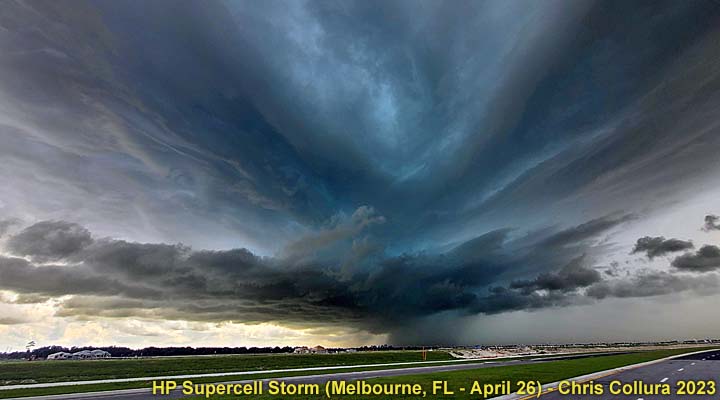
TABLE OF CONTENTS - CLICK TO GO TO PAGE
|
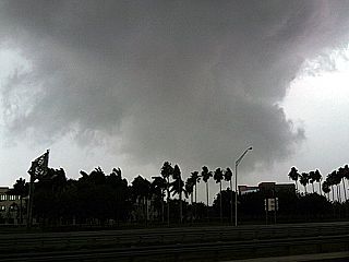
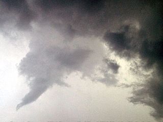
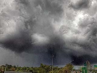
Interesting view of a tornado-warned storm looking eastward from I-95 in northeastern Miami-Dada county, Florida on March 29, 2010. Note the wall cloud (storm is over the coastal waters at this time) as well as the RFD clear slot to the upper left. |
|
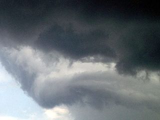
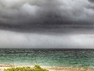
Here is a close up of the wall cloud (view is to the northeast) from Miami Beach, Florida on March 29, 2010. This is a portion of a small HP supercell storm that caused possible tornadoes / waterspouts. The storm here is about 5 miles over the Atlantic ocean and headed NE at 35 MPH. Note the funnel / lowering to the right of the wall cloud in this picture. |
|
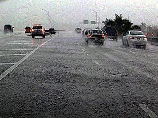
One of MANY traffic accidents that occurred between the severe thunderstorms and subsequent squall line pushing through Broward and Miami-Dade counties in South Florida on March 29, 2010. Beleive it or not, the driver had only minor injuries in this roll-over accident, caused by driving too fast in the rain and hydroplaning / losing control on an off-ramp from I-75 to Miramar Parkway. |
|
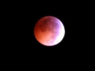
This is a digital picture of the lunar eclipse at about 2:45 AM EST during the overnight of December 20-21 viewed from Sunrise in South Florida in 2010. Cold and clear conditions allowed for great viewing of the eclipse. |
|
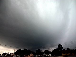
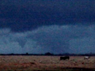
Here is a picture of a developing supercells storm, rather rare for Florida, to the southwest of Sebring, Florida in Highlands County and west of Highway 27 on January 25, 2011. |
|
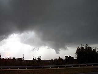
This is the same supercell storm as it moved farther east and is now SE of Sebring, Florida (near Sebring airport) in Highlands County on January 25, 2011. The storm has developed a pronounced RFD clear slot (left) and rotating wall cloud (center and right). |
|
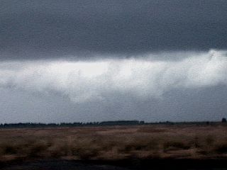
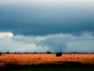
Another view of the tornadic supercell storm as it continues eastward through Highlands County, Florida on January 25, 2011. The RFD clear slot has wrapped around the storm with a large wall cloud / possible tornado (center) behind it. |
|
This is a view of the tornadic supercell storm moving away over rural areas of Highlands County, Florida before dark on January 25, 2011. The intense RFD and wall cloud / tornado can be made out in the center of the picture. Note the large funnel to the left of the wall cloud as well. |
|
Another final view, enhanced, of the wall cloud and tornadic region of the supercell storm on January 25, 2011 in Highlands County, Florida. |
|
Wall cloud in a severe thunderstorm cell near Sunrise and Weston in Broward County, Florida on June 12, 2011 (roughly 4 PM). |
|
Hail on roadway (at least 1" but melting fast) behind the severe thunderstorm cell along I-595 near Weston, Florida on June 12 (around 4:15 PM). |
|
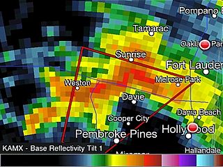
Radar (base reflectivity) image of a tornadic supercell in Broward County, Florida approaching Sunrise during the late evening of October 18, 2011. This went on to produce an EF-2 tornado in that area. Note the "hook" appendage near the center of the screen, just south of the precipitation core. |
|
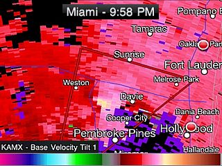
Radar (velocity / divergance) image of the same tornadic supercell in Broward County, Florida as in the image above approaching Sunrise. Note the velocity couplet (gate-to-gate shear) / TVS (tornadic vortex signatore) near the center of the image. At this time, I was visually observing the storm at about 9:45 to 10 PM, and was able to make out a large funnel illuminated by lightning from a vantage point near Griffith Road and I-75 (near Weston and just SW of Sunrise) with strong RFD and power-flashes also observed. |
|
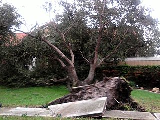
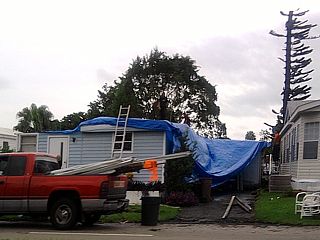
Damage observed on October 19, 2011 in Sunrise / Broward County, Florida a day after an EF-2 tornado affected the area late on October 18, 2011. |
|
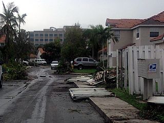
More damage on October 19, 2011 in Sunrise, Florida. |
|
More damage on October 19, 2011 in Sunrise, Florida. |
|
More damage on October 19, 2011 in Sunrise, Florida. |
|
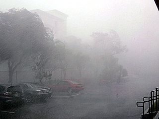
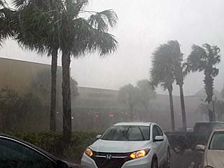
Severe thunderstorm (70 MPH winds and hail to 1") affecting Hollywood, Florida on April 6 (1:45 PM). Besides the whiteout conditions, note the little white pieces of hail in the lower portion of the picture. |
|
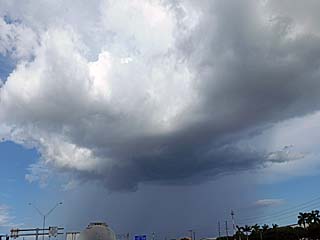
Interesting view of a weakening mesocyclone (view is to WNW) associated with an HP severe storm west of Sunrise, Florida on May 14. |
|
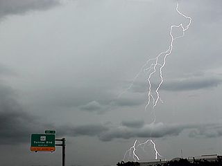
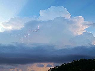
An intense CG to the northeast of a severe supercell storm near Sunrise, Florida on May 14. |
|
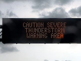
Traffic updates on a severe thunderstorm warning in the area in south Florida on May 14. |
|
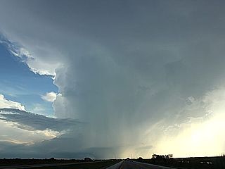
Severe thunderstorm west of Coral Springs, Florida on June 9 with prominant hail shaft. |
|
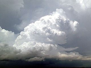
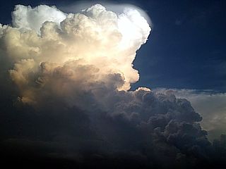
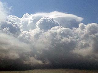
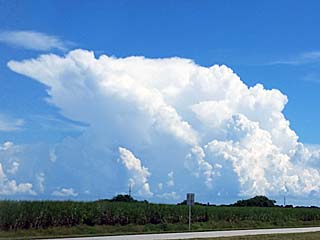
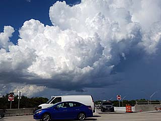
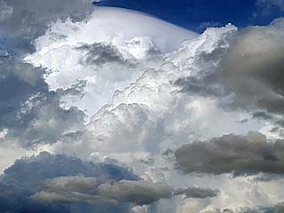
Powerful updraft of a strong to severe thunderstorm SE of Belle Glade, Florida on June 9. |
|
Developing severe thunderstorm over Miami-Dade county in south Florida on June 14. |

|
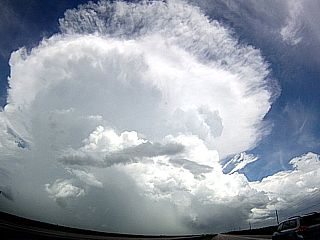
Close up shot of severe storm updradft over Miami-Dade in south Florida on June 14 with aircraft circumnavigating storm. |
|
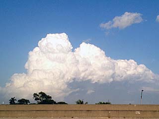
Caught this little LP supercell storm over the Florida Everglades during the early evening of June 15. Looking more like a storm in west Texas, note the developing wall cloud and little beaver's tail. This storm actually produced baseball sized hail earlier! |
|
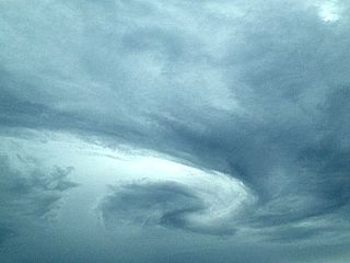
Interesting "swirl" in the sky over south Florida on Aug 10 (after a round of strong sea-breeze thunderstorms). Possibly a mid-level "eddy"? |
|
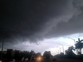
Severe warned storm in Broward County, Florida on Aug 17 with the gust front (view is looking to the east). |
|
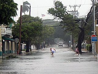
Street flooding from heavy rains and storm surge during Tropical Storm Isaac in Key West, Florida on Aug 26. |
|
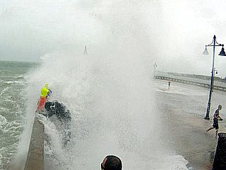
Waves from Tropical Storm Isaac crashing over end of White Street Pier in Key West, Florida on Aug 26. |
|
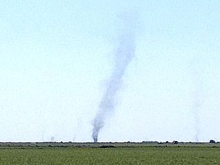
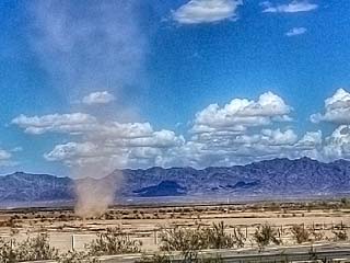
Large dust devil (with smaller ones) over sugar cane fields of western Palm Beach County, Florida and west of Highway 27 on March 16. |
|
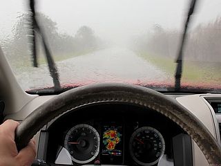
This is a strong to severe thunderstorm being viewed while chasing in my chase vehicle (note the radar display as well) on April 20 in Glades County west of Clewiston, Florida. |
|
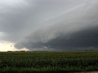
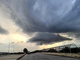
Strong gust front and shelf cloud from a developing severe thunderstorm west of Highway 27 in Palm Beach County, Florida on April 20. |
|
Strong outflow from a developing severe thunderstorm over open farmland in Palm Beach County, Florida on April 20. |
|
Anticyclonic (clockwise) rotation associated with a small supercell storm over Hialeah (Miami-Dade county), Florida on May 9. |
|
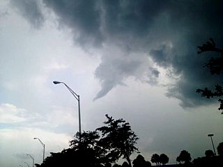
An anticyclonic (clockwise rotating) funnel develops from the same area of rotation a few minutes later over Hialeah (Miami-Dade county), Florida on May 9. |
|
Close up view of the same anticyclonic funnel over Hialeah (Miami-Dade county), Florida on May 9. |
|
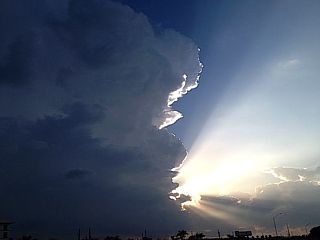
Beautiful updraft of a severe thunderstorm over open swamps west of Miami in Miami-Dade county, Florida on May 9 with the setting sun. |
|
Pileus "cap" cloud on a developing non-severe rain shower west of Fort Lauderdale, Florida on March 22, 2014. |
|
View of small cumulonimbus cloud off of Palm Beach County, Florida on March 22, 2014. |
|
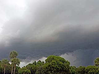
Gust front and updraft base being undercut by outflow from a strong thunderstorm over Palm Beach County, Florida on August 3, 2014. |
|
Approaching gust front from a strong summer thunderstorm over Palm Beach County, Florida on August 3, 2014. |
|
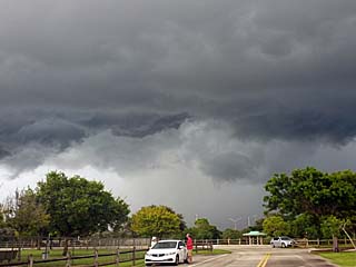
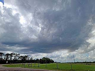
Developing multicell cluster of strong thunderstorms looking towards the southeast from Palm Beach County, Florida during the afternoon of September 16, 2016. |
|
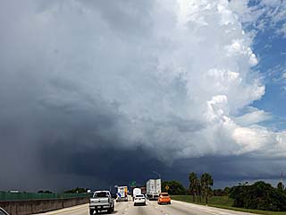
Intense (transient supercell) storm reaches severe intensity to the west of Fort Lauderdale, Florida during the afternoon of September 16, 2016. Note the inflow "flanking line" going into the storm from right to left. The view is towards the east. |
|
Strong winds and small hail affecting Broward County, Florida during the afternoon of September 16, 2016. |
|
Small LP type supercell storm, unusual for Florida, developing over Boca Raton, Florida on September 28, 2016. |
|
View of updraft an weak rotation on an "LP type storm" over Boca Raton, Florida on September 28, 2016. |
|
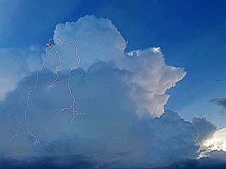
Daytime lightning from a non severe storm at dusk near Tamarac, Florida during the evening of August 15, 2017. |
|
Daytime lightning with cumulonimbus at dusk near Tamarac, Florida during the evening of August 15, 2017. |
|
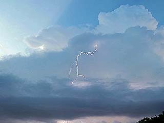
Daytime CG lightning into clear air from weakening non-severe storm at dusk near Tamarac, Florida during the evening of August 15, 2017. |
|
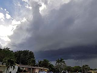
Squall line and gust front pushing through Hollywood, Florida on November 23, 2017 as a cold front moves through the area. |
|
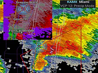
Radar image of rare tornadic supercell near Fort Lauderdale, Florida at around 4 PM EDT on April 10, 2018. The reflectivity image shows a "flying eagle" signature with a hook like appendage to the lower left. In the inset, a velocity couplet (gate to gate red and green velocities) can be seen to the SW of Fort Lauderdale. |
|
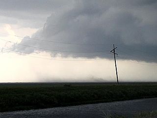
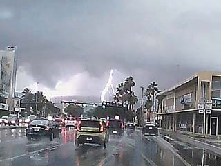
View of supercell storm looking east from I-95 and Sunrise Blvd as it was over Fort Lauderdale, Florida on April 10, 2018. Note the RFD area along the top and left of the image. The tornado (weak) is just to the left of the light pole and in the lower-center / left side of the image. |
|
View of same supercell storm - With possible large waterspout wrapped in rain - Moving offshore of Fort Lauderdale beach on April 10, 2018. The water spout is just to the left of the image center, above the white buoy. |
|
Second storm with intense lightning moving throuh northern parts of Fort Lauderdale, Florida late on April 10, 2018. This storm also had weak rotation, and a large slowly rotating wall cloud can be seen to the left of the lightning strike. |
|
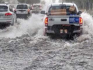
Flooded roads behind the storms late in the day of April 10, 2018 in Pompano Beach, Florida. |
|
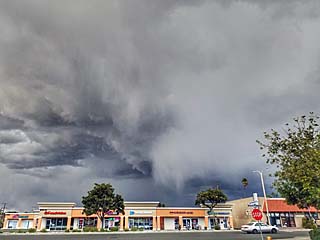
A high-based supercell develops in a cold-core environment on February 21, 2019 over northern Orange County near Anaheim, California during the late afternoon. |
|
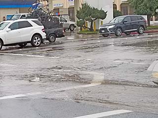
Street flooding on February 21, 2019 in Anaheim in Orange County, California during an above-normal rain event. |
|
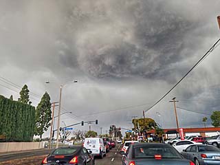
Another view of a rare supercell storm, developing in a cold-core environment (post frontal) on February 21, 2019 over Orange County, California. The upper-center of the image is the rotating portion of the storm / mesocyclone. |
|
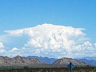
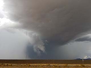
A developing supercell looms over the desert / mountainous terrain looking east from eastern California into far western Arizona. This was a supercell storm near Blouse, Arizona on September 23, 2019. |
|
A dust devil churns just north of Interstate 10 near the eastern California / western Arizona border on September 23, 2019. |
|
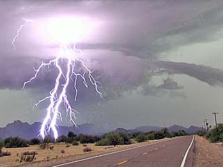
Incredible lightning and supercell structure (note beavers tail to the right) in La Paz County, Arizona on September 23, 2019. The view is to the west and southwest. |
|
RFD region with wall cloud and forward-flank funnel as a supercell storm approaches western Maricopa County, Arizona on September 23, 2019. |
|
Unusual LP (low precipitation) supercell developing near an area of convergence / sea-breeze boundary in Brevard / Indian River County, Florida on April 26, 2023. The view is to the west. |
|
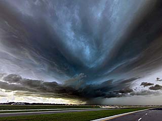
Powerful, and rare HP (high precipitation) supercell west of Melbourne, Florida (Brevard County) on April 26. Note the incredible lower and mid-level inflow features. The view is to the southwest. |
|
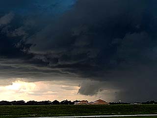
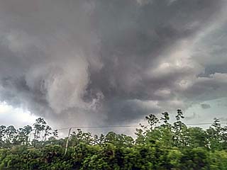
Wall cloud developing on the rear-flank of the HP supercell near Melbourne, Florida on April 26. The view is to the southwest. |
|
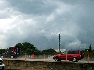
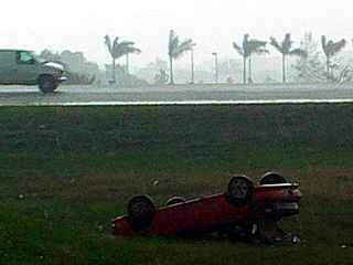
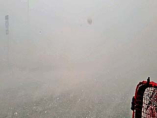
Intense hail core (up to or exceeding 1") driven by 60 to 70 MPH winds and zero visibility near the intersection of I-95 and Highway 192. |
|
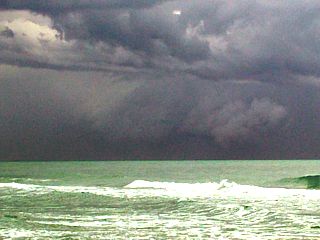
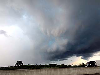
View of backside of supercell storm and rear-flank near Indian River County, Florida on April 26. Note the RFD and updraft base. Large hail (even slight green tint) is to the left. The view is to the east off I-95. |
|
View of the same HP storm updraft, evolving to a bow segment, and moving off shore of Saint Lucie County, Florida on April 26. The view is to the northeast, with storm top (and pileus) to 45,000+ feet. |
|
Another LP supercell developed in Broward County, Florida near Deerfield Beach by evening on April 26. This storm quickly got sheared apart and weakened via down-scale evolution. The instability was weaker down south, but 6k deep-later wind shear was at least 50+ knots. LP storms are extremely rare east of I-35 in the central USA (more confined to western Texas), let alone in Florida! |
|
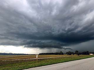
A supercell storm organizes near Brighton, Florida on April 29, 2023. Note the wall cloud and inflow tail. The storm would produce strong winds and large hail eastward towards Okeechobee at roughly 4:00 PM. The view is to the northwest. |
|
This is a view looking eastward and northeastward from near PGA Boulevard west of Palm Beach Gardens, Florida during the evening around 5:30 PM on April 29. This is a developing tornado, soon to become rain-wrapped, and cause EF-2 tornado damage from Palm Beach Gardens to Juno Beach with winds up to 130 MPH. Tornadoes like this are also extremely rare in south Florida. |
|
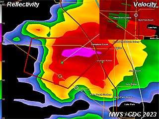
Radar image showing base reflectivity (and velocity in the upper-right inset) of the storm that would produce an EF-2 tornado near Palm Beach Gardens, Florida during the early evening of April 29. The little white circle is my location (too close?). |
|
|
There are no images for this section yet! |
HTML File "stplog4.htm" - Developed By Chris Collura
To Return To The HOME Page Of This Site Click The "INDEX.HTM" Link Here!