
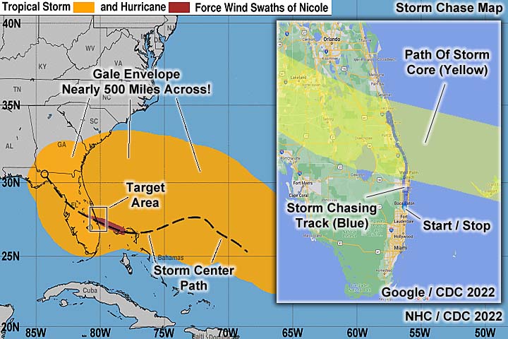
| Hurricane Nicole was a late season (and rare November) hurricane to affect the eastern coast of Florida during the second week of November, especially on November 9 and 10. The storm began with a large low pressure system, or "gyre", extending from the eastern Caribbean and eventually the western north Atlantic (well east of the Bahamas and south of Bermuda) from November 4 to 6. By November 7, subtropical cyclogenesis ensued and the system moved generally west, and even southwest (rare for November). A day later the storm evolved into a folly tropical system, and continued west towards the Bahamas, intensifying gradually. As a strong tropical storm, Nicole crossed the island of Abaco early on November 9, then passed near Grand Bahama. The storm continued west, and eventually turned northwest, becoming a minimal hurricane late in the period on November 9. Nicole had a large and expansive gale envelope of tropical storm forced winds. This area extended well to the east and northeast of the center, and drove a powerful fetch of strong winds over the swell window for eastern Florida. Extremely high surf, and storm surge - Coinciding with a near full moon and king tide - Seriously affected the coastal areas in eastern Florida, with buildings collapsing along the coast, especially in Daytona Beach and New Smyrna Beach, far from the storm center. The storm continued to the west-northwest, making landfall as a category 1 hurricane on Hutchinson Island, Florida at roughly 7:30z (2:30 AM local EST) on November 10. The storm continued to the northwest, and weakened to a tropical storm as it crossed Florida and briefly reached the Gulf of Mexico near Cedar Key late on November 10. The storm continued northwest, approaching the NW Florida and GA border late in the period from November 10-11. On November 11, the storm weakened to a tropical depression over SW Georgia, and continued north across the SE USA as a remnant / post-tropical low there-after. Hurricane Nicole has a lowest pressure of 980 MB (mainly at the Florida landfall point), winds gusting over 75 MPH, almost 500 million dollars in damage, and caused 11 deaths. Note - This page may take a while to load on some SLOWER connections! |
HURRICANE NICOLE - A NOVEMBER HURRICANE IN FLORIDA
| CHASER NAME | HOME CITY | CALLSIGN | OCCUPATION |
| CHRIS COLLURA | DEERFIELD BEACH, FL | KG4PJN | COMPUTER ANALYST |

|
Myself preparing my house (closing shudders) in Deerfield Beach, Florida on November 8, 2022. |
|
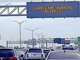
Sign on I-95 in Broward County, Florida showing a hurricane warning is in effect for the area. |
|
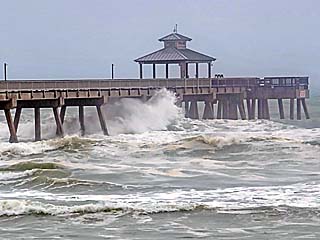
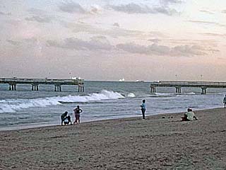
This is the high surf and ocean state at the Deerfield Beach fishing pier during the late morning of November 9. |
|
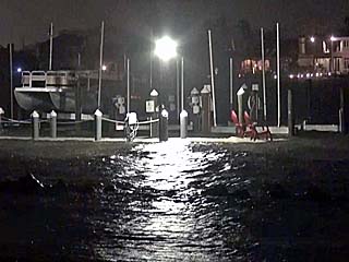
High water and boat docks on the bay side of Hobe Sound, Florida during the evening / night of November 9. |
|
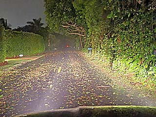
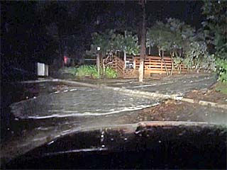
Leaves and small twigs in the roadway (A1A) near Hobe Sound, Florida. |
|
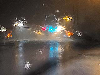
Heavy rains and 60 MPH winds near Stuart, Florida while heading north on Highway US1. |
|
Waves and rising water near the Jensen Beach Causeway. |
|
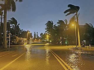
Storm surge covering the service road on the north side of the Jensen Beach Causeway. |
|
Waves from the ocean flow across the dunes and down the beach path into the parking lot at Jensen Beach, Florida just after high tide. |
|
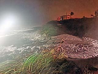
Waves and surge from the ocean covering the dunes and entire beach underwater in Jensen Beach. |
|
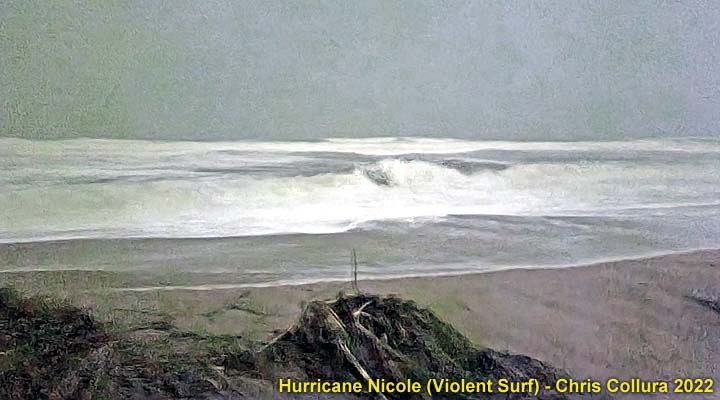
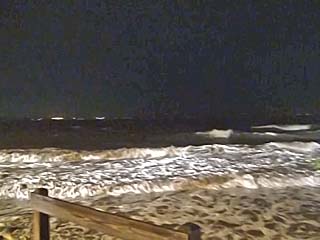
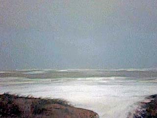
View of ocean, with waves and white-water to the horizon, off Jensen Beach. The moonlight allowed for this time-exposure. |
|
Large wave run-up flowing over the dunes and into the beach access path at Jensen Beach. |
|
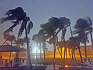
Palm trees whipping in the wind at Jensen Beach. |
|
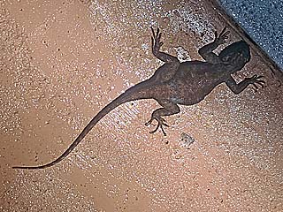
A lizard crawls up the parking lot wall to get away from the rising water. |
|
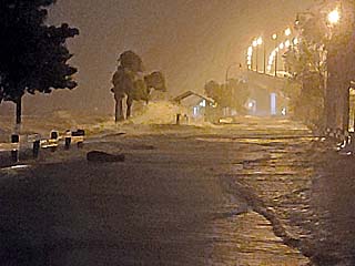
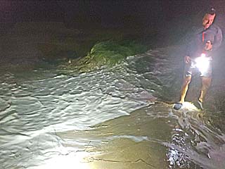
Storm surge flooding the roadway near Fort Pierce, Florida around midnight on November 9-10. |
|
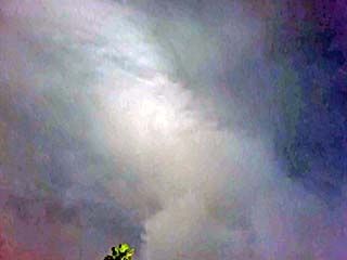
View of edge of calm eye near Hutchinson Island south of Vero Beach, Florida during the early morning of November 10. The ragged eyewall is in the center and to the left, and clearing to the right. Moonlight provided a view of the sky in the calm eye. |
|
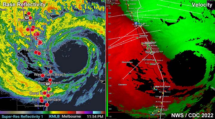
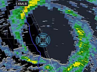
Radar (base reflectivity) image of the rain-free eye of hurricane Nicole, with my position (blue cross-hairs) inside the eye. |
|
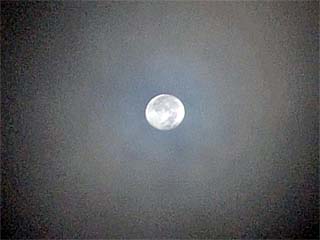
Clear view of the moon inside the calm eye of hurricane Nicole. |
|
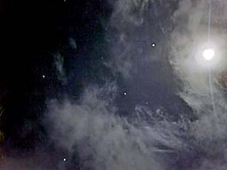
Wider view of moon and stars in the eye of the hurricane. |
|
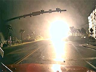
The second half / backside of hurricane Nicole approaches quickly, and a powerline is felled and explodes in a shower of sparks north of Fort Pierce, Florida. |
|
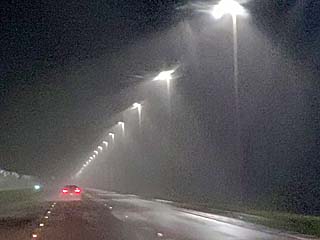
View of heavy rains and strong winds when exiting the southern eyewall of hurricane Nicole. The second (southern) half of the hurricane was weaker and much less extensive than the north (forward-right) side. |
|
Damage to the Commercial Fishing Pier near Lauderdale By The Sea, Florida, late in the day on November 10. Coastal damage and flooding extended along nearly the entire Florida east coast. |
HTML File "nico22.htm" - Developed By Chris Collura
To Return To The HOME Page Of This Site Click The "INDEX.HTM" Link Here!