
| The storm chase expedition to the US Great Plains for 2001 is completed with a total if 7 travel days. Three of these days were great chase days with five storm interceptions. My portion of this storm chase expedition was from May 22 to May 28, with five entire days available for chasing. The main "Weathervine" Storm Intercept Team left for Dallas, Texas on May 14, 2001 and chased until May 25, 2001. This is my second trip dedicated to severe thunderstorm research in this area, which includes the Great Plains and the Midwestern United States. Keep in mind that this chase log is scientific evidence and portrays my on-going storm chasing research. It has been placed on this page for easy reference and meteorological interests. Please do not plagiarize or copy this document to other sites for distribution. Note - This page may take a while to load on some SLOWER connections! |
| CHASER NAME | HOME CITY | CALLSIGN | CHASE DATES | OCCUPATION |
| AMOS MAGLIOCCO | DENTON, TX | KC5VPD | 5-25 TO 5-27 | WRITER |
| CHRIS COLLURA | MIRAMAR, FL | KG4PJN | 5-22 TO 5-27 | COMPUTER ANALYST |
| DAVID CORNWELL | WPB, FL | KG4PGD | 5-14 TO 5-25 | DSL TECHNICIAN |
| ERIC NGUYEN | NORMAN, OK | KD5HPZ | 5-25 TO 5-27 | OU STUDENT |
| JEFF GAMMONS | WPB, FL | KG4PGA | 5-14 TO 5-25 | WEB DESIGNER |
| JEFF LAWSON | DENTON, TX | KD5HPZ | 5-25 TO 5-27 | STUDENT |
NOTE - May 23 was an off day and a visit to Calsbad, Caverns in New Mexico. May 22 and May 28 were time-limited arrival and departure days. May 25 was another off day. Galleries for other activities and pictures were furnished for any off days.
The following entries are all storm chases and interceptions performed in the Midwest United States from a period from May 22, 2001 to May 28, 2001. This log is based on a joint effort of a storm chasing team. There is myself - Chris Collura (Skywarn storm spotter code B036), Jeff Gammons, and David Cornwell for the main chase team from Florida. This is jointly with the Weather Information Network or "Weathervine". The main chase vehicle was a 1996 Chevy Blazer.
Other documenting chasers were Jeff Lawson and Amos Magliocco from Denton, Texas, Eric Nguyen from Norman, Oklahoma, as well as other chasers from the Texas Tailchasers chase group. These chasers joined us for several vital chases while providing some important target area suggestions and forecast help. Jeff Lawson and Amos were in a 1998 Toyota 4-Runner. The Weathervine team chased from May 14 to May 25, I myself, rented a 2001 Chevy Cavalier and chased until May 28.
Communications employed were HAM radio, CB radio, FRS hand-held radios, and cellular phones and / or modems. Extensive camera and video equipment was also on board along with GPS and a laptop computer for navigation. The main chase duties were shifts in navigation using the GPS, radio communications, driving many miles, and preparing forecast data. The Chevy Blazer logged over 8000 miles total, with an additional 1434 miles logged on the Chevy Cavalier. I flew into Dallas, Texas on May 22 to meet Dave and Jeff who drove out on May 14. The chasing involved Texas, Oklahoma, and Kansas sometimes in the worst driving conditions imaginable, in very remote regions.
All chases and observations are in chronological order and a chase number is assigned to each entry. Please bear in mind that all observations adhere to modern storm analysis standards and do not include all storms that occurred in a given area for a particular chase period. The chase log is also augmented with a small chart at the conclusion the log showing types of observations.
Any kind of storm such as a thunderstorm, tornado, waterspout, tropical cyclone, and extratropical storm can be chased or observed. I have tried to keep this log of any storms that I have observed as accurate as possible, while using terms and expressions to abide by those used by most meteorologists and storm spotters today.
Storm chasing and observation can be extremely dangerous and may result in serious injury or death. I have received intermediate and advanced training for storm spotting in 1996. I strongly urge anyone who is to try their hand at storm spotting to get training before doing so. You must also have a good understanding of meteorology and storm dynamics. "If you don't know what you're doing, Don't do it!" Contact your local National Weather Service office for information on storm spotting and about training to become a Skywarn storm Spotter. It is also advised that chasing in the Great Plains is to be done only be experienced people as a group.
May 22 - Off day. Arrived at Dallas / Fort Worth airport to meet Weathervine storm intercept team members Jeff Gammons and Dave Cornwell. Continued to New Mexico to spend down time (not chasing) in Carlsbad Caverns. Spent the night in Carlsbad, New Mexico.
May 23 - Off day. Spent day exploring Carlsbad Caverns and New Mexico Desert. Returned late evening to Midland, Texas for possible storms the following day in south-central Texas. The pictures of Carlsbad Caverns are available in the OUTDOORS section of this WEB site. The link for the new mexico desert will take you there but that section is separate from this chase log.
May 24 - Verified possibility of storms in South-Central Texas near a stalled cold front. Did forecast in Midland, Texas for a target area south of Abeline. During the afternoon, drove to Edwards County observing developing storms near Junction and Interstate 10 by late afternoon. Three supercells and spectacular storms with lightning observed the entire evening near Junction and Rock Springs. Spent the night in Junction, Texas.
May 25 - Prepared for storms in the same locations as on May 24. Storms developed well after dark and were not intercepted. The afternoon was spent renting a car for the rest of my trip as Jeff Gammons and Dave Cornwell had to return after being in the Great Plains since May 14. I picked up the rental car in San Antonio and returned to Edwards County for possible storms. After dark, raced northwards to Abeline, Texas to meet Amos Magliocco, Jeff Lawson, and Eric Nguyen. Foercasted possible targets in Northwestern Texas for the following day. Spent the night in "Stag Beetle Infested" Abeline.
May 26 - Forecasted with Amos and Jeff for possible target area in Texas Panhandle area. Headed north through Aspermont where a large chaser convergance was taking place at the Allsups convenience store on the south side of town. Target area still verified in TX panhandle. Headed north through Jayton, Texas for a fuel stop where we witnessed a dust devil going through town. Reached final target area and intercepted an LP supercell near Macadoo, Texas. Spent the night in Aspermont, Texas. Eric Nguyen needed to spend the night in Norman, Oklahoma. Still many black stag beetles, but not as many as in Abeline.
May 27 - Forecasted primary target far north of us in Liberal, Kansas. Proceded north with a fuel and data stop in Wheeler, Texas, meeting with Eric Nguyen, who spent the night before in Oklahoma City. Continued north through the Texas Panhandle, then through Beaver county, Oklahoma into Liberal, Kansas by late afternoon. Verified target in Liberal with many chasers converging, including Tempest Tours, Steve Miller, Jeff Persoff, and Jim Politte. Encountered first storms near Meade, Kansas and chased for many hours afterwards as the entire chase group would split up and regroup while intercepting several HP supercells and gustnadoes. System pulled away as huge MCS as the entire band of chasers regrouped for the night in Woodward, Oklahoma.
May 28 - Not an off day, but needed to drive from Woodward, Oklahoma to Dallas, Texas to return the rental car and prepeare for the trip back to Florida. Felt a little sad to turn my back on an entire area in moderate risk for severe weather.
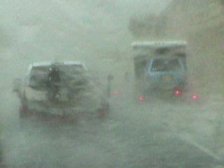
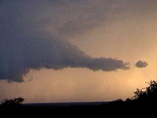
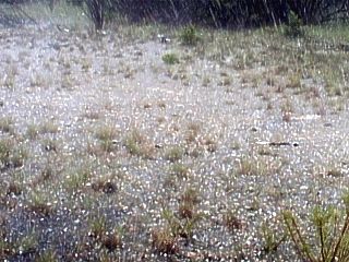
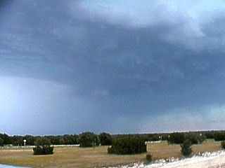
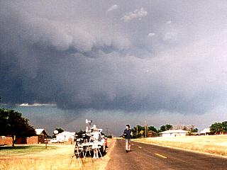
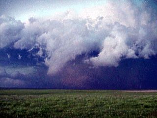
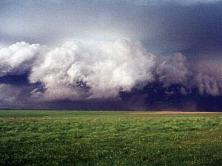
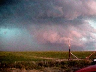
1). May 24, 6:30 PM - Observation and direct penetration of a severe thunderstorm near and along Interstate 10 in Edwards County, Texas east of Junction, Texas near Highway 377. The storm was part of convective initiation and started out as a field of towering cumulus. One cumulus tower broke the capping inversion and grew into a small, low-topped thunderstorm with a rather high base. The storm grew larger with time and evolved into a full-fledged High-Precipitation (HP) supercell which was penetrated during its development stages along Interstate 10 east of Junction. The storm core had torrential rains, hail up to 1 inch (quarter sized), frequent lightning with close hits, and winds up to 55 MPH. The storm caused the temperature to drop from the mid 90's to the mid 50's. A 1996 Chevy Blazer was used to chase the storms. Documentation was still photos, camcorders, and an audio log of the chase. Surface heating, unstable air aloft, and forcing along a stalled stationary frontal boundary caused the storms. This storm was one of several in a cluster of supercells. A severe thunderstorm watch was also in effect for the area until 11 PM CDT.
2). May 24, 7:30 PM - Observation from a few miles distance of a small but well-defined classic supercell thunderstorm 25 miles to the east of Rock Springs, Texas in Edwards County along highway 377. This storm was a classic supercell, with a sculpted, round, saucer-like updraft base with all precipitation falling away from the updraft on it's down-wind side. The storm produced frequent lightning but our chase team contacted no storm periphery. A 1996 Chevy Blazer was used to chase the storms. Documentation was still photos, camcorders, and an audio log of the chase. Surface heating, unstable air aloft, and forcing along a stalled stationary frontal boundary caused the storms. This storm was one of several in a cluster of supercells. A severe thunderstorm watch was also in effect for the area until 11 PM CDT.
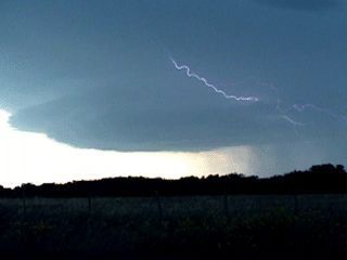
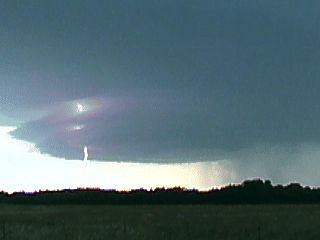
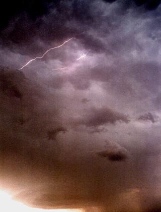
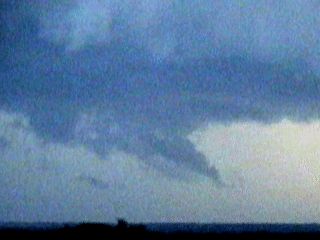
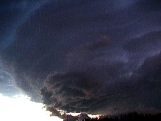
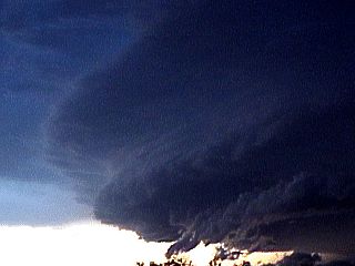
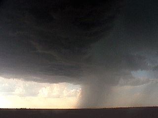
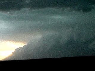
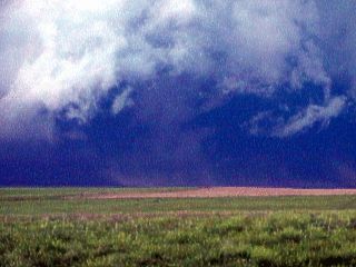
3). May 24, 8:00 PM - Observation and indirect penetration of an extremely severe thunderstorm 5 miles or so northwest of Rock Springs, Texas in Edwards County along Highway 377. The storm was an extremely well developed HP supercell with distinct structure and appeared like a "Mother Ship" or stack of flying saucers! The storm showed a TVS signature on radar for about 25 minutes with a dbz strength of 71 and a VIL of 78. Winds to 50 MPH and light rain were all that was encountered on the fringes of this extremely dangerous thunderstorm. Frequent lightning was also observed. This storm was very well documented, and produced several funnel and / or wall clouds as it was observed from its eastern side. A tornado warning was also issued for Rock Springs and tornado sirens sounded for the small town, which was nearly missed by the supercell core. Hail was estimated by radar at baseball to grapefruit sized (4 inches or so). A 1996 Chevy Blazer was used to chase the storms. Documentation was still photos, camcorders, and an audio log of the chase. Surface heating, unstable air aloft, and forcing along a stalled stationary frontal boundary caused the storms. This storm was one of several in a cluster of supercells. A severe thunderstorm watch was also in effect for the area until 11 PM CDT. Lightning photography behind this storm continued until about 10:30 PM.
4). May 26, 6:30 PM - Indirect penetration and observation of an LP (Low Precipitation) supercell near Macadoo, Texas in the west portion of this small town in Dickens County. The storm was one of the initiation cells forming ahead of a bulge in the dryline. The storm quickly reached LP status with powerful 30-knot inflow winds, a sculpted updraft base with striations, and a well-defined "vault" region. The storm began to weaken after other cells developed south of our location. The LP storm was indirectly penetrated and mainly light rain, small hail, and 30 to 40 MPH inflow winds were observed. This storm did produce large hail, but it was not penetrated. A jet stream aloft, dryline bulge, and upper air disturbance caused the storms. A 2001 Chevy Cavalier was used to chase the storms. A tornado watch was also in effect for this area until 9 PM CDT. Documentation was still photos, camcorders, and an audio log for the chase.
5). May 27, 7:00 PM - Observation and direct penetration of severe thunderstorms and gustnado-like tornadoes ahead of a powerful MCS in northwest Kansas near Meade, Kansas to Clark County. The chase began near Meade, Kansas and continued through Clark County along highway 160 and highway 283. The first HP supercell developed north of Meade and split into two storms. The left split moved south as a right-moving HP supercell. The right split continued to move to the southeast. Both of these cells became HP supercells with wall clouds and produced gustnadoes along their shelf clouds. Eric Nguyen and myself penetrated the right split as the MCS line caught up with the two cells. Dust was raised by the storm outflow forming a huge wall of dust ahead of the left-split storm. Eric Nguyen and myself measured winds near highway 160 at 68.1 MPH before anemometer failure. Estimated gusts were much higher, exceeding 80 MPH! Heavy rain, frequent lightning, and hail were also observed with these storms. The storms were followed southward into Oklahoma along highway 160 where numerous downed trees and power lines were encountered. A roadblock ended the chase west of Woodward, Oklahoma as downed power lines made the road impassible. The storms developed well ahead of a dryline and were enhanced by a low-pressure system over Colorado to the west. Low level advection allowed Gulf of Mexico moisture to enter this region and storms were enhanced by upper-air dynamics. A 2001 Chevy Cavalier was used to chase the storms. A tornado watch was also in effect for this area until 11 PM CDT. Documentation was still photos and camcorders.
This concludes the Midwestern United States Chase Log. The summary includes a total of 5 severe thunderstorms, several funnel clouds, and a well-documented gustnado type tornado. The main chase vehicle conducting and leading the first 3 chases was a 1996 Chevy Blazer. The secondary vehicle was a 2001 Chevy Cavalier and was used in two chases. A third vehicle, a 1998 Toyota 4-Runner SUV, was used as a third vehicle in several of the chases. This information was prepared exclusively for the National Weather service and the team of Skywarn storm spotters.
|
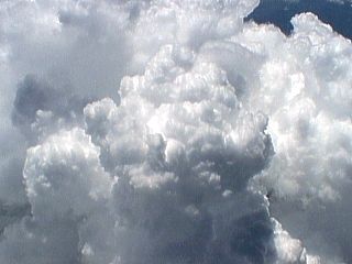
While climbing out of the South Florida area, at around 20,000 feet over the Florida Everglades in a Boeing 767 Commercial jet, solid cumulus and cumulonimbus clouds well up through the tropical atmosphere as sea breeze fronts converge over the area. You could actually see the cloud tops "billowing" upwards towards us. These clouds also developed into full fledged thunderstorms. |
|
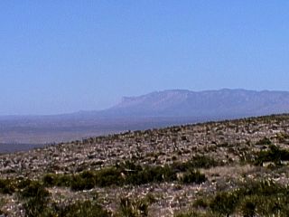
This is a picture of the New Mexico desert from Carlsbad, New Mexico. The famous Carlsbad Caverns are about 700 feet below where I am standing here to take this picture. The plains of the desert southwestern US stretch from the left of this picture and give way to the Guadelope Mountains, over 9,000 feet high. Looking SW in this picture, the Texas / New Mexico border is between the mountains and desert plain. The Guadelope Mountains, with the peak called "El Capitan", are the highest points in the state of Texas. |
|
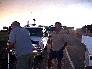
A local from Rock Springs, Texas asks Jeff Gammons and myself as Dave Cornwell takes video about an approaching HP supercell storm on May 24, 2001. Many people like this approach us and ask questions about threatening storms. One of our jobs is to make sure timely warnings do get out as needed as well as if a dangerous storm is or is not going to affect a populated area. The storm here was to the left and out of view in this picture, but contained hail between baseball and grapefruit sized. The storm just missed Rock Springs, Texas. |
|
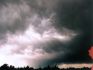
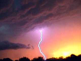
Time exposure reveals a form of cloud to cloud lightning or CC which crawls over the underside of a storm's backsheared anvil. These are called anvil crawlers, or dendrite, lightning. The red face to the far right is myself standing in the frame illuminated by the red tail lights of the chase vehicle. This was during the early night of May 24, 2001 near Junction, Texas. |
|
In this picture, a classic supercell with a "saucer" shaped base produces a CC or cloud to cloud lightning strike near Junction, Texas on May 24, 2001. The supercell here is called a classic supercell where all the precipitation falls down wind, or to the right in this picture, of the main updraft (rain-free base). The precipitation from this storm was large and damaging hail. The storm was part of a cluster of storms, mainly supercells, and is sculpted in a circular manner due to the rotation of the mesocyclone. |
|
In this picture, a classic supercell with a "saucer" shaped base produces a CG or cloud to ground lightning strike near Junction, Texas on May 24, 2001. The supercell here is called a classic supercell where all the precipitation falls down wind, or to the right in this picture, of the main updraft (rain-free base). The precipitation from this storm was large and damaging hail. The storm was part of a cluster of storms, mainly supercells, and is sculpted in a circular manner due to the rotation of the mesocyclone. |
|
This is a wide (tall) picture of a classic supercell storm on May 24, 2001 south of Junction, Texas and north of Rock Springs. This was a very lucky shot taken with a Cannon Rebel 2000 SLR that was NOT on "bulb" setting! This picture, taken in daylight, shows the base of the storm, with the famous "saucer" appearance as well as the structure of the storm up to the anvil base. At least one cloud to cloud lightning strike was captured in this snapshot as it discharges in the mammatus field under the storm anvil. The colors here are not false, the storm appeared that way you see it in this picture. |
|
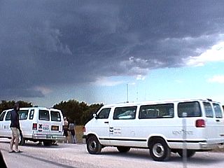
A group of chasers, including the famous Cloud 9 Tours, appears on the side of the road near Junction, Texas on May 24, 2001, near a developing region of supercell thunderstorms. Chasers coming across others near a storm is called a chaser "convergence", and occurs routinely around active storms. Cloud 9 Tours takes paying clients on a tour of 10 days or so in the Great Plains each year in search of severe thunderstorms and tornadoes using large passenger vans like the ones in this picture. |
|
Once behind a storm, we must reposition to get ahead of it, and sometimes we are forced to penetrate its precipitation core in a contraversial tactic called "core punching". The storm here is a developing HP supercell storm east of Junction, Texas on May 24, 2001. Since the storm is developing, we race east to get in front of it before conditions in its core become too dangerous to drive through. Here, the visibility drops as the sky is stained a green color from the effects of hail. Hail as big as quarters pelts us with winds over 50 MPH as we carefully creep east along Interstate 10 crossing the supercell core. |
|
This striking picture was taken by Jeff Gammons with the Weathervine storm intercept team 5 miles north of Rock Springs, Texas on May 24, 2001. Dave Cornwell is to the right and myself to the left taking still photos and video of a magnificant HP supercell thunderstorm about 5 miles to our west. The supercell here is evident by the striated clouds marking intense storm rotation. The core is in the center of the picture and vault region is to the far right. This storm indicated a TVS (Tornadic Vortex Signature) on radar for about 25 minutes, and produced radar dbz and VIL values or 71 and 78, respectively. Hail size in this HP monster was 4 inches (between baseball and grapefruit sized). The possible tornado was hidden in the HP "notch" and was not visible from outside this storm. The entire cloud structure could be seen rotating with the unaided eye! |
|
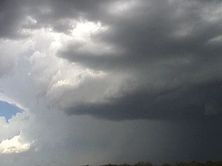
A thunderstorm complex near Junction, Texas on May 24, 2001 just north of Interstate 10 begins acquiring supercell characteristics after being mature with a persistant updraft. In this picture, about an hour and a half after storm initiation, the storm evolves into an HP supercell, which can be visually determined in this picture by evidence of rotation in the storm updraft. Note the dark updraft base and precipitation to its right. Now look at the left side of the updraft "tower" ... Can you see the striations? Also note the small clear-slot above (in the foreground) of the updraft base in the picture denoting a counter-clockwise spin in the storm. The radar image of this storm was beginning to show a "hook" echo feature and the storm was also producing large hail (quarter to golfball sized). |
|
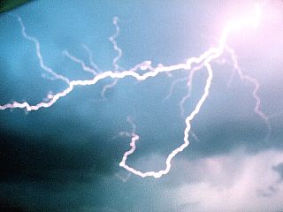
This rather blurry but neat shot of forked lightning was from the passenger side window of the Weathervine chase vehicle while just south of Rock Springs, Texas on May 24, 2001. This was a close bolt of forked lightning, from a large HP supercell. The photo was taken using a time exposure and a very steady hand. |
|
A huge HP supercell just north of Rock Springs, Texas on May 24, 2001 sports a "beaver's tail" inflow cloud feature on its eastern side. The sky appears orange from the setting sun and green in areas from hail. The vault region of the storm is also visible in the upper portion of this picture. |
|
The updraft region of a large HP supercell produces a brief funnel as it twists just north of Rock Springs, Texas on May 24, 2001. This funnel rotated but did not touch down. It soon became obscured in the notch of the HP supercell. |
|
The updraft region of a large HP supercell produces a larger funnel as it twists just north of Rock Springs, Texas on May 24, 2001. This funnel rotated more vigerously than a previous one but did not touch down. It soon became obscured in the notch of the HP supercell. |
|
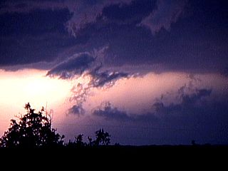
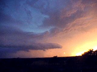
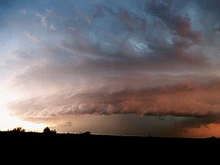
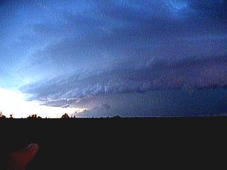
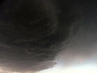
A terrifying maw of dark clouds on the leading edge of a large HP supercell descend on the small town of Rock Springs, Texas on May 24, 2001. These clouds are a portion of the shelf cloud from the RFD (Rear Flank Downdraft) gust front. Note that the sky in the background, looking SE, is still bright as in late afternoon. This deadly storm just passed west of the town of Rock Springs, causing a scare but little or no damage. Tornado sirens were also blairing as the storm lumbered by. |
|
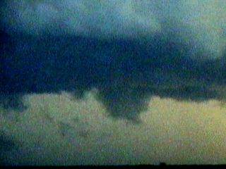
The low level mesocyclone of a large HP supercell moves just southwest of Rock Springs, Texas during the evening of May 24, 2001. Note the distinct mid-level cloud striations and the underlying tight swirl in the lower levels of the cloud base. This is the most dangerous part of the storm due to the threat for tornadoes. Note the collar cloud rotating around the meso in the lower portion of the picture. Note the greenish blue tint to the upper portions of the supercell tower. It is this persistant rotation in the storm updraft that allows the supercell to be the highest risk of any thunderstorm type. Updrafts in this region can also exceed 150 to 175 MPH! |
|
A close up view of an intense rain / hail foot beneath the south side of a very severe HP supercell near Rock Springs, Texas on May 24, 2001. The storm core is to the right. In this view, the lower portion of the rain foot was racing from right to left, while the scud clouds above the rain foot were moving up, then from left to right back into the storm updraft! Strong winds aloft are required so that the rain-foot and downdrafts like this cannot cutoff the updraft ofd the storm. The rain foot eventually stopped and retreated back to the right, allowing the storm to continue as a supercell. Winds inside this foot are gusting well over 75 MPH, and are part of the storm's RFD or Rear Flank Downdraft. |
|
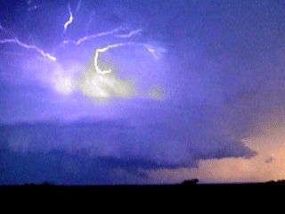
Brilliant cloud to cloud or CC lightning illuminates the anvil of a large HP supercell near Rock Springs, Texas on May 24, 2001. The storm core is to the lower left, and vault region to the upper right. A wall cloud and small funnel are visible in the lower center of the picture. Note the banding of the supercell structure. |
|
Brilliant cloud to ground or CG lightning illuminates the anvil of a large HP supercell near Rock Springs, Texas on May 24, 2001. The storm core is to the lower left, and vault region to the upper right. A wall cloud and small funnel are visible in the lower center of the picture. Note the banding of the supercell structure. |
|
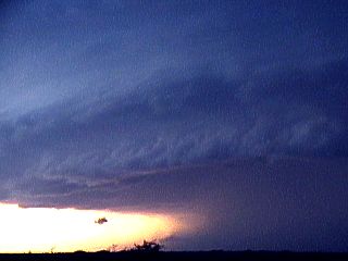
A very photogenic Cloud to Ground lightning, or CG, blasts through the vault region of a large HP supercell northwest of Rock Springs, Texas on May 24, 2001. The colors of this picture are NOT false, they are caused by the sun setting behind the storm and refracting through precipitation producing shades of green, yellow and red. The cloud has a grey to bluish color while a CG produces a brilliant purple flash. Note the vault region of the storm, updraft to the far left, and inflow "tail" cloud to the lower left. |
|
This picture shows the vault region of a large HP supercell northwest of Rock Springs, Texas on May 24, 2001 just as the sun is about to set. The storm core is to the lower left, with the beaver's tail cloud extending to the center of the picture. The higher base, sometimes called a Bounded Weak Echo Region, or BWER, on radar forms the vault of the storm. This region has hail up to softball sized (4 inches). Note the supercell updraft column to the far left of the picture with banding due to storm rotation. The colors are a combination of the sun setting through the storm structure and are enhanced by precipitation in the storm, such as hail. The sun can be seen just about to set near the lower center of the picture. |
|
A large wall cloud descends ahead of the notch area of a large HP supercell north of Rock Springs, Texas on May 24, 2001. In this picture, the bottom of the wall cloud appears to touch the ground! Radar indicated a tornado with this storm for nearly 25 minutes. |
|
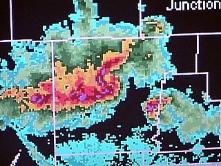
This is a screen shot from a laptop showing the current radar as we were filming an incredible HP supercell near Rock Springs, Texas on the evening of May 24, 2001. The TVS (Tornadic Vortex Signature) is evident in the center of the picture, where al "C" shaped lobe of high reflectivity meets a "ball" shaped area at the bottom of the "C". The entire area spun cyclonically when animated. The maximum DBZ was 71 with a VIL (Vertically Integrated Liquid) of 78. Note the smaller storm, also a supercell, to the SE (lower right) of the main storm. Junction, Texas is in the upper right of the screen shot, Rock Springs is just below the center, not shown. |
|
Hail up to quarter sized bounces on the ground as we pull over during the penetration of a developing HP supercell core near Junction, Texas along Interstate 10 on May 24, 2001. The storm covered the ground in hail up to 1 inch deep after only 10 minutes. |
|
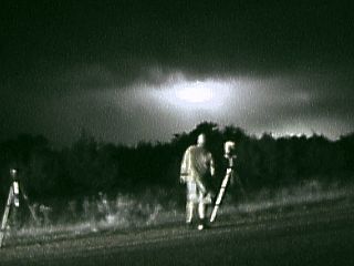
Using night vision on my Sony camcorder, the sky lights up with cloud to cloud lightning behind a supercell storm near Junction, Texas on May 24, 2001. Dave Cornwell, with the Weathervine storm chase team is standing among one of the cameras mounted on the tripods for time exposures. The light from the left is from the tail lights of the chase vehicle. |
|
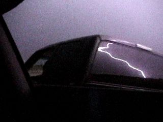
A cloud to ground lightning strike lights up the sky south or Rock Springs, Texas on May 24, 2001. The pickup truck was a local of Rock Springs asking us about the storm. As she drove away, a flash of lightning was captured reflecting off the rear window of her pickup truck. |
|
This is a wide angle view of an extremely dangerous HP supercell thunderstorm NW of Rock Springs and S of Junction, Texas on May 24, 2001. The colors are real and are caused by the sun setting just behind the supercell. Blue is caused by rain-laden clouds. Green is from reflections through hail areas. Oranges and reds are caused by the sun setting itself. This surrealistic display is accented by the vigorous rotation of the HP (High Precipitation) supercell. Note the RFD gust front and rain foot in the lower left part of the picture. Note the notch (with possible hidden tornadoes) in the lower right to center of the photo. The striations create a "mother ship" effect of stacked plates or saucers. Despite its majesty, this storm was producing baseball to grapefruit sized hail, continuous lightning, 80 to 100 MPH winds, and was indicating a TVS (Tornadic Vortex Signature) on RADAR for over 25 minutes. |
|
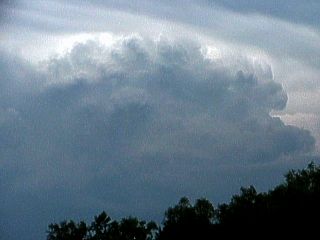
About an hour after initiation from a small field of cumulus clouds, a thunderstorm reaches maturity near Interstate 10 and Junction, Texas. This storm now has a well defined updraft and downdraft section but is not yet rotating. As the storm continues developing in an environment plagued by directional wind shear and high instability, the storm will soon develop rotation, and evolve into a yet more severe supercell storm. This picture was taken during the afternoon of May 24, 2001. |
|
A curved and striated cloud deck appears on the updraft column of an HP supercell thunderstorm near Rock Springs, Texas on May 24, 2001. The striations are caused by the rapid rotation of the storm called a mesocyclone. Dry air from outside the storm enters the storm's sides (entrainment) causing erosion of the cloud and these bands to appear. Such a storm with a powerful meso will sometimes appear as a huge "flying suacer" or stack of plates in the sky, hence the name "Mother Ship" some chasers call this cloud formation. It is an indicator of strong rotation, and possibly tornadoes. Note the rain foot and scud being swept from right to left beneath the storm. That's a powerful Rear Flank Downdraft, or RFD. |
|
Here is another picture of the RFD rain foot and "Mother Ship" mesocyclone associated with a large HP supercell near Rock Springs, Texas on May 24, 2001. The center or rotation of this supercell storm is to the right of this picture. This was an extremely dangerous thunderstorm. |
|
A wider view of a large HP supercell on May 24, 2001 near Rock Springs, Texas shows a display resembling a stack of plates or saucers. The banding is caused by dry air being pulled around and into the storm at mid levels and is sometimes called a "Mother Ship" or "Barber Pole" structure by chasers. In real time, you could actually see this while things spinning from left to right (counterclockwise), with cloud features that would come into view on the left edge of the storm wall and rotate around to the right where they would dissapear again out of view behind the storm! The rain / hail foot under the storm was rapidly moving from right to left. This was the RFD "punchout" south of the storm's rotation. |
|
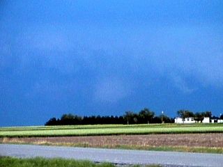
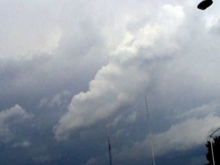
A rather innocent looking field of cumulus clouds marks the initial development of showers and thunderstorms in unstable air near Junction, Texas during the afternoon of May 24, 2001. The large towering cumulus, abbreviated TCU, is growing in the middle of the picture. This cloud actually became a supercell thunderstorm an hour or two later! |
|
Another view of a field of towering cumulus on May 24, 2001 near Junction, Texas. One towering cumulus has grown large enough to produce precipitation in the center of this picture. This process, called initiation, is where updrafts break through a dry layer aloft called a "cap", that limits weaker updrafts earlier during the day. Once this cap is broken, explosive thunderstorm development may occur. The cumulus in this picture has already broken the cap and is being sheared by the upper air winds. Note the darkening base of the clouds. This cloud actually became a full-fledged supercell within an hour of this picture. |
|
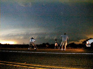
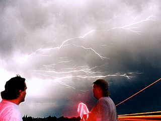
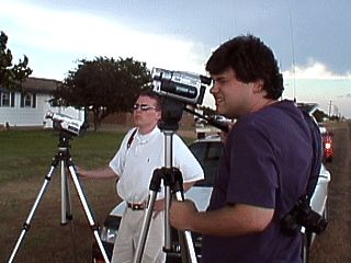
Here is a time exposure view of myself, right, and Dave Cornwell, lower center with the Weathervine storm intercept team filming lightning near Junction, Texas on the evening of May 24, 2001. We appear red due to the flashing lights of the chase vehicle behind the camera. The red streaks are from a semi truck which passed during the shutter open time. The anvil crawler lightning lights up the underside of the storm anvil revealing mammatus clouds. This shot was not an accident. We both had to stand very still so both us and the lightning would come out clear in the shot. |
|
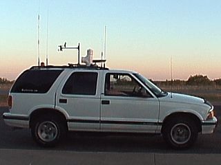
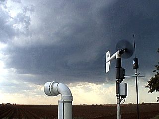
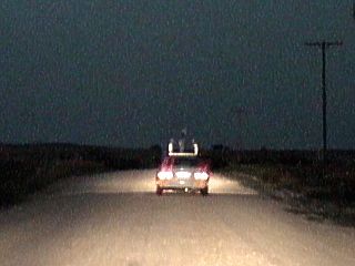
This is a picture of the Weathervine chase vehicle, a 1996 Chevy Blazer SUV. The top rack of this vehicle has a small weather station from Oregon Scientific, which reports temperature, dewpoint, wind speed and direction, as well as other parameters including barometric pressure to a small console inside the vehicle. The chase vehicle is also equipped with mobile radio, TV, CB and cellular devices and uses a laptop-GPS combo for navigation. Weather stations like this are sometimes called "mobile meso-nets", and are used by many chasers. |
|
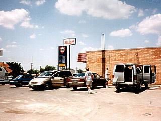
Several storm chaser groups "converge" on an Allsups convenience store in Aspermont, Texas on May 26, 2001. From left to right, the "Weathervine" storm intercept team, the "Texas Tailchasers" chase group, and "Cloud Nine" chase tours (the grey van). Here we all are stopping for gas, getting a bite to eat, talking about storms, and waiting for the atmosphere to heat up and "break the cap"! |
|
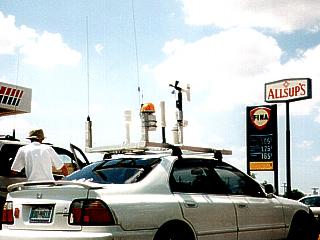
During a data / fuel stop and chaser "convergence" at an Allsups convenience store near Aspermont, Texas on May 26, 2001. We are waiting for storms to develop in the later afternoon. Eric Nguyen's chase vehicle is shown here with the portable "mesonet" (weather station) mounted on the hood. The "Texas Tailchaser" group is to the left. |
|
Amos Magliocco, right and Eric Nguyen, center film an LP supercell in Macadoo, Texas on May 26, 2001. These people often chase with the Texas Tailchaser storm intercept group during severe season in the Great Plains. Note the anvil of the LP storm spreading overhead. The LP storm is not visible to the left. |
|
The backside and rock-hard updraft of an HP supercell is visible just over the horizon east of Lubbock, Texas near Dickens county on May 26, 2001. This storm was producing large hail and high winds about 20 mile south of where this picture was taken. The storm structure appears dark due to shadows of other clouds nearby, but is illuminated at its crown (top) by the high altitude sunlight. |
|
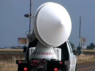
While chasing an LP supercell in Dickens County, Texas near Macadoo on May 26, 2001, the doppler on wheels truck rolls by scanning the nearby storms in a 360 degree radar sweep using the on-board doppler radar. The white cone shaped unit is the radome cover protecting the radar antenna and dish. |
|
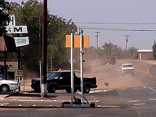
A dust devil sweeps up the street during a fuel stop in Jayton, Texas during the afternoon of May 26, 2001. The dust devil, rotating counter-clockwise at nearly 60 MPH, is about 15 yards wide and is moving northwards up the left side of the road. Note the small piece of debris just behind the tail of the pickup truck. It is a small yellow cardboard sign that spend nearly the entire life of the dust devil suspended in the vortex. Seconds after this picture was taken, the DD dissapated in the trees in the background. The DD had a life of about 90 seconds. |
|
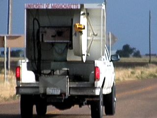
A smaller doppler on wheels truck, one of the first ever built by MIT and ran by Howard Bluestein of the NSSL. The dish does not have a protective radome over the dish and antenna and cannot sweep a complete 360 degrees. This truck was scanning the same LP supercell near Macadoo, Texas on May 26, 2001 along with another DOW truck. |
|
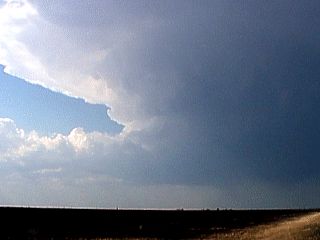
This picture shows a wide angle view of the early stages of an LP (Low Precipitation) supercell near Macadoo, Texas on May 26, 2001. The dark base, although void of precipitation, is rotating steadily. No precipitation has reached the ground yet. LP storms are very common around drylines or in moisture-limited regions of high instability. |
|
As an LP supercell winds up in intensity, strong inflow winds of 30 MPH-Plus feet directly into the storm north of the small town of Macadoo, Texas on May 26, 2001. The anemometer clearly marks the presence of strong inflow air issuing into the storm to the NW. The equipment is on the top of Eric Nguyen's chase vehicle. The PVC pipe is the dewpoint sensor and the antenna is for cellular. Note the swirl in the cloud base of the LP storm. |
|
A thunderstorm develops far to our northwest as we enter Dickens County, Texas on May 26, 2001. This storm began as an elevated (high based) storm developing along the dryline. Soon the storm will ingest moist air to the southest (Gulf of Mexico air) and become an LP supercell storm. An LP supercell, like all supercells, has a powerful rotating updraft, but lacks a dense shaft of visible precipitation. Such storms are the rarest of all supercells but are encountered by many chasers working severe weather along the dryline in Western Texas and Western Oklahoma. |
|
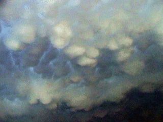
Mammatus clouds on the underside of an anvil spreading out from an LP supercell near Macadoo, Texas on May 26, 2001. These clouds are being driven downwind by a powerful jet stream over the top of the developing storm. The winds aloft are from the northwest while surface winds are southeast. The winds veer with height from ground level all the way to the upper air, creating extreme turbulance and causing the storm to rotate (helicity) making for a spectacular mammatus display east of the storm. |
|
With still little precipitation falling, a swirl appears in the bottom of the updraft base of this LP supercell north of Macadoo, Texas on May 26, 2001. Precipitation, mostly large hail, is beginning to fall to the right of the updraft. The swirl in the cloud base is the bottom of a rotating updraft called a mesocyclone. The view is to the northwest. |
|
As this LP supercell continues north of Macadoo, Texas on May 26, 2001, a curtain of rain and large hail is released downwind, or to the right, of the supercell updraft. The line between the rain-free updraft base and precipitation (downdraft) is called the UDI, or Updraft Downdraft Interface. This is the LP supercell at its most prolific precip-producing stage, and is on its way to dissipating soon as other thunderstorms began developing to its southeast cutting off its inflow of warm, moist air. |
|
Just to the right, or downwind of the main updraft of this LP supercell, is a developing deluge of precipitation, mostly large hail. The lower updraft rain-free base and space between the precipitation core to the right form a deep chasm or "vault" region that extends high into the storm. LP supercells often have these striking visual features due to lack of "opaque" precipitation around the storm. LP supercells often produce barely visible shafts of large hail, like in this picture, below the vault region. This storm was just north of Macadoo, Texas on May 26, 2001. On radar, the vault region appears as a BWER or Bounded Weak Echo Region. |
|
About 15 miles south of Macadoo, Texas on May 26, 2001, a high based thunderstorm evolves into an LP (Low Precipitation) supercell as it draws in air from the southeast. The main updraft is clearly visible with a well-developed anvil spreading out above. Looking to the northwest, the storm flanking line stretches from left to the updraft in the center of the picture. At this point, no visible precipitation is reaching the ground yet in the right side of the pciture. These type of supercells are rare but limited mostly to western sections of Texas and Oklahoma where moisture is limited near the dryline. Chasers who work severe weather in these regions will eventually encounter an LP supercell sooner or later. |
|
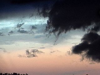
After an outbreak of severe thunderstorms, the anvil, or upper air blowoff from the storms feature women's breast shaped cloud formations called mammatus clouds or mammato-cumulus. They are named from the latin word "mamma" meaning breasts. They are associated with extreme turbulence aloft at the anvil level (15,000 to 30,000 feet, or higher). On May 26, 2001, the sun sets and illuminates these clouds north of Aspermont, Texas. |
|
On the west side of the small town of Macadoo, Texas, the "Texas Tailchaser" storm chase group observes a developing LP supercell to the north (left in this picture and not visible) on May 26, 2001. A strong NW jet stream aloft blows the storm anvil and mamma field overhead making for a spectacular display. Note the hail falling from the anvil (grey streamers). Note the bright edge of the anvil past the darker clouds in the background (lower left). The winds here were 30 to 40 MPH from the right (southeast) in this picture. Note the wind vane atop Eric Nguyen's white chase vehicle depicting storm inflow. Amos Magliocco is standing in the roadway, Eric is in the white shirt to the left. |
|
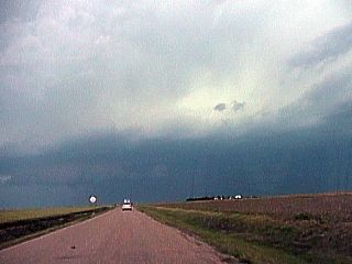
This is the view out the front window approaching a severe thunderstorm in SW Kansas near Meade on May 27, 2001. The cell in the center of this picture is one developing ahead of a potent MCS and is already in the process of evolving to HP supercell mode. Note the lowering below the storm base. |
|
While passing through a small town in NW Oklahoma along Highway 160 downed trees lay across the road on May 27, 2001 behind a powerful cluster of severe thunderstorms. Wind gusts ranged from 65 to near 100 MPH across Kansas and Oklahoma from this storm system. |
|
A brief and violent dry microburst slams into the ground at over 65 MPH during the gustout stage of an HP supercell in Clarke County, Kansas on May 27, 2001. The microburst is dry because it occurred on the leading edge of a powerful gust front preceding the HP supercell. Note that the air is pressed into a very shallow layer that curls up at the leading edge of the microburst, as marked by dust being lofted. The strongest winds are just behind the "curl" in the shallow layer known as a "cusion" or "impact" stage of the microburst, containing extreme winds. |
|
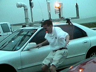
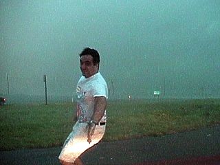
Eric Nguyen with the University of Oklahoma is blasted by outflow winds in excess of 65 MPH as he attempts to assess damage to his anemometer atop his chase vehicle. This was along Highway 160 in Clarke County, Kansas on May 27, 2001. A large HP supercell was just to our southwest, with the Forward Flank Downdraft, or FFD, blasting over us. The green hue to the sky warns that large hail is nearby, but we maintain our positions here to avoid driving closer to the core of the supercell, remaining in the FFD region of storm outflow. |
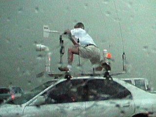
|
Eric Nguyen with the University of Oklahoma braves 65 MPH-plus winds and hail while attempting to remove the broken impellor from an anemometer fixed to the roof of his chase vehicle. The anemometer was damaged from an antenna bending and striking it, just after recording a peak wind of 68.1 MPH. This was before the peak winds even hit! Note the sky color stained green from the presence of hail in the HP supercell core just SW of our position along highway 160 in Clarke County, Kansas on May 27, 2001. |
|
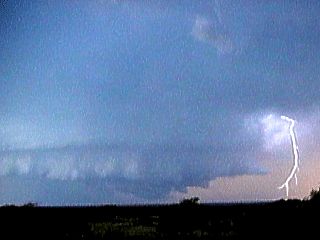
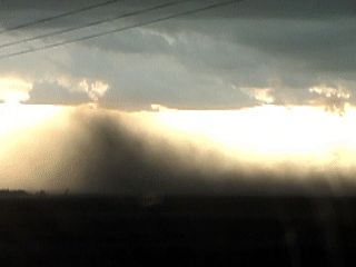
The gust front, marking the leading edge of a Forward Flank Downdraft, or FFD outflow of an HP supercell is so strong that is picks up dust from the ground. Since the outflow air is cooler, it races along the ground ahead of the storm at 60 MPH-plus. This is sometimes called a "Haboob" in the SW United States. The view is to the west towards Meade, Kansas on May 27, 2001. The supercell core is to the far right. Note the "cold front slope" the cooler dusty air has contrasted against the "cleaner" air ahead of the storm. |
|
An HP supercell thunderstorm near Meade Kansas spawns an ominous lowering on its shelf cloud on May 27, 2001. Since this feature was rotating, classifying it as a tornado, but on a shelf cloud (thunderstorm outflow) rather than on a wall cloud (thunderstorm inflow), it was classified as a gustnado. These are a type of tornado if on the ground and still can be destructive. |
|
A well-developed gustnado appears on the edge of a huge shelf cloud of an HP supercell near Meade, Kansas on May 27, 2001. The entire cloud feature in this picture was rotating counter-clockwise. Note the "wedge" of dust beneath the gustnado as dirt is picked up from the famland. These are weak tornadoes and can be very dangerous. Note the funnel shaped cloud feature with small clear "slot" to its right. |
|
A closer view of a large gustnado developing on the shelf cloud of an HP supercell east of Meade, Kansas on May 27, 2001. The entire cloud feature was cyclonically rotating in this picture. Note the dust whirl on the ground and even the faint contrast of a funnel extending upwards into the clouds. These type of tornadoes can still be very dangerous. |
|
This picture shows the zoomed out view of a large gustnado forming along a shelf cloud of an HP supercell near Meade, Kansas on May 27, 2001. The entire cloud feature in this picture is rotating counter-clockwise. The gustnado circulation is about 1/4 mile wide and extends from ground level up into the clouds. |
|
East of Meade, Kansas on May 27, 2001, a wall cloud develops as an HP supercell splits into two HP cells ahead of an active MCS. This view, looking to the north shows a wall cloud developing on the left split HP's updraft which eventually turned to the right and started moving south. The right split HP continued southeast and developed its own new mesocyclone. |
|
Here is a lonely dirt road in NW Oklahoma after a very stormy evening of May 27, 2001. These roads, called farm roads, are often unpaved and named "Bob's" roads by many chasers. The other chase vehicle in front is Eric Nguyen's and we are trying to cut across to Woodward, Oklahoma. |
|
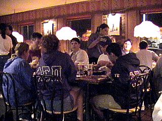
Here is a view inside the Pizza Hut Restaurant on May 27, 2001 in Woodward, Oklahoma after a long day of storm chasing. This was the only town with power for hundreds of square miles after the storms. Everyone in this restaurant is a storm chaser, the only exceptions being the people working there. As Eric Nguyen and myself, chasing all day together, walked in the front door, we were all cheered on by everyone. This is called a chaser convergence, where many chasers, most who don't even know or expect to meet each other, happen to meet at a single place. Nothing like "pigging out" after a great day of chasing! |
|
Along Higway 160 in NW Oklahoma, a powerline is blown down by previous high winds and makes the road impassible on the evening of May 27, 2001. The chaser in front of me is Eric Nguyen, and is being told to turn around by officials. We actually tried to go around the shoulder of the road in efforts to continue south, but failed as Eric's car nearly got stuck in the mud. Note the powerlines strewn in the street, lower right as well as from upper left to the right. The broken power pole is not visible to the far left. |
|
During the height of outflow winds on the FFD side of an HP supercell, a power pole bends just before breaking on May 27, 2001 east of Meade, Kansas. Winds here gusted to an estimated 80 MPH-plus with torrential rain and hail. Note the greenish hue to the sky. |
|
East of Meade, Kansas on May 27, 2001, a large wall cloud develops as an HP supercell splits into two HP cells ahead of an active MCS. This view, looking to the east and northeast, shows a wall cloud developing on the right split HP's updraft. Note the "clear slot" between the shelf cloud of the other HP storm, out of view to the left, and new HP split to the right. |
|
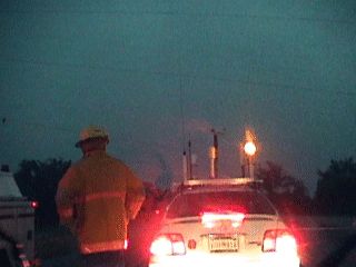
A roadblock ends a long chase while trying to catch up with a supercell-infested MCS barreling along at over 60 MPH. A live powerline fell across the road forcing authorities to block the road for safety issues on May 27, 2001 in NW Oklahoma. Eric Nguyen's chase vehicle is in front of mine as the police order us to turn around or attempt crossing off the road. We attempted crossing the side of the road, but to no luck as Eric's car nearly sank in the mud. |
|
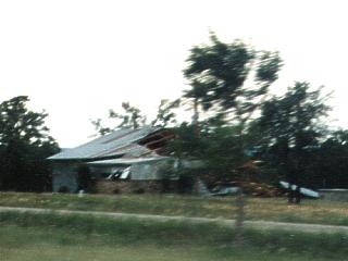
A house along Interstate 35 in Oklahoma sustained major damage with a large portion of its roof blown off during the storms on May 27, 2001. The winds were from the right in this picture (from the northwest) and were gusting around 100 MPH during the passage of a powerful MCS that initiated in Kansas during the afternoon and through Oklahoma into Northern Texas through the night. The winds that caused most damage were straight-line winds, although the MCS had many embedded supercells along its leading edge. |
|
Beneath a towering but small cumulus cloud, a non-tornadic funnel called a shear funnel appears near Meade, Kansas on May 27, 2001. Small updrafts and cumulus clouds grow in the de-stabilizing atmosphere during convective initiation. One of such clouds gets "toppled" by the intense change in windspeed and direction (veering) with increasing altitude, and develops this small funnel on an overhang. |
|
As a system of thunderstorms containing tornadic supercells approaches on May 27, 2001, the de-stabilizing atmosphere becomes evident north of Meade, Kansas. A tall and narrow turkey-tower type towering cumulus column quickly shoots up and is quickly toppled over by the vertical wind shear. |
|
Winds gusting over 60 MPH buffet me as I stand in front of my chase vehicle while chasing with Eric Nguyen on May 27, 2001 near Meade, Kansas off Highway 160. Eric actually clocked a wind gust near 65 MPH while I was standing in this picture using an anemometer mounted on top of his chase vehicle. This was actually BEFORE the stronger winds hit, containing heavier rain and hail. Note the green hue of the sky, and power pole in the background bending in the strong FFD outflow winds from an HP supercell just to my SW. |
|
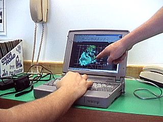
One of the most important things to storm chasers these days are data stops. In the picture here, myself, Jeff Lawson, and Amos Magliocco mull over a radar image at a truck stop in Wheeler, Texas. Our planned target is near Meade, Kansas, but we need these hourly updates so we know exactly where to be long before the expected storms begin. Here we are looking at a May 27, 2001 radar image to determine where an outflow boundary, left from convection the day before, will enhance storms for that day. Many truck stops have phones for local calls and a laptop with a modem is all you need to get tons of weather data from the Internet. |
|
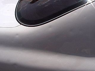
A close look at the rear fender of Eric Nguyen's chase vehicle reveals numerous dings and dents from a previous encounter with giant hail. The damage here is from penetrating an HP supercell a week earlier on May 19, 2001 in western Oklahoma. Hail larger than golfballs and 80 MPH-plus winds slammed into the rear of his vehicle causing dents, chipped paint, broken tail lights, and two shattered rear-view mirrors. Most of the equipment mounted on his car top was also heavily damaged. The windows were spared by quick-thinking and facing the right-rear fender into the brunt of the winds and hail. |
HTML File "mwcl2001.htm" - Developed By Chris Collura
To Return To The HOME Page Of This Site Click The "INDEX.HTM" Link Here!