
| This area shows the interception of Hurricane Matthew in the Cocoa Brach / Cape Canaveral area of the Florida "Space Coast" from October 6 to October 7, 2016. The storm western eyewall passed near or over this area, with winds gusting over 100 MPH during the night. Matthew began as a tropical wave that originated off the coast of Africa, and moved across the Atlantic basin. The storm turned north, passing east of Jamaica, and severely impacting SW Haiti and the tip of eastern Cuba with devastation and loss of life as a category 4 storm. While over the open Caribbean sea, the storm reached 160 MPH (category 5), making it the first storm of that intensity since 2007. After hitting Cuba, the storm re-emerged over the Bahamas and continued NW and eventually northward, brushing the FL east coast as a category 3 / 4 storm, and making landfall in south Carolina as a weaker (category 1) hurricane during the morning of October 8. The main interception was done overnight on October 6-7 near and south of Port Canaveral. Note - This page may take a while to load on some SLOWER connections! |
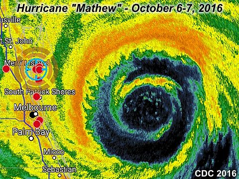
The radar (base reflectivity from early morning of October 7, 2016) image above shows hurricane Matthew passing near the east coast of Florida. Note the concentric "double" eyewalls! Although winds gusted near (and sometimes over) 100 MPH from Cape Canaveral to Cocoa Beach, this could have been much worse, had the main core, or right side of the storm came ashore. The marker to the upper left is my position awaiting the western eyewall to impinge on my location. The space between the concentric eyewalls is known as a "moat".
| CHASER NAME | HOME CITY | CALLSIGN | OCCUPATION |
| CHRIS COLLURA | DEERFIELD BEACH, FL | KG4PJN | IT CONSULTANT |
| DEREK SIBLEY | HOLLYWOOD, FL | KG4PJN | STUDENT / LIFEGUARD |
The list above shows storm chasers who actively participated in this chase. This was myself as another chaser, Derek Sibley, and this was his FIRST hurricane!
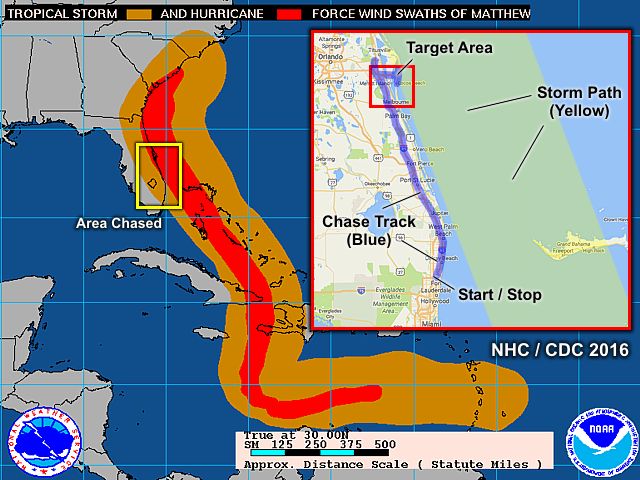
This is the chase map for the interception of hurricane Matthew's closest approach to the Cocoa Beach / Port Canaveral area on the Florida East coast. The image shows the storm path through the Carribean and into the USA, courtesy of the National Hurricane Center (wind swath product). The inset shows the section of the coastline where the interception of Matthew's CPA was executed on October 6-7, 2016.
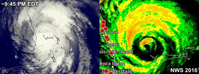
The images above (IR satellite to the left, and base reflectivity from the Melbourne radar site to the right) above shows the hurricane approaching the Florida East coast, and has just passed the western tip (Settlement Point) of Grand Bahama Island. The storm is beginning an eyewall replacement cycle, with the inner eyewall weakening and a larger outer eyewall forming around it, after slamming into the Bahamas on October 6. These images were from about 9:45 PM EDT.
|
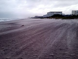
Sand blowing on Cocoa Beach, FL as the storm approaches on Oct 6, 2016. |
|
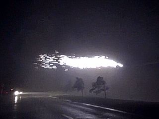
Power flashes and sparks fly in 100 MPH gusts early on Oct 7, 2016. Near Cocoa Beach / Cape Canaveral, FL. |
|
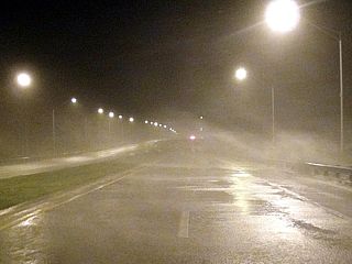
Strong winds late on October 6. Causeway near Cocoa Beach / Cape Canaveral, FL. |
|
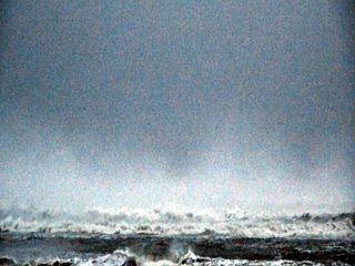
Violent surf just before sunrise with spray on backside of the storm early on October 7, 2016. Cocoa Beach, FL. |
|
Waves lash the bay side of Cocoa Beach, FL early on October 7, 2016. |
|
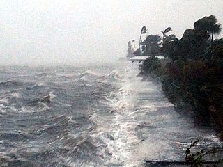
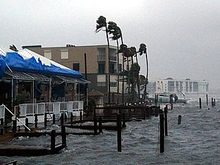
Storm surge / high tides on the bay side of Cocoa Beach, FL early on October 7, 2016. |
|
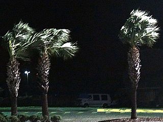
Palm trees blowing in tropical storm forced winds at Cocoa Beach, FL late on October 6, 2016. |
|
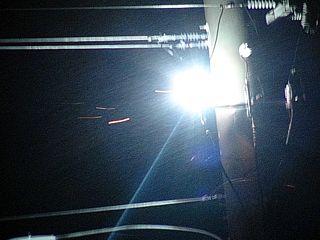
Powerlines shorted and arching near Cocoa Beach, FL early on October 7, 2016. |
HTML File "matt16.htm" - Developed By Chris Collura
To Return To The HOME Page Of This Site Click The "INDEX.HTM" Link Here!