
| This area shows pictures taken from the interception of tropical storm Keith as it was in the process of re-emerging into the Atlantic Ocean after crossing Florida on November 23, 1988. The storm was rather disorganized but had winds near 60 MPH with most observations of this storm near Sabastian, Florida. Check out some pictures on tropical storm Keith on this page. |
|
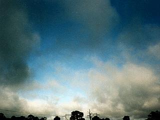
This picture was taken on Interstate 95 west of Sabastian, Florida on November 23, 1988. The broad and diffuse center of tropical storm Keith passes directly overhead causing winds and rains to stop completely yeilding blue skies. Keith had 60 MPH sustained winds at the time this picture was taken. |
|
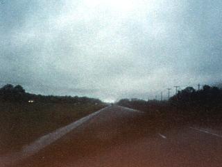
Heading north on Interstate 95, 60 MPH winds from the west and light to moderate rains fall on the south side of the center of tropical storm Keith on November 23, 1988. Note the "bright area" at the very end of the roadway, that is the southern edge of the circulation center of the storm, where the winds and rain stop. This picture was taken about 10 to 15 miles south of the storm center. |
|
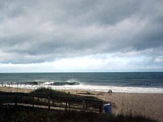
The circulation center of tropical storm Keith moves back out over water on November 23, 1988 near Sabastian, Florida. In this picture, winds are NW at about 40 MPH and rain bands are moving back in on the rear side of the tropical storm. The broad and diffuse storm core is still visible over the horizon looking NE. This storm became subtropical, then extratropical a day later (Thanksgiving Day) becoming a gale center in the North Atlantic. |
HTML File "keith88.htm" - Developed By Chris Collura
To Return To The HOME Page Of This Site Click The "INDEX.HTM" Link Here!