
| This area shows the two interceptions, the first one for tropical storm "Isaac" in the Florida Keys, followed by a second interception of hurricane "Isaac" in the northern Gulf coast in late August of 2012. The interceptions were done from a period of August 26, 28, and 29 in 2012. Isaac originated from a tropical wave that came off of Africa (Cape Verde system) and developed south of Puerto Rico / Hispanola on August 24. It moved over eastern Cuba and just south of Key West, Florida by the 26th as a strong tropical storm. On August 28, bearing down on the Louisiana and Mississippi Gulf coasts, it intensified to a category one hurricane with 80 to 85 MPH winds. The storm made landfall near Southwest Pass, Louisiana during the late night of August 28-29, and stalled for about 6 hours with the eye near Houma, Louisiana during the morning of August 29. After that, the storm moved slowly northwest and weakened by August 30-31. In this chase log, my interception and observations of hurricane Isaac is shown in detail (in Florida and the Gulf Coast for BOTH intercepts). This was also my first tropical cyclone intercept of 2012. Note - This page may take a while to load on some SLOWER connections! |
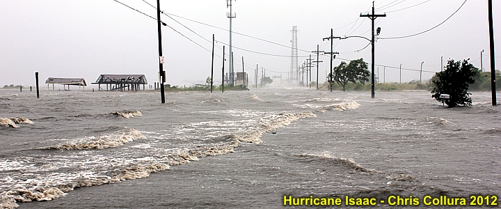
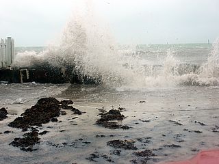
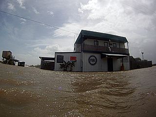
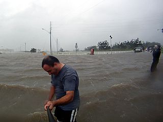
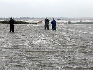
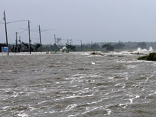
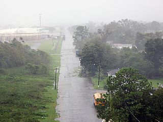
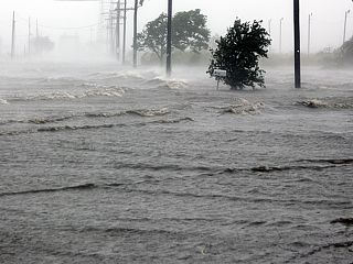
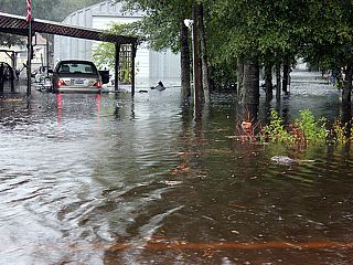
One of the scenes of a flooded street and raging storm surge during the morning of August 29 in Louisiana just to the northeast of New Orleans. This was south of Interstate 10 and near the junction of Highway 11 on the eastern side of Lake Ponchartrain. Winds gusting to near 85 MPH drive the water ashore about 60 miles east of the eye of hurricane Isaac make for the all-too-familiar scene of raging storm surge floods that have plagued the Gulf States the past decade during these storms.
| CHASER NAME | HOME CITY | CALLSIGN | OCCUPATION |
| CHRIS COLLURA | SUNRISE, FL | KG4PJN | COMPUTER ANALYST |
| JEFFERY LAM | SUNRISE, FL | N/A | PROFESSIONAL SERVICES |
The list above shows personnel who actively participated in this chase, including myself. Jeffrey Lam accompanied me on the first intercept of Tropical Storm Isaac as it passed south of Key West, Florida on August 26, 2012. The second intercept was solo by myself in Mississippi / Louisiana on August 28 and 29.
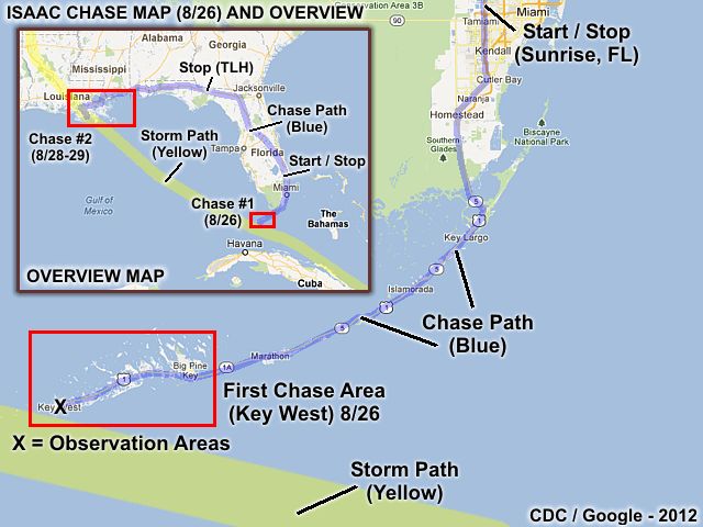
The chase map above shows the full overview of Isaac (upper-left inset) and any chasing done as well as the initial chase track for Tropical Storm Isaac in the Florida Keys (particularly Key West) on August 26. On both the overview and the diagram, the blue line is the chase track and yellow swath is the path of the storm eye / center. On August 26, the main chase was in the lower Florida Keys and in Key West. In the overview, the chase towards the northern Gulf Coast is also shown. These target areas appear as red boxes. A total of about 454 miles was logged on the first chase on 8/26, to and from the Florida Keys from my "base" home city in Sunrise, Florida.
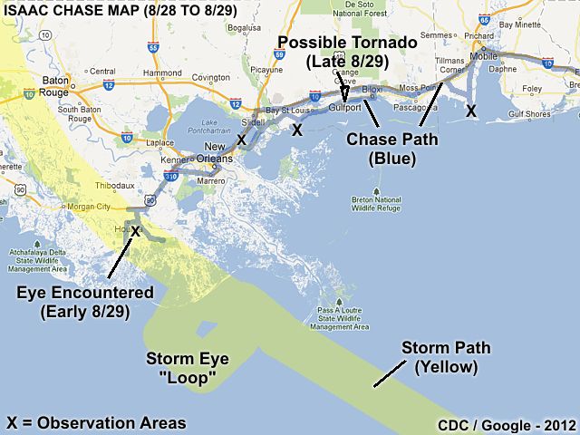
This second chase map shows the chase path (in blue) and storm center's path (in yellow) from the second chase of hurricane Isaac from August 28-29 in the northern Gulf Coastal states, mainly Mississippi and Louisiana. The black X's denote any major areas damage and / or storm surge was observed. The eye of the storm, with calm winds, was encountered southeast of Houma, Louisiana during the morning of August 29. A rain wrapped HP supercell and possible tornado was also observed in Gulfport, Mississippi later in the day on August 29, associated with the feeder bands of Hurricane Isaac. Storm surge was observed as early as mid-day August 28, and as far east as the Dauphin Island Causeway southeast of Mobile, Alabama. Note the small cyclonic "loop" the eye of the hurricane made just before making its second landfall in Louisiana! A total of 2024 miles was logged to and from these "target" areas and my "base" home town of Sunrise, Florida.
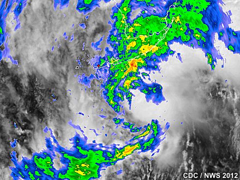
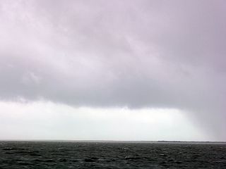
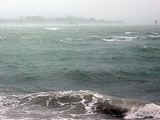
The image above is a radar (reflectivity) and visible satellite composite that shows tropical storm Isaac approaching the lower Florida Keys from Cuba and the Florida Straits early on August 26. The storm center at this point had sustained winds from 60 to 65 MPH, mainly in an intense convective band that curved around the northeast quadrant (right-front side) of the storm. This area of strong winds is what impacted the lower Florida Keys (especially Key West) on August 26.
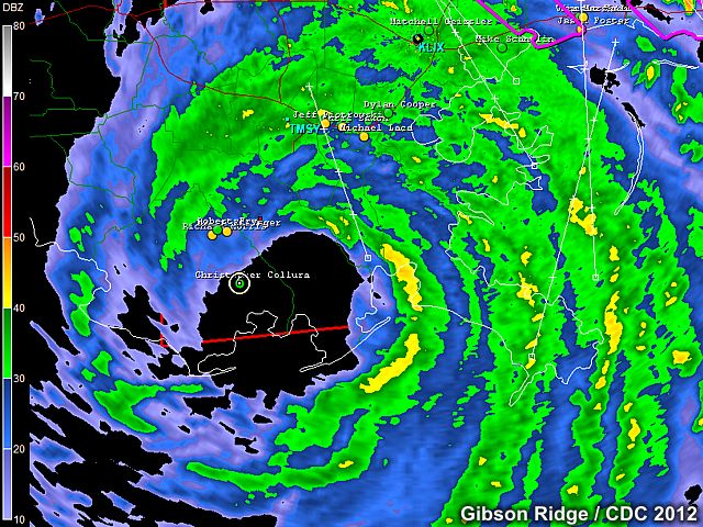
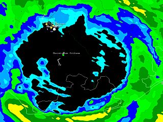
Hurricane Isaac came into Louisiana early on August 29 packing sustained winds of about 80 MPH with higher gusts. Despite being just a category-one hurricane, the cyclone's large size and powerful convection made it nothing to mess with. The storm surge alone approached 12 feet in many places! In this radar (base reflectivity) image, the hurricane's center is just southeast of Houma, Louisiana, surrounded by the intense eye-wall rain bands and strong winds. The eye of this storm was very large (up to 40 nm wide) and my location (white circle denoted by the GPS) is just entering the NW side of the rain-free calm eye. The eye was not clear, as a layer of low fog prevented viewing of any blue sky while in the eye. This radar presentation of the core of Hurricane Isaac on August 29 was very impressive to say the least.
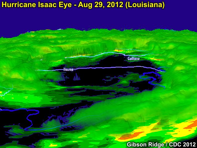
The image above is a to-scale isosurface radar map (reflectivity) of hurricane Isaac as it was southeast of Houma, Louisiana during the morning of August 29. The image is a 3D rendering, courtesy of the Gibson Ridge (GR Level II) Analyst software. The view in the image is looking down and towards the east and east-southeast. The eyewall is clearly represented and almost completely surrounds the large (40+ mile wide) eye with a "soft spot" on the western side. The most intense winds and rain, represented by the highest cloud "towers", are seen in the eyewall to the upper-left side of the image. Note the little "meso" low in the center of the picture, on the west side of the calm eye!
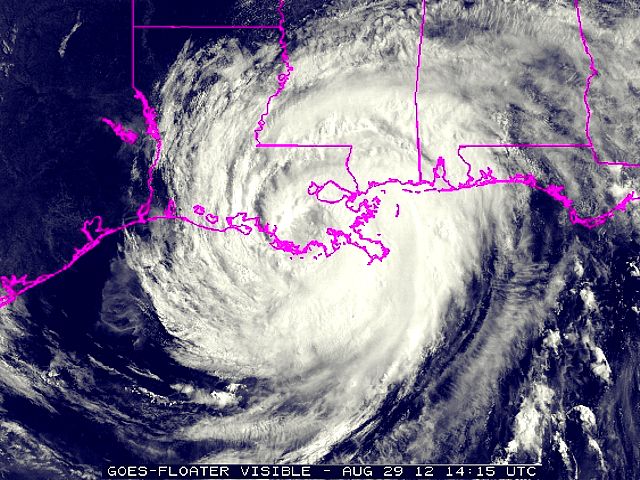
This is a visible satellite image of hurricane Isaac as it over southeastern Louisiana during the morning of August 29. The eye is clearly visible, and in about the same position as in the radar images above. The eye was not clear visually due to a low deck of fog and drizzle in the lower 1,000 feet of atmosphere inside the large eye. The upper cloud layers, however, were completely open in the large eye.
|
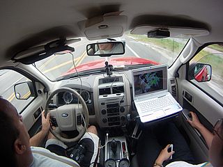
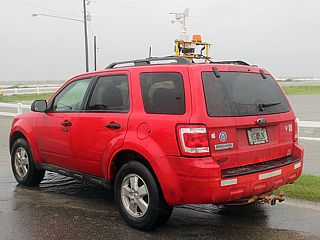
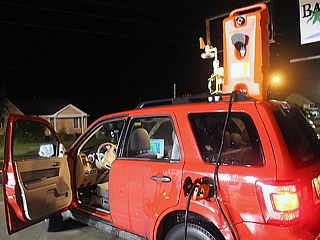
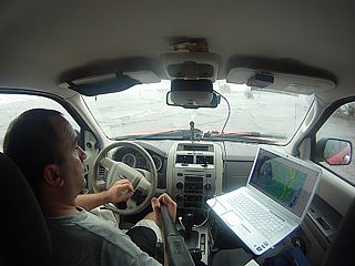
Here is a picture (wide angle) of the inside of my 2009 Ford Escape chase vehicle all prepped and ready to chase tropical storm Isaac as it was moving through the lower Florida Keys on August 26. |
|
One of the outer rain bands of TS Isaac while headed south on US Highway 1 into Key Largo during the morning of August 26. |
|
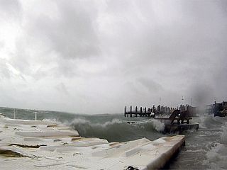
Strong winds (near 60 MPH) and heavy waves from the Florida Bay batter this docking area on the north side of Key West near Mallory Square. Picture was taken with the GoPro waterproof HD camera. |
|
Ran into Jeff Piotrowski and his wife in the same dockage area on the north side of Key West. Jeff was very excited about the storm, and already talking about chase plans the next few days! |
|
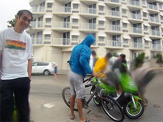
Some locals in Key West righting a broken scooter that was just blown over by winds gusting to 65 MPH. |
|
This is a picture of the Florida Bay north of Mallory Square in Key West being whipped by 60+ MPH winds. |
|
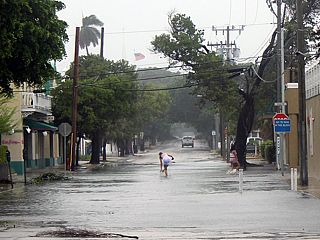
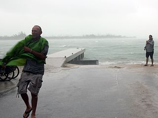
Here is a flooded street near Mallory Square with a person wading through the flood waters. Sloppy Joe's bar is around the corner to the right. |
|
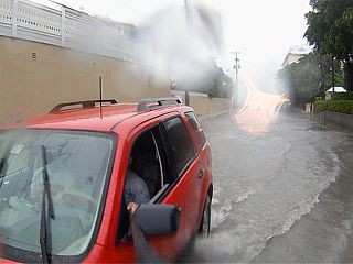
This is a GoPro camera shot of myself driving through the flooded streets in Key West. |
|
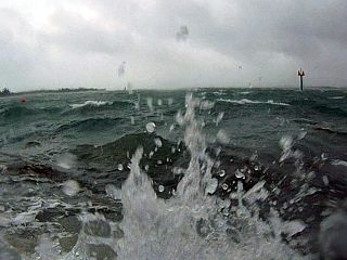
Here are some waves splashing over a dock area on the north side of Key West. |
|
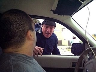
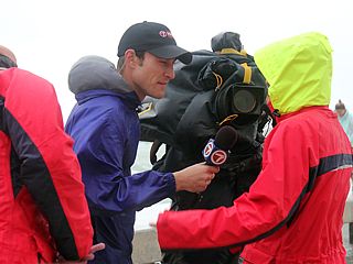
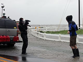
A local (Channel 7) news crew interviews some locals in Key West asking them why they are out in such conditions. |
|
Another view of the docks and boat ramp on the north side of Key West near Mallory Square. Intense winds to 65 MPH make it difficult to stand / walk. |
|
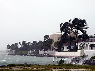
Blowing palms and higher class residences on the northeastern side of Key West near Stock Island. |
|
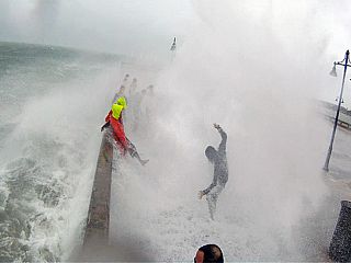
As the storm center of Isaac passed south of Key West, the southern and eastern facing parts of the island started receiving the strong winds. In this GoPro camera shot, taken from the end of the White Street Pier, waves crash over the end of the structure with locals foolishly standing right in their path. |
|
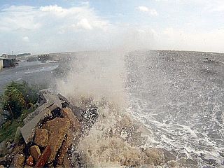
Waves crashing over a seawall near the Southernmost Point in Key West as the storm center of Isaac passed about 10-15 miles to the south of the island. |
|
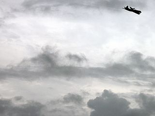
This P3-Orion aircraft flew overhead several times. I thought right away that it may be the NOAA Hurricane Hunters. |
|
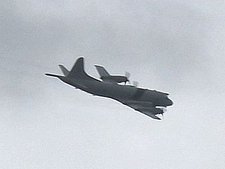
Another closer pass of the P3 Orion aircraft showed the red stripe (Coast Guard) livery on the side of the plane. Sometimes this branch of the military, concerned primarily with sea surface conditions in such storms, flies low missions (1500 feet or less) on occasion. |
|
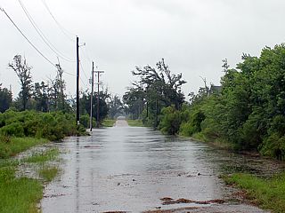
While heading back to the Florida Mainland from the FL Keys, there was also quite a bit of fresh water / urban flooding observed from TS Isaac. Isaac was a very wet system, dumping as much as 20 inches of rain in a 24 to 36 hour period. This parking lot was severely flooded near Hollywood, Florida until late on August 27. |
|
This is some storm surge and flooding near Heron Bay to the southeast of Mobile Alabama along Highway 193 into Dauphin Island at about noon on August 28. Isaac is now a hurricane and about 180 miles south of the area. Winds here are easterly to southeast at about 35-40 MPH with rising tides. |
|
Flooded establishment to the east of Highway 193 and near the start of the Dauphin Island Parkway. |
|
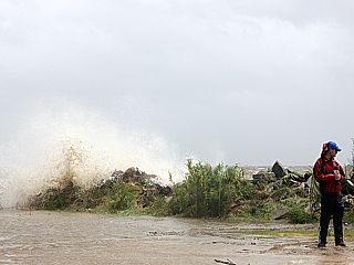
A local news reporter standing along the east side of Highway 193 as a wave crashes over the jetty / seawall to the left of a flooded parking lot. |
|
Rising waves and storm surge on the DIP (Dauphin Island Parkway) causeway. The police have already closed the roadway at this point, and those you see on it are evacuating Dauphin Island. I did a quick interview with the Weather Channel on site there as well. |
|
Rising surge and waves overwashing the Dauphin Island Parkway / causeway by afternoon on August 28. Winds are gusting to near 50 MPH from the ESE. |
|
Closeup shot of the overwash, storm surge, waves, and debris crossing highway 193 near Dauphin Island and Heron Bay just after closure of the road by police. |
|
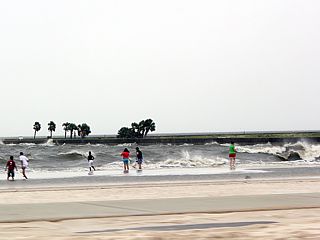
This is the Gulf of Mexico waterfront between Biloxi and Gulfport, Mississippi during the afternoon of August 28. The hurricane was about 140 miles south of this location at the time. People can be seen walking up and down the beach, and some areas have waves soming into the street (Highway 90). Police began yelling at them on their PA saying that the beach is being close for safety. |
|
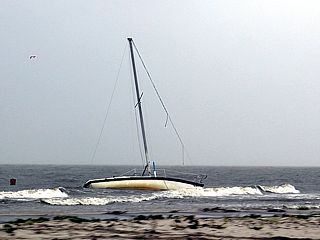
A sailboat moored offshore breaks its mooring and drifts ashore just east of Gulfport, Mississippi. It is pretty much too late to save this boat so early before the worst conditons still yet to come. |
|
Storm surge flooding becoming more severe by late afternoon on August 28 between Bay St Louis and Waveland, Mississippi on N Beach Blvd. |
|
Flooding from the increasing storm surge in Waveland, Mississippi along S Beach Blvd during the late afternoon of August 28. |
|
A car pushing through deepening salt water along S Beach Blvd in Waveland, Mississippi. |
|
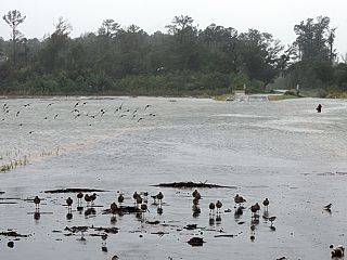
Coming across a flooded roadway along Ralroad Avenue and near the Jackson Marsh southeast of Waveland, Mississippi. Note the fire hydrant to the right. It is extremely dangerous to attempt a drive across this (the road may not even exist anymore under the rapidly flowing waters). A re-route was taken across the other side of town to pass this area. The birds / wildlife don't seem to mind! |
|
Storm surge flooding near Clairmont Harbor, Mississippi along S Beach Blvd. This was early evening on August 28, with hurricane Isaac about 120 miles to the southeast. |
|
Another picture of the storm surge flooding and waves crashing over the small seawall near Clairmont Harbor, Mississippi along S Beach Blvd. |
|
Flooded and impassible road near Clairmont Harbor, Mississippi. This road was called "Lake Drive" for what it's worth! |
|
I met up with some other hurricane chasers, including this group from Alabama, on the corner of Lakeshore Drive and S Beach Blvd, and just to the north of the Silver Slipper, Casino (where chaser Reed Timmer was "stuck" chasing at). This was on the east side of the small town of Lakeshore. |
|
Storm chasers and their equipment / vehicles as the storm surge rises and winds increase to 60 MPH gusts from the northeast. I remained here until evening and it got too dangerous to stay here. Always make sure you have a "way out" when chasing like this - we all did. |
|
GoPro camera shot of myself standing in the middle of S Beach Blvd ... Waist deep in storm surge. I was able to mount the GoPro camera on a long handle for a broom using a custom mount - Worked great. |
|
Here is another GoPro camera shot of myself standing in the middle of S Beach Blvd as winds gist over 60 MPH with rapidly rising tides. |
|
Alabama storm chaser group member standing in the intersection of Lakeshore Drive and S Beach Blvd. |
|
Another shot of some storm chasers standing in the intersection of Lakeshore Drive and S Beach Blvd as the Gulf of Mexico takes control. |
|
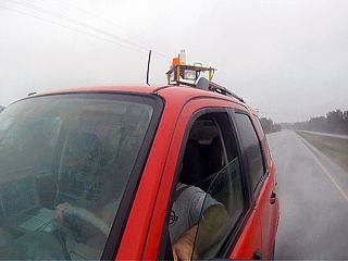
Here is a picture of my 2009 Ford Escape chase vehicle - This was the first hurricane this vehicle was ever in. |
|
This is a view to the south along Lakeshore towards the Silver Slipper Casino. Lakeshore drive is to the right. Who would park an ice cream truck there? |
|
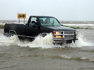
These brave locals wanted to show the abilities of their chevy pickup. They drive through 2-3 feet of water for about 1/4 mile up the road and back ... Gotta love those southern folks! |
|
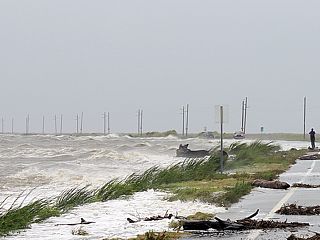
This is the view to the north along S Beach Blvd as the winds started increasing with gusts over 60 MPH. |
|
Another view looking to the north along S Beach Blvd with a close up of the water showing streaks of foam and spray whipped by the increasing NE winds. |
|
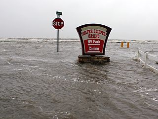
Sign to the Silver Slipper Casino with rapidly flowing waters from the Gulf of Mexico rushing over Lakeshore Drive. |
|
Severe storm surge flooding now starting in low lying areas of the small town of Lakeshore, Mississippi. This view is looking south along Ann Street. At this time it was dusk, and my retreat inland to Highway 90 into Louisiana was already being executed. |
|
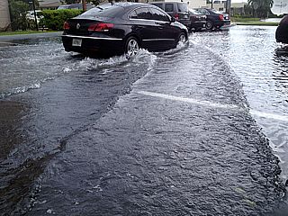
This was just to the southwest of Lake Catherine, Louisiana along Highway 90 during an attempt to get to I-10 and between Lake Ponchatrain and Lake Borgne just after dusk. The road was now impassible, and a retrat back the same way and north towards I-10 was taken. In this picture, a car is seen floating in front of a residence. |
|
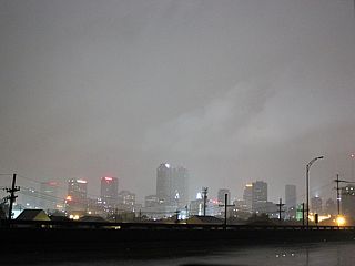
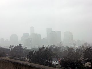
This is the New Orleans, Louisiana skyline during the onset of huuricane forced winds (near 75 MPH) during the evening of August 28. This city has been having some bad luck the past decade. |
|
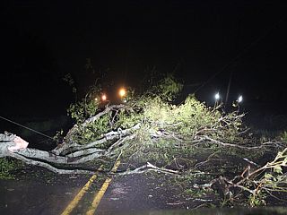
My attempt was to make it towards Galliano, Louisiana towards midnight on August 28-29 just before the eyewall of hurricane Isaac came ashore into SE Louisiana. This tree fell in front of me just NE of Larose on Highway. There was no way around it, so I had to backtrack towards Lockport. |
|
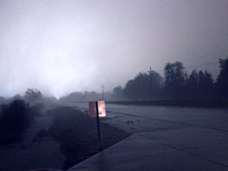
I settled for Houma, Louisiana for better road options, as well as some brief sleep at a church parking lot NE of town on Prospect Road after midnight on August 29. The eyewall winds (gusting over 80 MPH) hit at about 2 AM with blowing (sideways) rains. In this view towards Houma, a powerflash illuminates the sky. |
|
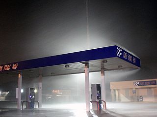
Strong winds batter a gas station on the NE side of Houma, Louisiana near Prospect Road during the early morning hours of August 29. |
|
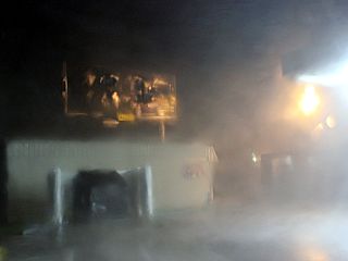
Damage to a billboard sign and violent wind-driven rains on the NE side of Houma, Louisiana near Prospect Road. |
|
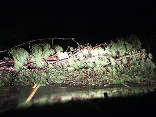
Trees down near Presquile, Louisiana along Highway 56 headed south and southeast out of Houma. I was able to get past this by driving around it across the edge of a field. |
|
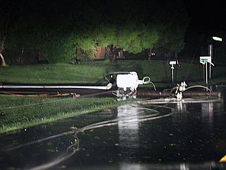
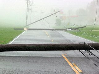
Powerlines down near Presquile, Louisiana along Highway 56 at about 3:30 AM on August 29. I am just on the edge of the eye of the hurricane, so winds are coming down. |
|
The calm eye of Hurricane Isaac was encountered near the south side of Chauvin, Louisiana from after 3:30 AM and well into sunrise. In this picture, I am refueling my vehicle (with gas I carried in a large container) at a gas station that has generator power (but closed). The calm eye of Isaac was large and slow-moving, so it lasted very long. |
|
Here is a radar (base reflectivity) image of Hurricane Isaac's large eye during the morning of August 29 over Louisiana and when i was near Chauvin. Note my position - Right where I wanna be! |
|
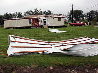
This is one of many damaged trailer / mobile homes back north near Houma, Louisiana during the morning of August 29. Houma is now in the calm eye as well. |
|
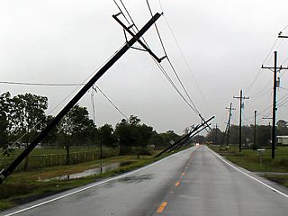
Some more power poles down near Houma, Louisiana while still in Isaac's large eye. |
|
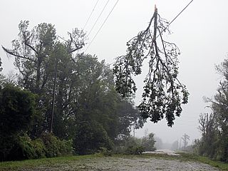
While attempting to head east along Highway 24 towards Larose, and still in the calm eye, I came across a wooded area with many downed trees. This tree branch was hanging in a powerline. Note the fog in the air ... This was in the center of the calm eye of hurricane Isaac. The low clouds were bright at times, with no rain, but unfortunately did not break to allow view of any blue sky and / or eyewall "stadium" effect. |
|
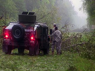
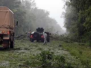
Downed trees along Highway 24 made it impossible to get to Larose. I ran across some of these Army folks who did not have a chainsaw, and were attempting to move the trees using a small chain. |
|
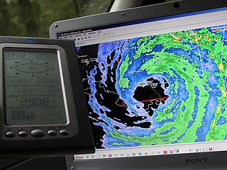
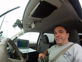
Here is a picture of my handheld weather station (showing 29.08" of pressure) and the GPS / GR Level III screen showing my location in the northern portions of the eye of the hurricane on Highway 24. This calm in th eye is so deceptive. You really think the storm is over, but you are right in it's center! |
|
After finally clearing the one fallen tree, there were others up ahead. The wise choice was to abandon trying to get to Larose, with the second half of the hurricane eyewall approaching, and back-track to Houma then north to Highway 90 to "exit" the eye and back into the hurricane conditions. |
|
Here I am haded to the northeast out of Raceland, Louisiana along Highway 90 to the ENE. I am leaving the hurricane's eye fast, and punching back into the northeastern (right) eyewall. The low clouds remained socked in, but up the road, you can see the strong winds and sideways rain (low visibility) while in the foreground it's still clear. The transition from calm to 80 MPH winds was a mere 2 miles or so! |
|
This is a GoPro shot of myself driving from outside the vehicle using my special camera (pole) mount. I am hading to the east along Highway 90 towards New Orleans in winds gusting over 80 MPH at times. |
|
More downed powerlines during the morning of August 29 near Harvey, Louisiana and along River Road while trying to divert around a closed section of Highway 90. The Mississippi river and levee is to the left, and I was able to drive left around the snapped poles to get through. |
|
This is another shot (from the handle mounted GoPro camera) of myself driving towards New Orleans, Louisiana, doing what I do best. |
|
This is a view up Nunez Street from the Crescent City Bridge (connection) in Hurricane conditions near McDonough, Louisiana. |
|
Here is another view of the New Orleans, Louisiana skyline during a hurricane from the Crescent City Connection. |
|
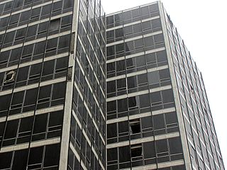
Downtown New Orleans fared pretty well during hurricane Isaac as far as flooding was concerned. The new post Katrina levee / flood control systems worked well for the most part. Wind damage was observed in some areas, including this office building with some windows blown out. |
|
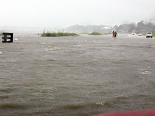
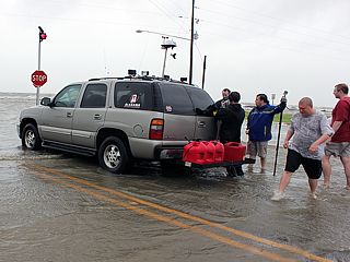
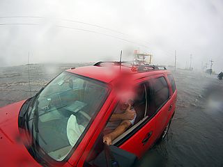
Areas outside of New orleans, such as shores along Lake Ponchatrain and other low lying coastal areas were subject to severe flooding from storm surge. Here is a picture of myself driving in my vehicle in rising storm surge flooding on Highway 11 off I-10 just northeast of New Orleans during the late morning of August 29. |
|
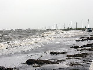
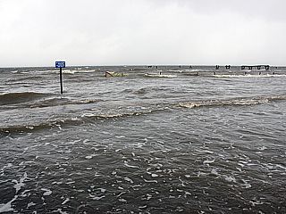
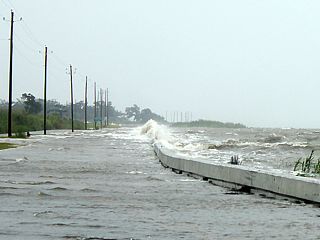
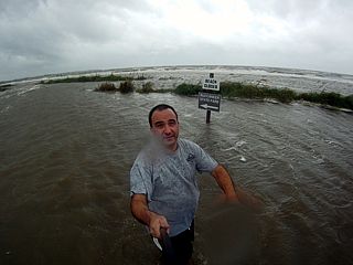
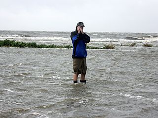
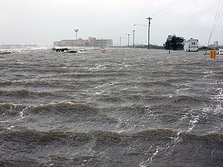
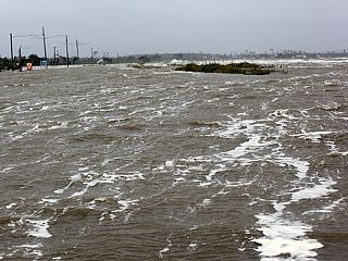
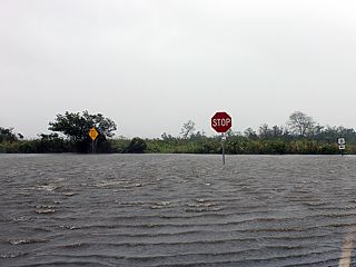
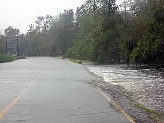
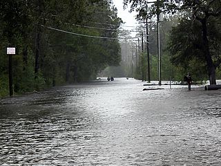
This is a flooded intersection along Highway 11 south of Interstate 10 on the eastern side of Lake Ponchartrain. Storm surge in Louisiana approached 12 feet above sea level, very impressive for a category one hurricane. |
|
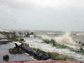
Storm surge sweeping across Highway 11 just south of Interstate 10 on the eastern side of Lake Ponchartrain. Although winds are gradually coming down, they are still gusting near 85 MPH as I am about 60 miles east of the eye of Isaac at this time. |
|
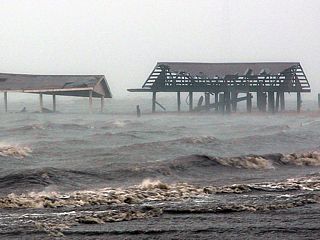
Damaged roofing and storm surge flooding south of Interstate 10 and near the junction of Highway 11 on the eastern side of Lake Ponchartrain. |
|
This is another wide-angle GoPro shot of myself and the interior of my 2009 Ford Escape chase vehicle while in storm surge flooding south of Interstate 10 and near the junction of Highway 11 on the eastern side of Lake Ponchartrain. |

|
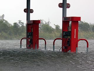
This is a flooded gas station south of Interstate 10 and near the junction of Highway 11 on the eastern side of Lake Ponchartrain. |
|
Same view of the flooded gas station showing the gas pumps. This was late morning on August 29, and south of Interstate 10 and near the junction of Highway 11 on the eastern side of Lake Ponchartrain. |
|
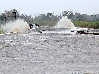
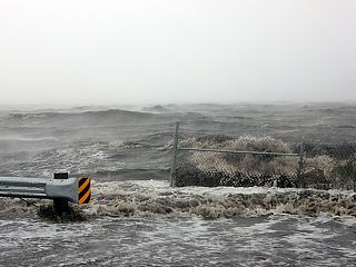
Some flooding also ocurred along Interstate 10 near Lake Ponchartrain. This is a view of waves crashing into the south shoulder of I-10. |
|
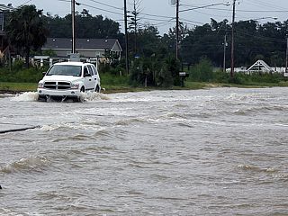
Severe flooding was encountered around noon of August 29 near Highways 190 and 90 back into Mississippi west of Pearlington. Water can be seen here rushing across Highway 190. |
|
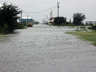
Here is a flooded residence and car port near the junction of Highways 190 and 90 and to the west of Pearlington, Mississippi. |
|
This is a view up a flooded road off Highway 190 as a search and rescue team heads up the street in deep water to search for any flood victims. This scene lasted into early afternoon of August 29. |

|
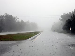
Extremely heavy rains and winds gusting over 70 MPH associated with a severe thunderstorm in an intense feeder band near Gulfport, Mississippi during the afternoon of August 29. |
|
Possible tornado / funnel cloud associated with an HP supercell storm racing northward across Gulfport, Mississippi during the afternoon of August 29. This storm was one of several HP (high precipitation) supercells (also called a TCMS or "Tropical Cyclone Mini-Supercell") embedded in an intense feeder band / convergence line east of hurricane Isaac's eyewall. The tornado was probably EF-1 or less, but anough to cause structural damage to homes, and tear a roof off a grocery store. |
|
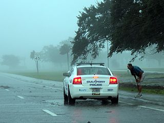
Here is a picture of a Gulfport Police Car with a person wandering along Highway 90 being asked why he was out. Highway 90 was closed and a curfew in effect for the area after the storm. |
HTML File "isaac12.htm" - Developed By Chris Collura
To Return To The HOME Page Of This Site Click The "INDEX.HTM" Link Here!