
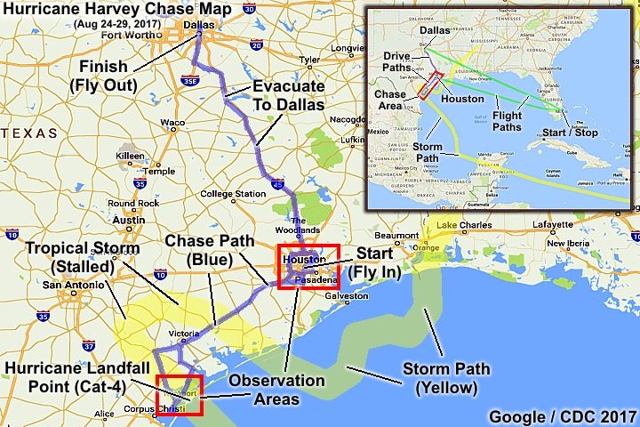
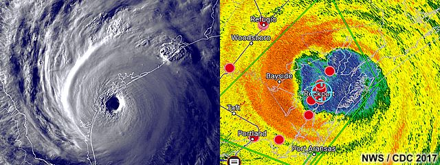
| This area shows pictures taken from the interception and observation of powerful category-four hurricane Harvey in southeastern Texas from its devastating landfall point in Aransas County near Fulton and Rockport, and the subsequent catastrophic flooding event as the storm moved inland and weakened to a tropical storm west of Houston. This storm, was the first major hurricane (with sustained 130-MPH at the first landfall) to strike the United States in 12 years. This devastating storm began originally began as a tropical disturbance that moved off Africa and moved across the tropical Atlantic. The disturbance became a tropical storm in the eastern Caribbean, but weakened to a remnant low as it reached the Yucatan area of Mexico. The low pressure area crossed into the Bay of Campeche, and SW Gulf of Mexico around the 22nd of August. The dry air and wind shear, plaguing tropical development in the Atlantic for so long, relaxed and the storm began re-organizing in an area highly favorable for intensification, with an area of high oceanic heat content associated with a warm gyre in the Gulf of Mexico loop current. On August 24th and 25th, the storm went from a tropical depression to a storm, then a hurricane in a mere 24 hours, with rapid - or even explosive - intensification. This storm steadily and rapidly intensified into a category 4 hurricane on the Saffir-Simpson scale, packing 130 MPH winds and a central pressure as low as 938 MB at the time of landfall near Rockport, Texas late on the 25th. This produced catastrophic wind damage in some areas, mainly near and right of the first landfall point near Rockport and Fulton, and extending to near Tivoli. Severe flooding (from both violent rain and storm surge) also occurred in these areas. After landfall, the storm weakened inland to a tropical storm over the next few days, from Aug 26th to the 29th, but stalled and moved slowly west of Houston. This placed Houston on the right side of the storm, with training rains and severe (even tornadic) thunderstorms. At least 50 inches of rain fell in these areas near Houston, causing the worst flooding "in a 1,000 years"! The storm re-emerged into the Gulf of Mexico on the 28th, and did not start moving NE until the 29th, leaving "legendary" flooding and a swath of wind damage in its path. Eventually, the storm moved ashore again, with 50 MPH winds, and weakened inland thereafter on August 30. The second part of the chase was in the Houston area, with cancelled flights out of Houston, observing the flooding. I "evacuated" the area on Aug 28th to Dallas, flying back to Florida from there on the morning of the 29th. The chase began by flying into Houston on the 24th and driving to the target areas for the first landfall. The total mileage was 1,015 miles. Note - This page may take a while to load on some SLOWER connections! |
| CHASER NAME | HOME CITY | CALLSIGN | OCCUPATION |
| CHRIS COLLURA | DEERFIELD BEACH, FL | KG4PJN | COMPUTER CONSULTANT |
|
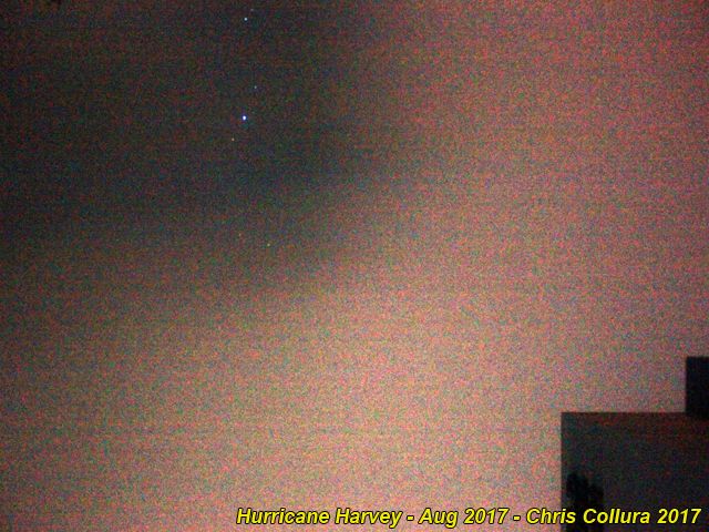
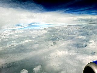
View of sky looking over the Gulf of Mexico while connecting via Tampa (from Fort Lauderdale, Florida to Houston, Texas) aboard a Boeing 737 commercial airliner. The outer fringes of hurricane Harvey as well as another tropical disturbance makes for showers and thunderstorms, some of which produced waterspouts during the evening of August 24, 2017. |
|
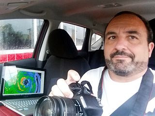
Here is a picture of myself in the "target area" of Aransas County, Texas and in position and ready for the chase on August 25, 2017 after making my way from Houston to Victoria, then the Rockport / Fulton area 25 miles outside of Corpus Christi. |
|
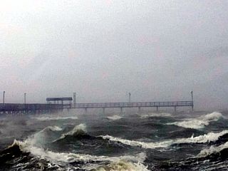
Wave and wind action between Estes and Port Aransas, Texas as the gale forced wind envelope arrives during the afternoon of August 25, 2017. |
|
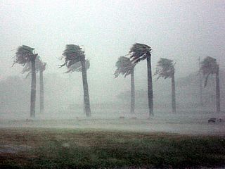
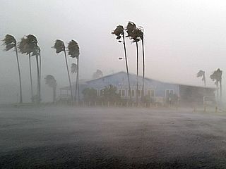
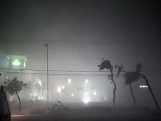
Palm trees blowing in the coastal areas of Fulton / Rockport during the afternoon of August 25, 2017 as hurricane forced winds arrive. |
|
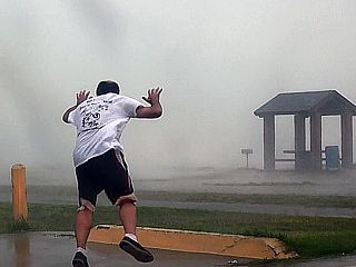
Myself trying to stand / walk in 75 MPH wind gusts near a beach and marina on the bay side in Rockport, Texas late on August 25th. |
|
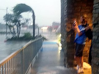
Palm trees whipping in 70 to 80 MPH winds at the Fulton Convention Center in the Rockport waterfront area on August 25th. |
|
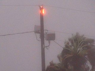
Fire atop power pole in hurricane conditions near Rockport, Texas on August 25. |
|
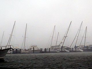
Marina in Rockport with masts bending and collapsing on sailboats during the early evening of August 25th. Hurricane conditions are well underway with gusts near 100 MPH at this point, just outside the eyewall of the storm. |
|
Retreating to the Marriott Fairfield in Rockport / Fulton just before the eyewall of Harvey arrives during the evening of August 25. |
|
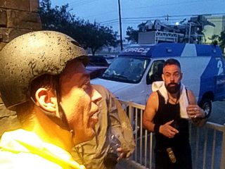
Storm chasers Reed Timmer (in the yellow raincoat) and Josh Morgerman (from iCyclone in the black tank-top) on the side of the Rockport / Fulton Marriott. |
|
Eyewall of Harvey hits Rockport / Fulton after dark just before power failure during the evening of the 25th. Winds here gusting over 120 MPH. |
|
Structural failure of east side of the Marriott hotel during the storm eyewall and 130+ MPH winds, viewed from the 3rd and 4th floors. We are in the eyewall of Harvey here, and winds are gusting over 140 MPH. |
|
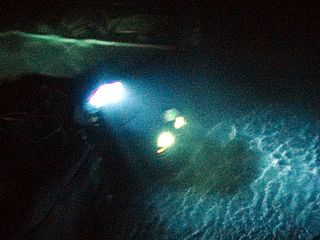
View of chase vehicle in the parking lot on the downwind side of the hotel, during the eyewall, with whipped up water from flooding and / or storm surge. |
|
View of damage to the building from the 4th floor just before entry into the eye of Harvey during the late evening of August 25th in 140+ MPH wind gusts. Basically, the hallway ends and "drops off" 4 stories into "nothing". The building was shaking at this point, making for a very uneasy feeling. |
|
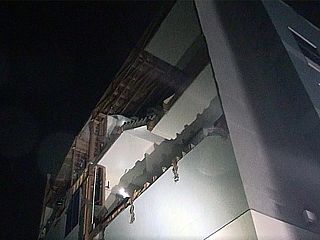
View of severe structural damage to the windward side of the Marriott Hotel while inside the calm eye of Harvey around 10:30 PM CDT. At this point, stars and birds are overhead, with a "stadium effect" noted by lightning flashes around us in the eyewall. Some folks at the hotel, deeming the structure as unsafe, are also evacuating to a nearby school. |

|
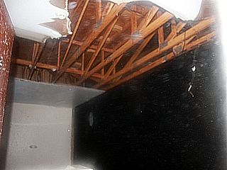
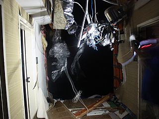
Most of the rooms of the Marriott in Rockport looked like this in the morning of August 26th. With the roof off the hotel, and severe structural damage on the sides, water found its way into most interior spaces, coming out of electrical fixtures, cracks, lights, etc. |
|
Daylight on August 26th reveals another view of the damage from the 4th floor of the Rockport Marriott. The hallway and stairwell basically "end" in "thin air". |
|
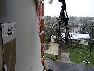
View of devastation looking out of the damaged section of the Rockport Marriott and down from the 4th floor before leaving the area on the morning of August 26, 2017. |
|
Damage in Rockport with overturned trailer in Rockport / Fulton during the morning of August 26th. |
|
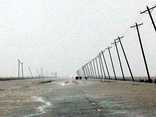
View along an impassible and flooded section of Highway 35 between Fulton and Tivoli, Texas during the morning of August 26. This is storm surge flooding, and is actually going down as the storm has passed. |
|
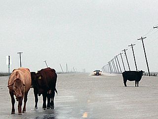
Cows "running away" from the storm surge flooding on Highway 35 between Fulton and Tivoli. Police 4x4 cruisers are also attemping to get out of the area, but needed to turn around as well. |
|
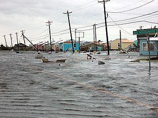
Severe flooding and damage near Fulton, Texas on August 26th. |
|
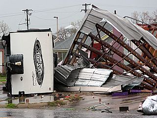
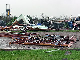
Severe wind damage to some repair shops and a gas station during the morning of August 26th near Rockport. |
|
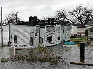
Overturned mobile home near Fulton, Texas on August 26th. |
|
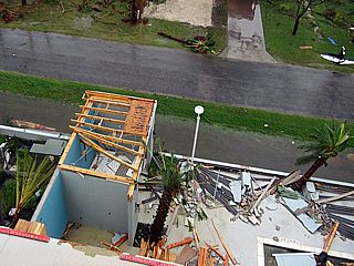
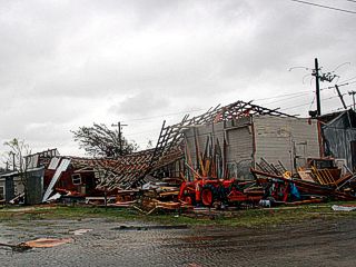
Major structural damage and missing roof of businesses on August 26th near Rockport. |
|
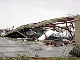
Destroyed airplanes and hangar near Fulton, Texas during the morning of August 26th. |
|
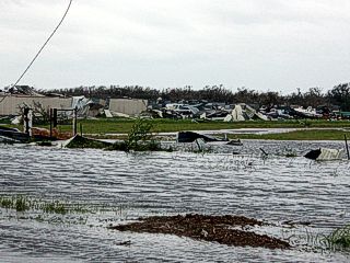
Flooding and destruction near Estes / Rockport on August 26th. |
|
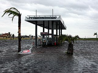
Damaged and flooded gas station near Estes, Texas on the 26th. |
|
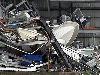
Destruction at a boat storage facility near Estes and Aransas, Texas during the morning of August 26th. |
|
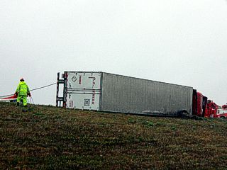
Overturned semi-truck on Highway 77 east of Sinton, Texas during the morning of August 26th. |
|
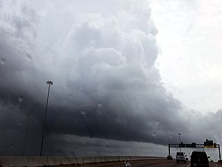
Tropical cyclone mini-supercell (TCMS) developing on the south side of Houston, Texas during the afternoon of August 26, 2017. This storm went on to produce a large tornado north of the area after this picture was taken, and marked the start of a devastating flooding event for the area. The developing tornado is to the lower-left in this picture by the pole. Also note the RFD slot to the far lower-left as well. The view is to the ENE. |
|
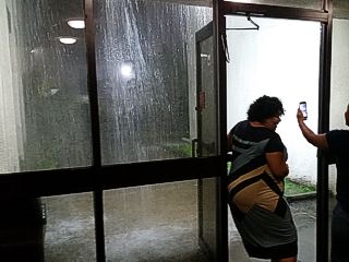
Torrential rains of 3 to 4 inches per hour, with lightning and severe weather, viewed from a hotel near Houston Hobby airport during the evening of August 26th and into the 27th. This torrential rain was so continued for the next 3 to 4 days, as hurricane Harvey moved inland and weakened to a tropical storm, and stalled west of the area. |
|
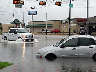
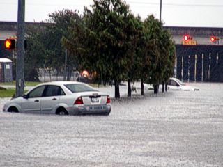
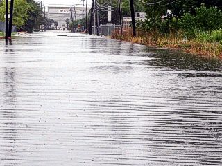
Morning light on August 27th reveals stranded cars on Airport Road in South Houston, Texas and high water from continous rains. |
|
Flooding and stranded car in South Houston, Texas during the morning of August 27, 2017. |
|
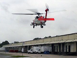
US Coast Guard helicopter landing near a "dry area" during the morning of August 27th. It's not good when you see the Coast Guard 100 miles inland! |
|
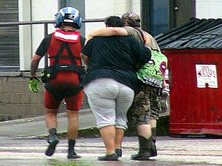
Folks being rescued and walking toward the US Coast Guard helicopter with the rescue swimmer during the morning of August 27th. |
|
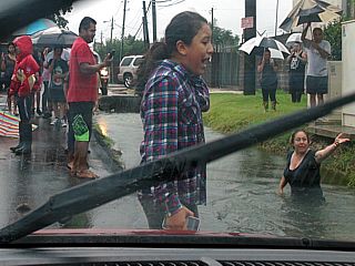
Locals near South Houston wading in high water during the morning of August 27th. |
|
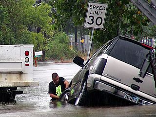
Stranded vehicle in flooded ditch being hitched up for recovery in South Houston on August 27th. |
|
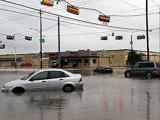
View of Airport Road (main road to Houston Hobby Airport) on August 27th. I-45 is in the background with cars flooded and stranded in the foreground. |
|
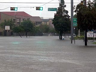
Another view of Airport Road in South Houston on August 27th with stranded vehicles. "Green" does NOT mean "go"! |
|
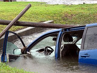
SUV stranded in a ditch in South Houston near I-45 on the 27th. Water is going down a bit, but was higher earlier, and people driving lost view of the road because of the flood waters, and drove into a ditch or swale. |
|
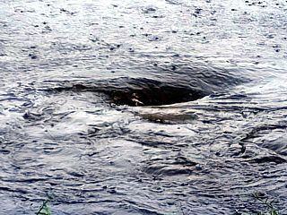
Whirlpool in the middle of a flooded road in South Houston on August 27th. Overwhelmed storm drains and manhole covers blown off are concealed by flood waters, and made driving extremely dangerous. |
|
View looking west along Airport Road in South Houston during the afternoon of August 27th. Flights were cancelled for about a week because of flooding and its after-effects. |
|
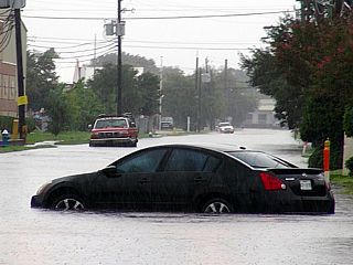
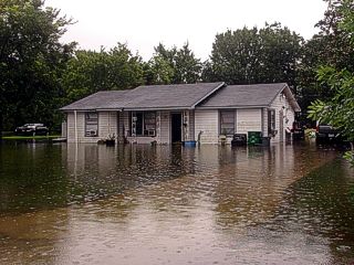
Flooded home in South Houston, Texas during the afternoon of August 27th. |
|
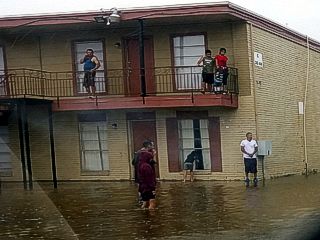
Flooded apartment complex and occupants in South Houston, Texas during the afternoon of August 27th. |
|
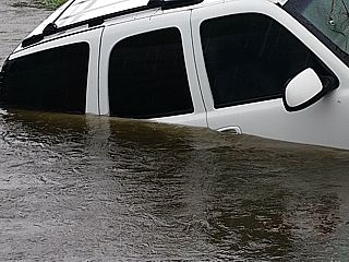
View of submerged SUV in South Houston, Texas during the afternoon of August 27th. |
|
View along side street towards Telephone Road with one of the hangars of Houston Hobby Airport at the end of the road, with flood waters on August 27th. |
|
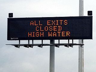
Traffic sign showing all exits closed due to "high water" on I-45 south of Houston on August 28th. |
|
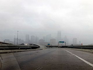
View of Houston during the 3rd day of torrential rains from I-69 northbound during the late afternoon of August 28th. Normally this view would be bumper-to-bumper rush hour traffic at this time. |
|
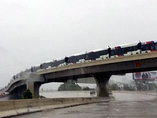
Caravan of motorcoach buses parked on an overpass to be used to evacuate people out of Houston. This was on August 28th near I-69. |
|
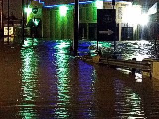
Surging and fast-moving flood waters overspilling the Buffalo Bayou near Shepherd Drive west of Houston during the evening of August 28th. At this point I decided to evacuate Houston, finding any way I can, and try to make it to Dallas since cancelled flights and flooding would cause me to be stuck there for at least a week! |
|
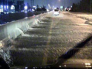
This is a terrifying view of I-45 northbound near Spring, Texas late on August 28th with raging flood waters rising and going from left (the southbound lanes) to right (my northbound lanes) and spilling over the centre median barrier. The water level to the left of the barrier is high and over-topping the 4 foot barrier. This is an EXTREMELY DANGEROUS attempt to go north and get out of the Houston area. On my side, the water is about 6 inches deep, but swiftly rushing across the lanes. An overflowing dam caused this part of the violent flood in the area. |
|
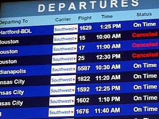
View of flight status monitor at Dallas Love Field airport during the morning of August 29, 2017. I evacuated Houston the night before, and returned the rental car and flew out of Dallas, which was dry and unaffected by Harvey's wet "wrath". All flights into and out of Houston would be cancelled for many days to come. |

|
Taking off out of Dallas and climbing to altitude and en-route to Fort Lauderdale, Florida. Looking to the southeast, the clouds associated with tropical storm Harvey can be seen over the horizon during the morning of August 29th. |
|
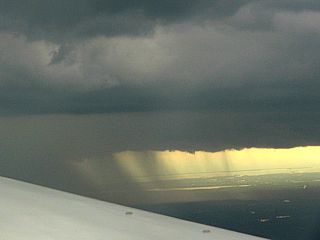
When flying eastward (Dallas, Texas to Fort Lauderdale, Florida), a brief view of the circulation center of tropical storm Harvey can be seen looking south at high altitude, while passing over the TX / LA border. This is the clear area just to the left of the center of the image. At this point, the storm was disorganized and sheared, with 45 to 50 MPH winds, but still producing catastrophic flooding over eastern Texas / Houston during its departure. |
HTML File "harvey17.htm" - Developed By Chris Collura
To Return To The HOME Page Of This Site Click The "INDEX.HTM" Link Here!