
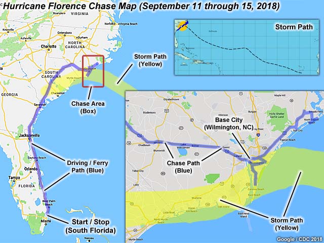
| This area shows pictures taken from the interception and observation of category-one (borderline 2) hurricane Florence in North Carolina including its landfall on September 13 and 14 mainly near Wilmington and Topsail Beach. Hurricane Florence began its journey as a wave that came off Africa in late August of 2018, taking more than two weeks to reach the United States in mid September. The storm peaked in intensity around September 10 and 11 with explosive intensification, becoming a strong category 4 storm with winds near 150 MPH. As the storm approached north Carolina on September 13, the storm weakened to category 2 with 100 MPH winds, and strong category 1 with 90 MPH as it made landfall on September 14, 2018 near Wrightsville Beach, NC. The chase included a drive from Deerfield Beach, Florida to the primary target area of Wilmington, North Carolina via I-95 north on September 11 and 12, with a stop in Jacksonville, Florida. The chasing was done near Highways 17 and 74 in the Wilmington and North Topsail Beach areas on September 13 and 14. Late on the 14th, I left Wilmington to avoid being trapped by catastrophic flooding by heading back west on Highway 74 to I-95 south, spending that night in Hardeeville, South Carolina. On September 15, I drove back to South Florida, wrapping up the chase with a total mileage on the vehicle (2016 Jeep Wrangler) of 1699 miles. Chaser Derek Sibley also accompanied me on this chase. Note - This page may take a while to load on some SLOWER connections! |
| CHASER NAME | HOME CITY | CALLSIGN | OCCUPATION |
| CHRIS COLLURA | DEERFIELD BEACH, FL | KG4PJN | COMPUTER CONSULTANT |
| DEREK SIBLEY | HOLLYWOOD, FL | N/A | METEOROLOGIST |
|
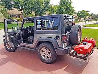
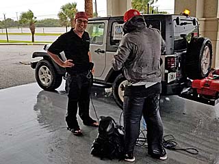
Preparing my chase vehicle, a 2016 Jeep Wrangler, for the chase of hurricane Florence. This is before departing south Florida late in the day on September 11, 2018. |
|
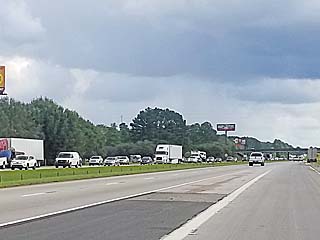
Evacuation traffic headed southbound on I-95 in South Carolina during the morning of September 12, 2018. Note that there is little of no traffic on our side (northbound). |
|
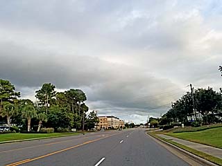
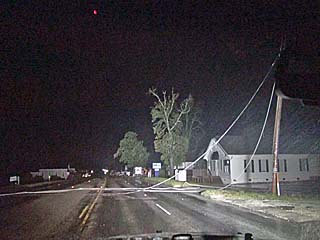
One of the outermost rain bands approaching Wrightsville Beach / Wilmington, North Carolina late in the day on September 12 as meteorologist Derek Sibley and I arrived in the target area. Hurricane Florence is still a few hundred miles away. |
|
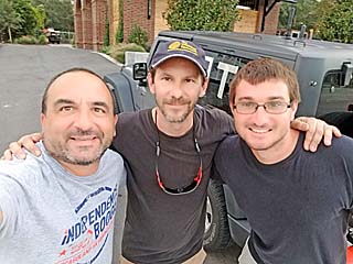
From left to right is myself, Canadian explorer George Kouranis, and meteorologist Derek Sibley near Wrightsville Beach causeway late on September 12. |
|
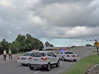
Police roadblock at the entrance to the Wrightsville Beach causeway late on September 12. No one was allowed to cross over except residents and those with media credentials. |
|
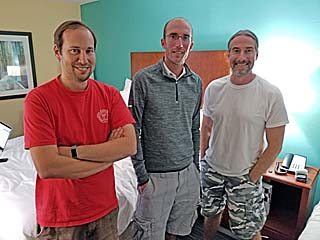
From left to right is Dave Lewison, Tim Millar, and Scott Mcpartland at the Wilmington Holiday Inn and ready for the chase of Florence late on September 12. |
|
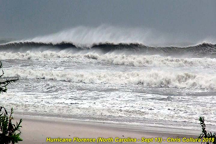
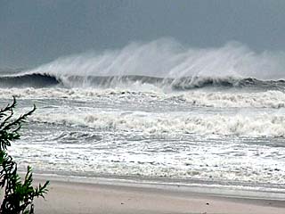
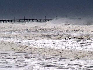
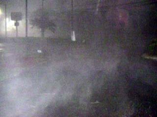
Violent surf (15+ foot waves) pounding North Topsail Beach, NC during the morning of September 13, 2018. Hurricane Florence was about 100 miles to the east, moving towards us. Winds here are tropical storm forced from the north and blowing offshore. |
|
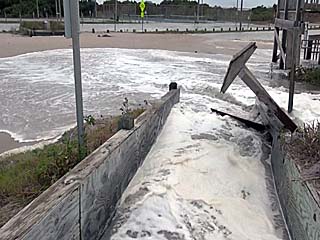
Wave runup and storm surge pouring over dunes, across stairs, and into parking lot during the morning of September 13 at North Topsail Beach. This was just after the high tide cycle. |
|
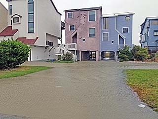
Beachfront homes with flooding and minor damage to the first levels in North Topsail Beach on September 13. |
|
Meteorologist Reed Timmer, left, and part of his group in North Topsail Beach on September 13 before we were asked to leave by police. |
|
View of North Topsail Beach pier before leaving (police orders) late on September 13 as hurricane Florence draws closer. |
|
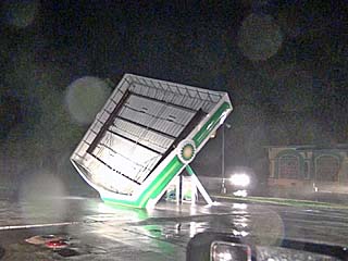
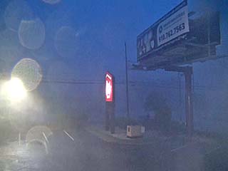
A BP gas station canopy is topped by strong winds of the outer eyewall of Florence just before midnight on September 13 in North Topsail Beach. |
|
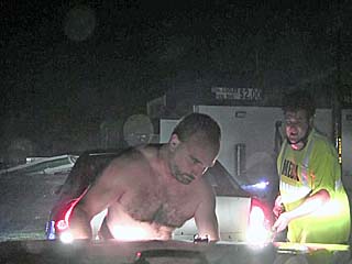
Myself using the winch on my jeep (I am hooking it up) to pull fellow storm chaser Kyle Bower's car (chasing with Derek Smith) from a ditch at the BP gas station in North Topsail Beach on September 13. Since I was completely SOAKED to the bone, I just decided to remove my shirt and rain coat. |
|
Downed powerlines across Highway 17 north of Wilmington, NC after midnight on September 14, 2018. |
|
Strong winds gusting over 80 MPH and horizontal (sideways) rain at the Wilmington Red Roof Inn during the pre-dawn hours of September 14. This marked the arrival of the inner eyewall. |
|
Sunrise twilight and horizontal rains and winds at the Wilmington Red Roof Inn on September 14. |
|
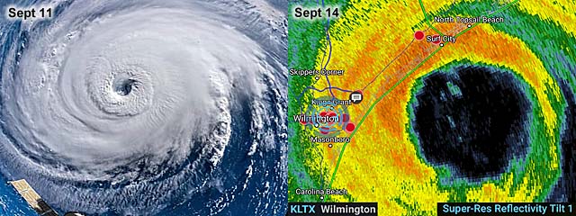
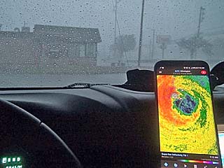
View of radar image on my smartphone (Radarscope app) just before entering the calm eye of hurricane Florence just prior to landfall at Wrightsville Beach to the east of Wilmington on September 14. |
|
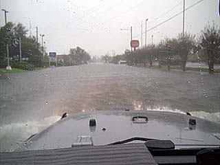
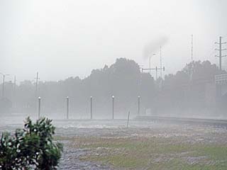
The beginning of a catastrophic flooding event for Wilmington and the surrounding areas. Here the roadway is covered with rising waters of both the Cape Fear River and storm surge. This was just before entering into the calm eye of Florence during the morning of September 14. |
|
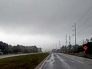
The edge of the calm eye (brighter sky) of hurricane Florence can be seen over the southeastern horizon near Wilmington after sunrise on September 14. |
|
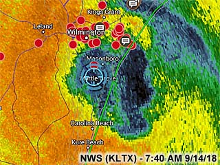
Radar (base reflectivity) image of the eye of hurricane Florence sitting over my location (the blue crosshairs) just before 7:45 AM EDT southeast of Wilmington on September 14. |
|
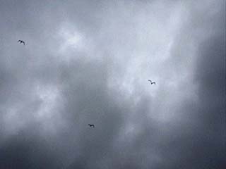
View looking up towards the sky while inside the calm eye of hurricane Florence at about 7:45 AM EDT on September 14 while just SE of Wilmington. The eye was clouded over, with a thin fog / stratus layer, but bright with a warm and muggy environment with skies bright overhead. In this shot you can see ocean birds "caught up" within the eye (there were hundreds of birds noted overhead at one point)! |
|
The backside of the hurricane arrives at Wrightsville Beach by mid morning of September 14, with a strong wind from the east and southeast, as hurricane Florence turns to the southwest. The flying tree debris did minor damage to by vehicle. |
|
Trees begin falling and blocking roads after the wind shift in Wilmington during the mid morning of September 14 as hurricane Florence drifts southwest over the area. |
|
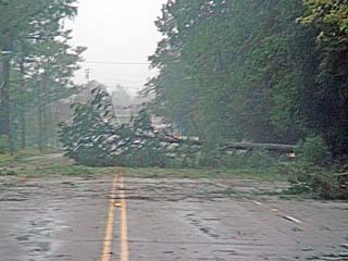
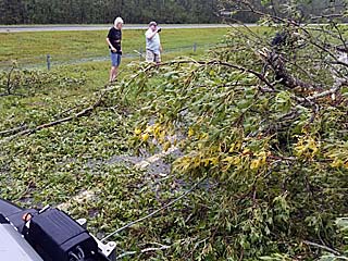
Parts of Highway 74 out of Wilmington blocked by downed trees during the mid morning of September 14. |
|
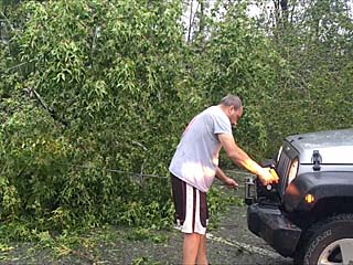
Myself using the winch to help clear trees blocking Highway 74 out of Wilmington on September 14. We are trying to get out before flooding traps us. A group of folks had chain saws and I am helping them. Picture taken by meteorologist Derek Sibley. |
|
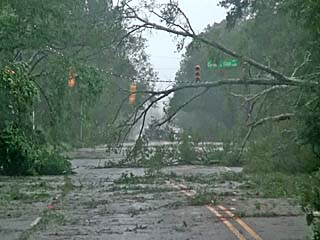
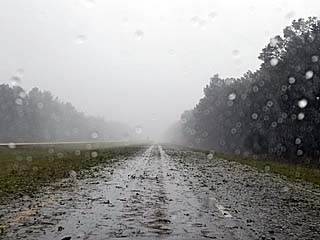
View of Highway 74 with heavy rain, wind, and tree debris while headed northwest away from Wilmington during the late morning of September 14. |
|
Another view of my vehicle and winch cable clearing downed trees from Highway 74 during the late morning of September 14. Picture taken by meteorologist Derek Sibley. |
|
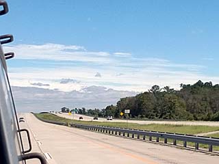
Heading south out of Hardeeville, South Carolina the following day during the morning of September 15, 2018. The view is looking back along I-95 at the edge (or margin) of now tropical storm Florence looming over the horizon. |
HTML File "flor18.htm" - Developed By Chris Collura
To Return To The HOME Page Of This Site Click The "INDEX.HTM" Link Here!