
Facebook Photo Album Storm Chasing 2015
(Storm Chasing 2015 Sky-Chaser Chris Collura Facebook Posts)
[ PARENT INDEX ]
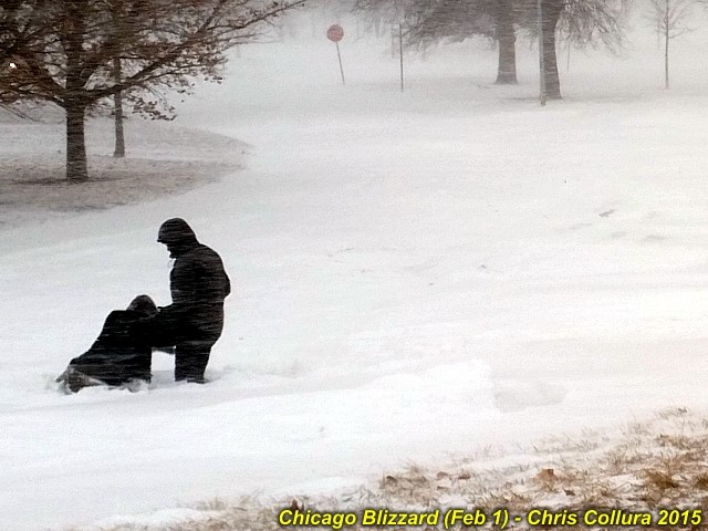
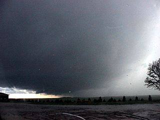
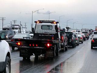
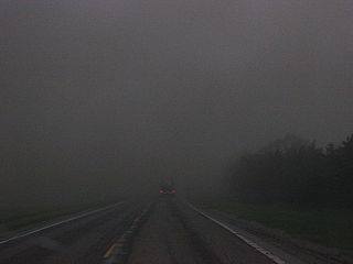
Blizzard on Feb 1, 2015 in Chicago, IL. Near lakefront with 50 MPH wind gusts.
Posted: Feb 1, 2015, 6:15 PM
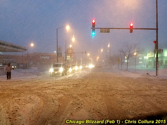
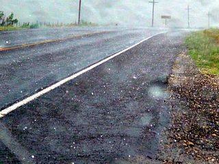
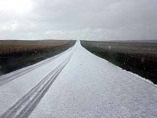
Blizzard on Feb 1, 2015 in Chicago, IL. Sanded road and snow.
Posted: Feb 1, 2015, 6:15 PM
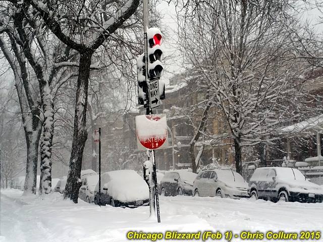
Blizzard on Feb 1, 2015 in Chicago, IL. Residental street and heavy snow.
Posted: Feb 1, 2015, 6:15 PM
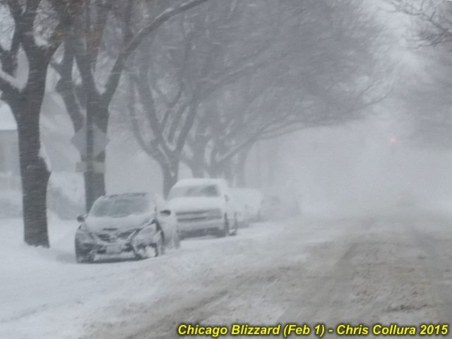
Blizzard on Feb 1, 2015 in Chicago, IL. Near whiteout on residental street.
Posted: Feb 1, 2015, 6:15 PM
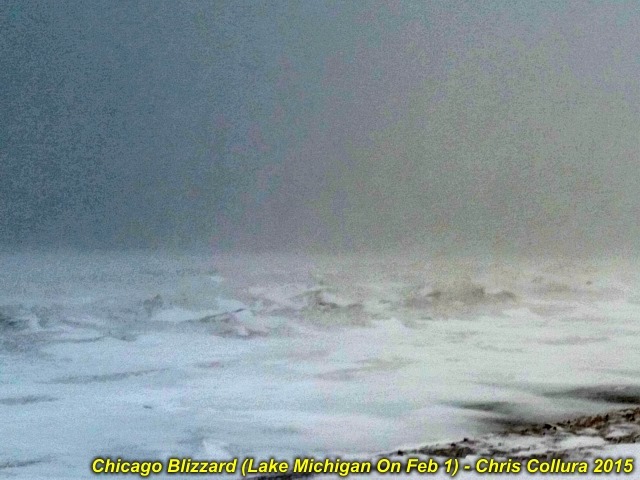
Blizzard on Feb 1, 2015 in Chicago, IL. Lake Michigan (frozen, with waves and freezing spray).
Posted: Feb 1, 2015, 6:15 PM
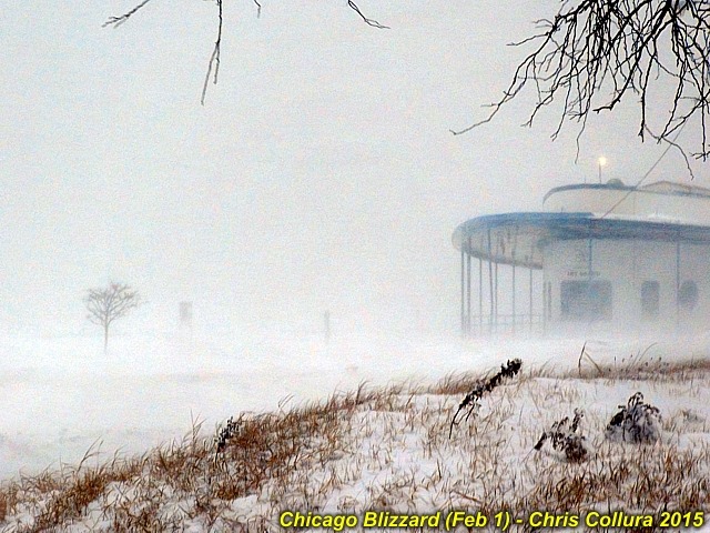
Blizzard on Feb 1, 2015 in Chicago, IL. Whiteout near North Street / Fullerton at lakefront.
Posted: Feb 1, 2015, 6:15 PM
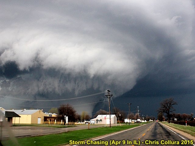
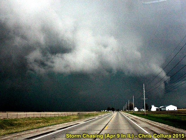
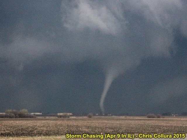
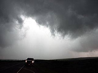
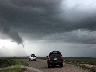
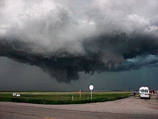
Approaching a violent wedge tornado just west of I-39 near Rochelle, Illinois on April 9, 2015.
Posted: Apr 9, 2015, 9:21 PM
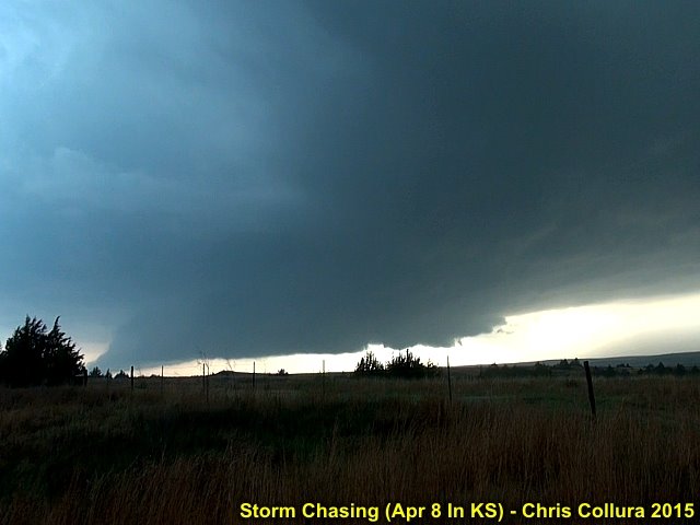
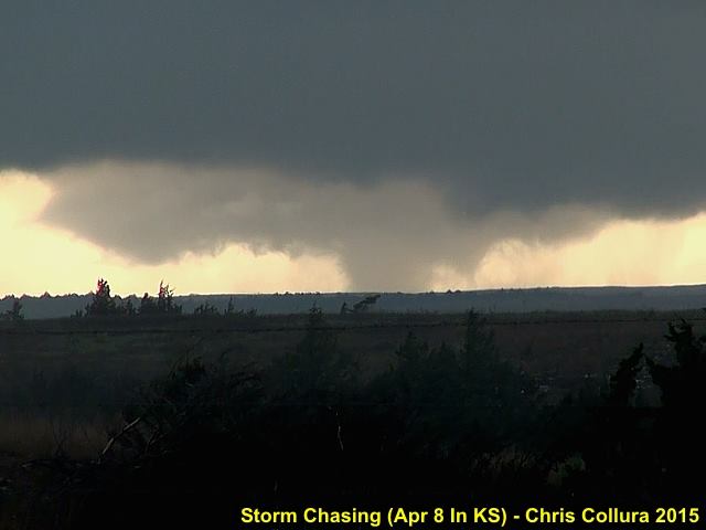
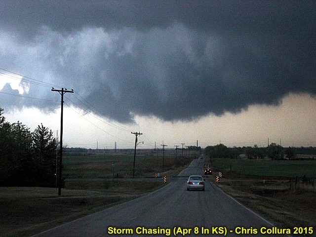
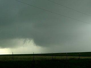
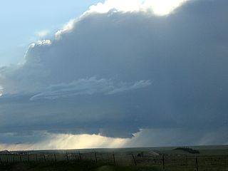
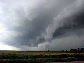
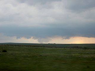
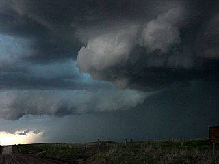
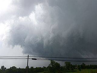
Wall cloud on the Medicine Lodge supercell storm in Kansas on April 8, 2015.
Posted: Apr 10, 2015, 5:13 PM
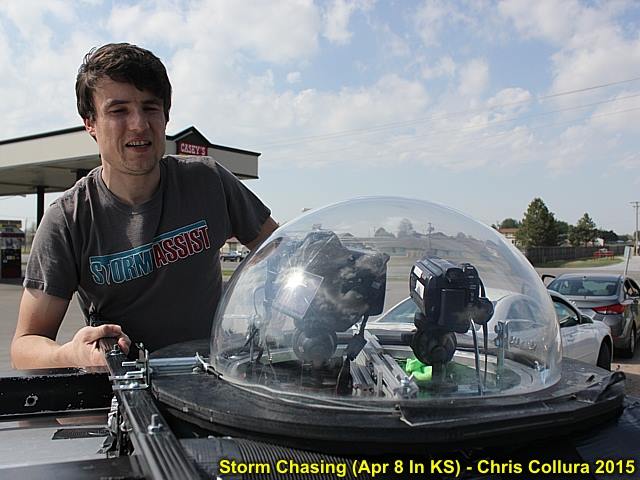
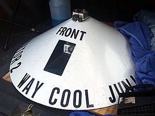
@[22012908:2048:Skip Talbot] and his Mesodome (camera housing) atop his chase vehicle near Wellington, Kansas on April 8, 2015.
Posted: Apr 10, 2015, 5:13 PM
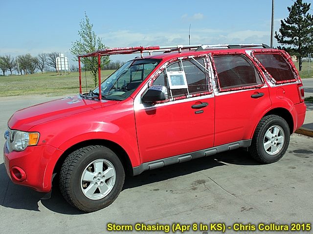
My chase vehicle (2009 Ford Escape) with hail protection in place and ready to start chasing in Kansas (April 8, 2015).
Posted: Apr 10, 2015, 5:13 PM
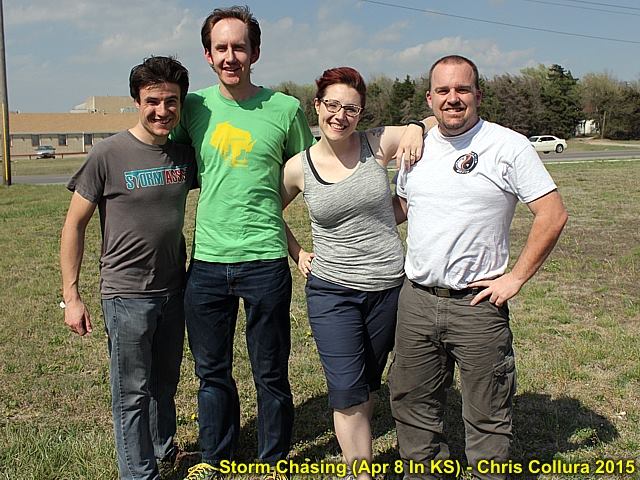
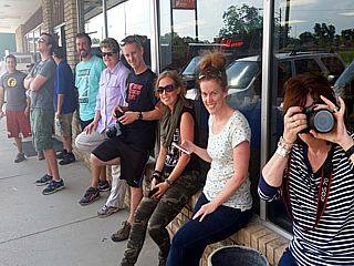
Part of the chaser convergence near Wellington, Kansas on April 8, 2015. @[22012908:2048:Skip Talbot], Blake Naftel, @[72204051:2048:Tony Laubach] and many others were there.
Posted: Apr 10, 2015, 5:13 PM
Brief wedge tornado to the southwest of Medicine Lodge, Kansas on April 8, 2015.
Posted: Apr 10, 2015, 5:14 PM
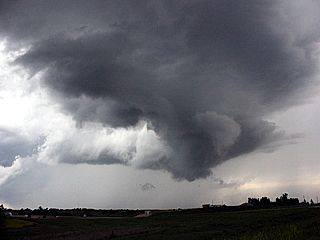
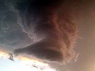
Occluding supercell after tornado weakens to the southwest of Medicine Lodge, Kansas on April 8, 2015.
Posted: Apr 10, 2015, 5:14 PM
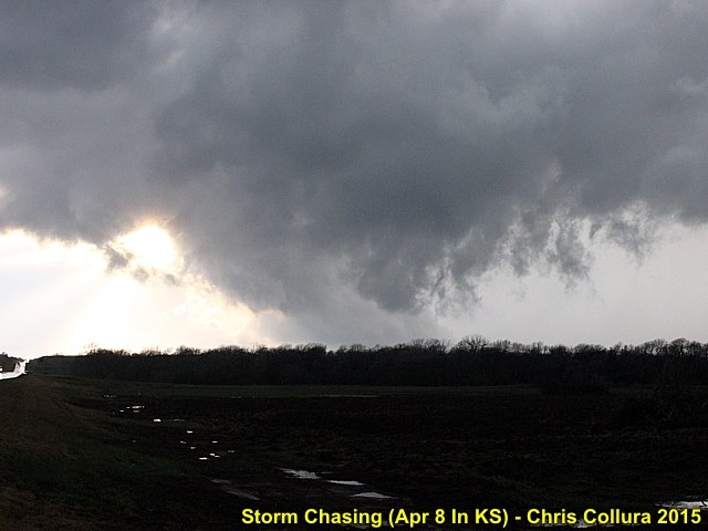
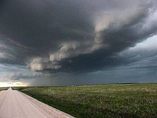
Weakening mesocyclone and low scud clouds southwest of Nashville, Kansas on April 8, 2015.
Posted: Apr 10, 2015, 5:14 PM
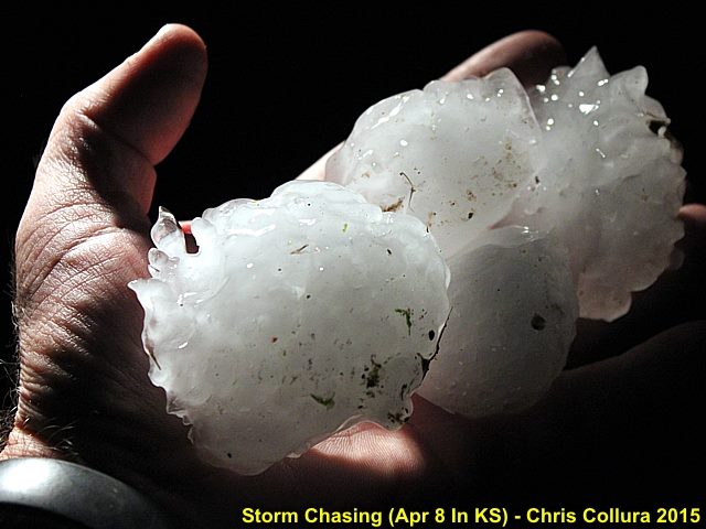
Large hail, partially melted (tennis to baseball sized) near Nashville, Kansas on the evening of April 8, 2015.
Posted: Apr 10, 2015, 5:14 PM
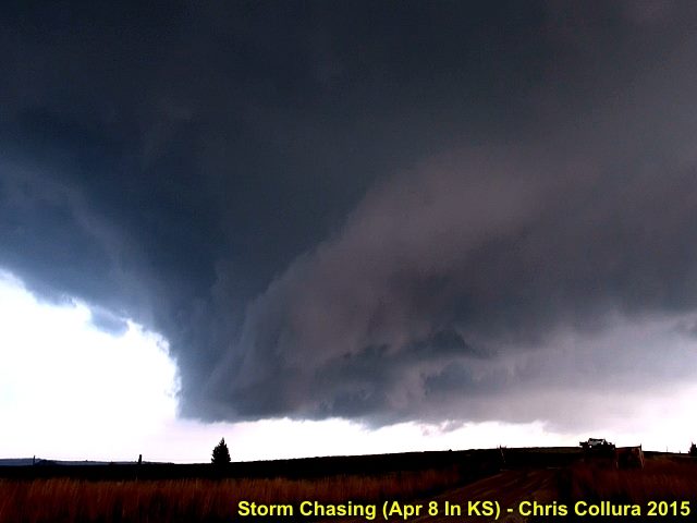
Looking north at the RFD clear slot and intense mesocyclone southwest of Nashville, Kansas on April 8, 2015.
Posted: Apr 10, 2015, 5:14 PM
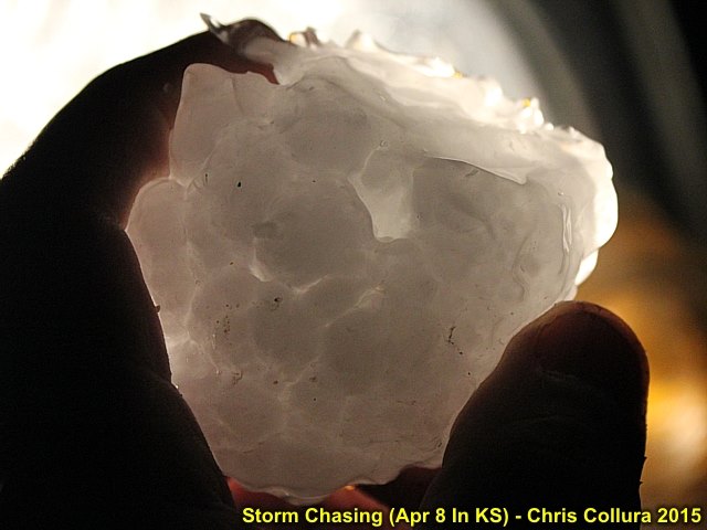
Piece of very large hail held up to car headlight. This was one of many pieces covering the ground near Nashville, Kansas on the evening of April 8, 2015.
Posted: Apr 10, 2015, 5:14 PM
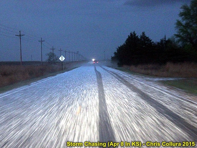
Hail covering roadway near Nashville, Kansas on the evening of April 8, 2015. Note the hail fog forming.
Posted: Apr 10, 2015, 5:14 PM
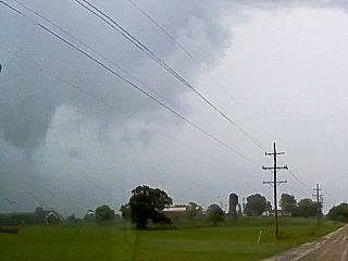
Tornadic HP supercell storm to the west of Davenport, Iowa on April 9, 2015. The weak tornado, to become rain wrapped soon, is to the lower right side of the image.
Posted: Apr 10, 2015, 5:14 PM
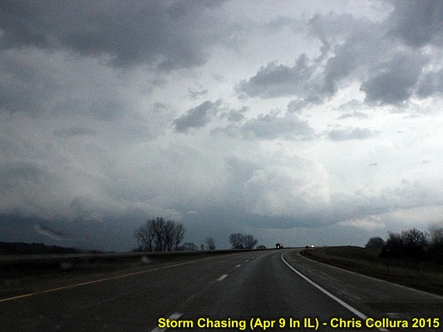
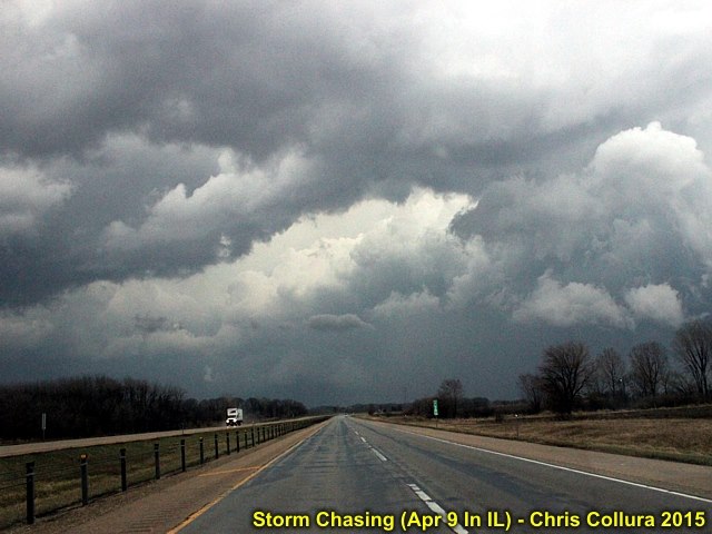
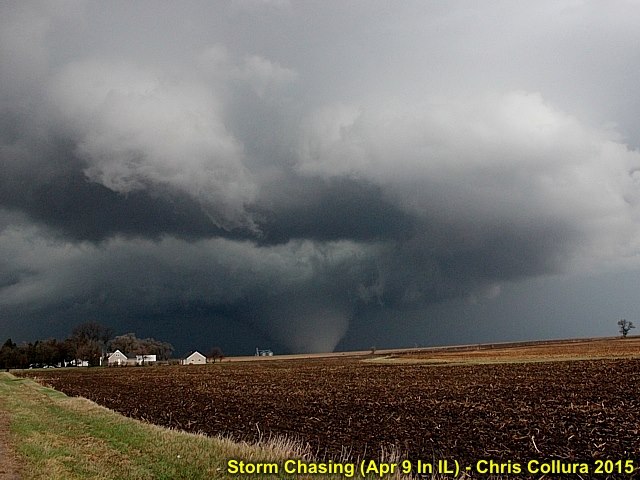
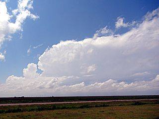
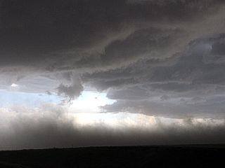
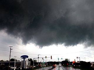
New supercell developing near Dixon, Illinois on April 9, 2015. This will be the violent supercell and tornado to affect the areas north of Rochelle, IL later. The powerful RFD is developing in the center of the image, with flanking line and updraft just right of that. The view is to the east.
Posted: Apr 10, 2015, 5:14 PM
Possible weak tornado becoming rain-wrapped to the west of Davenport, Iowa on April 9, 2015.
Posted: Apr 10, 2015, 5:14 PM
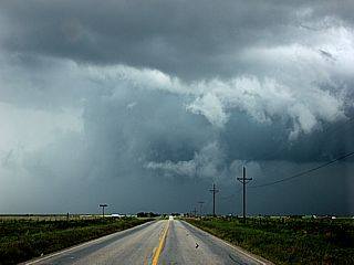
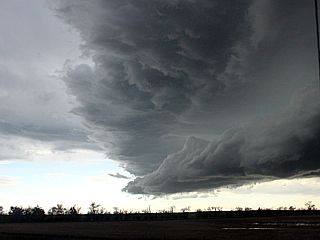
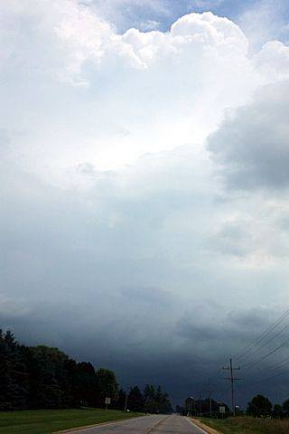
Powerful RFD clear slot develops on a rapidly intensifying supercell storm near Dixon, Illinois on April 9, 2015. The view is east along I-88.
Posted: Apr 10, 2015, 5:14 PM
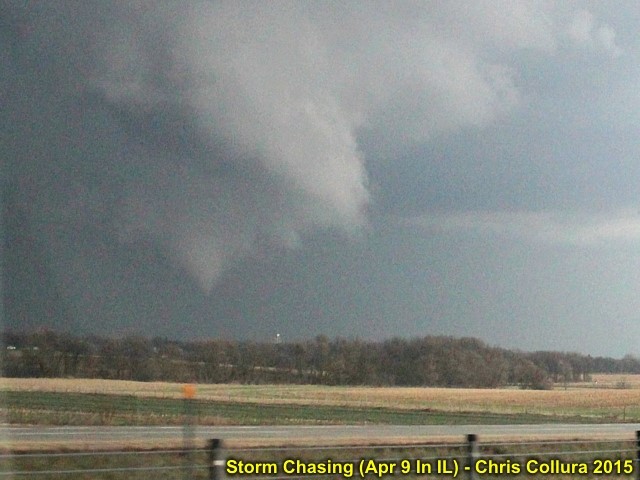
Developing tornado north of I-88 and southwest of Rochelle, IL on April 9, 2015.
Posted: Apr 10, 2015, 5:14 PM
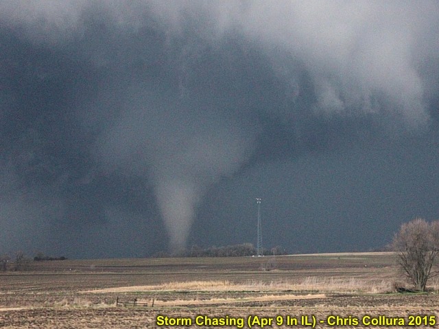
Stovepipe tornado north of I-88 and southwest of Rochelle, IL on April 9, 2015. The view is to the north.
Posted: Apr 10, 2015, 5:14 PM
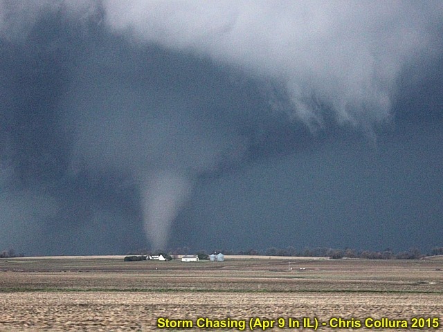
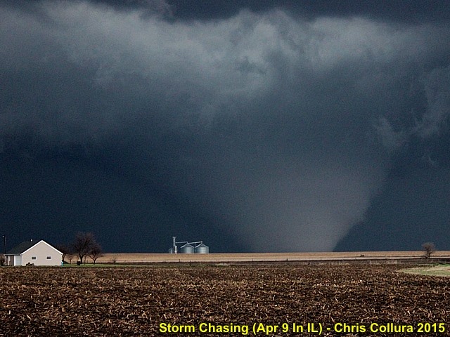
Mature elephant trunk tornado north of I-88 and southwest of Rochelle, IL on April 9, 2015.
Posted: Apr 10, 2015, 5:14 PM
Another similar view of the large stovepipe tornado north of I-88 and southwest of Rochelle, IL on April 9, 2015. The view is to the north.
Posted: Apr 10, 2015, 5:14 PM
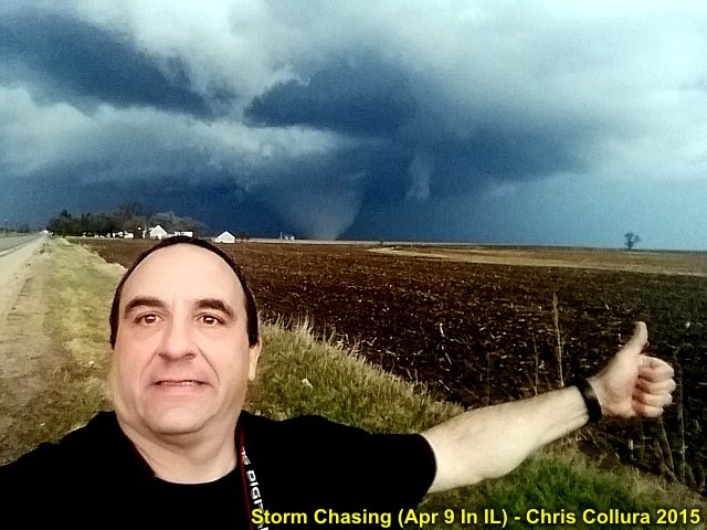
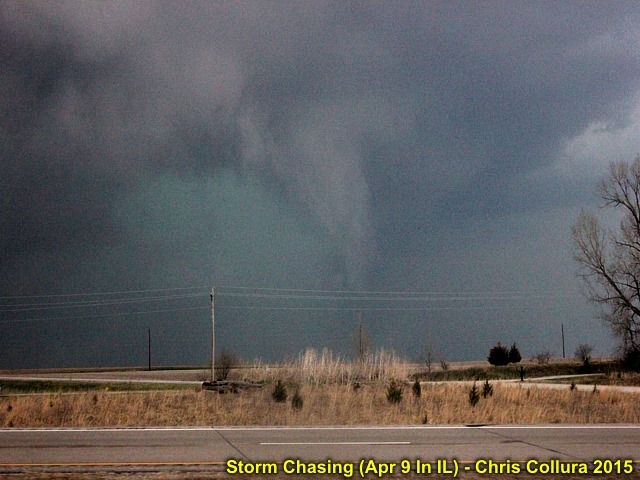
Myself with violent wedge tornado in the background off Highway 251 and north of Hillcrest / Rochelle, Illinois on April 9, 2015.
Posted: Apr 10, 2015, 5:14 PM
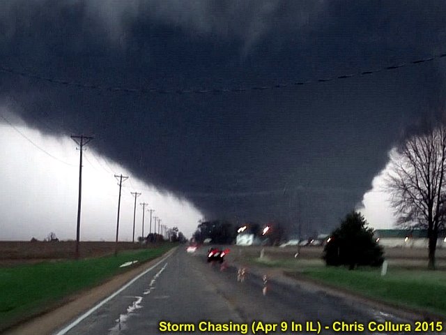
Violent wedge tornado, backlit by a flash of lightning, heading towards Fairdale, Illinois on April 9, 2015. The view is to the north along Highway 251.
Posted: Apr 10, 2015, 5:14 PM
View of violent wedge tornado north of Hillcrest / Rochelle, Illinois on April 9, 2015.
Posted: Apr 10, 2015, 5:14 PM
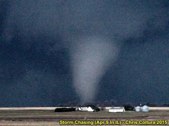
Close-up view of the large stovepipe tornado north of I-88 and southwest of Rochelle, IL on April 9, 2015. The view is to the north.
Posted: Apr 10, 2015, 5:14 PM
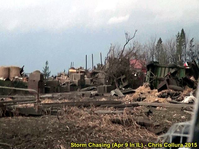
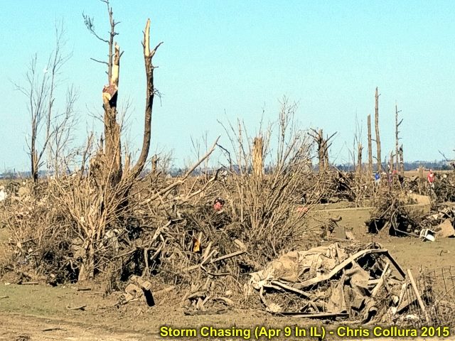
Extensive damage to a farmstread near Fairdale, Illinois on April 9, 2015.
Posted: Apr 10, 2015, 5:14 PM
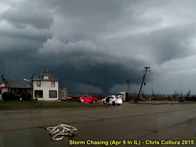
Damage in the foreground near Kings and Fairdale, Illinois with the tornado still on the ground moving into the distance. The view is to the northeast.
Posted: Apr 10, 2015, 5:14 PM
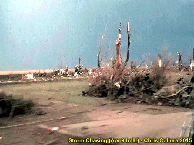
More damage north of Highway 72 and near Fairdale, Illinois. Note the bare dark dirt from the ground scouring in the center of the picture extending left to right. This was late on April 9, 2015.
Posted: Apr 10, 2015, 5:14 PM
Closer-up view of violent wedge tornado north of Hillcrest / Rochelle, Illinois on April 9, 2015.
Posted: Apr 10, 2015, 5:14 PM
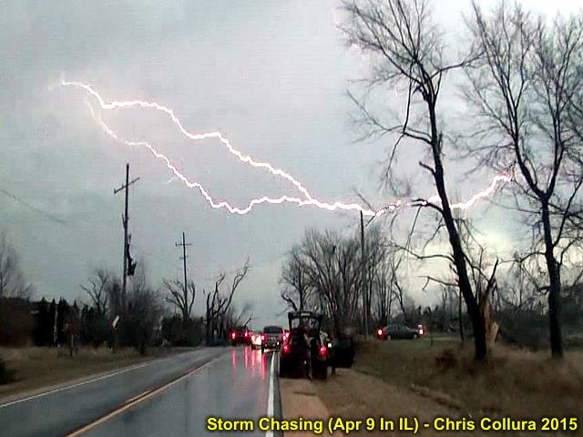
Trees and debris blocking the road as lightning flashes overhead and the chase ends (time to stop and assist) on April 9, 2015 near Fairdale, Illinois.
Posted: Apr 10, 2015, 5:14 PM
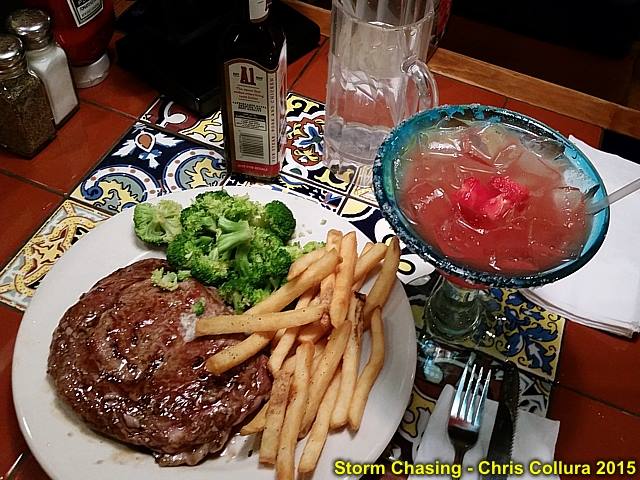
Steak dinner upon returning back to Chicago on April 10, 2015.
Posted: Apr 12, 2015, 8:18 AM
Damage in Olga County (north of Rochelle, IL) on April 11, 2015.
Posted: Apr 12, 2015, 8:18 AM
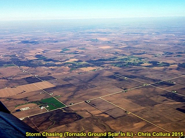
Ground scarring (black line oriented SW to NW west and north of Rochelle / Hillcreast viewed from PAC 750 skydive aircraft at about 5,000 feet. The view is to the north. April 11, 2015.
Posted: Apr 12, 2015, 8:18 AM
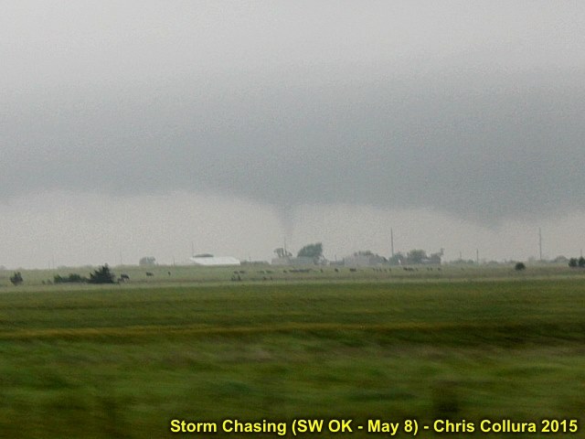
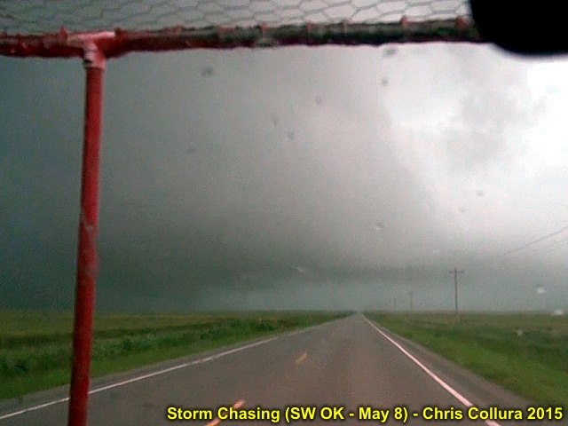
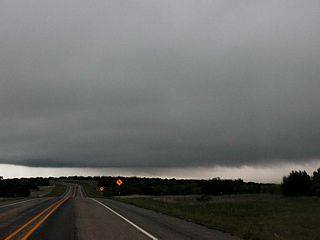
Brief tornado on northern "split" of HP storm south of Frederick, Oklahoma - May 8, 2015.
Posted: May 9, 2015, 10:03 AM
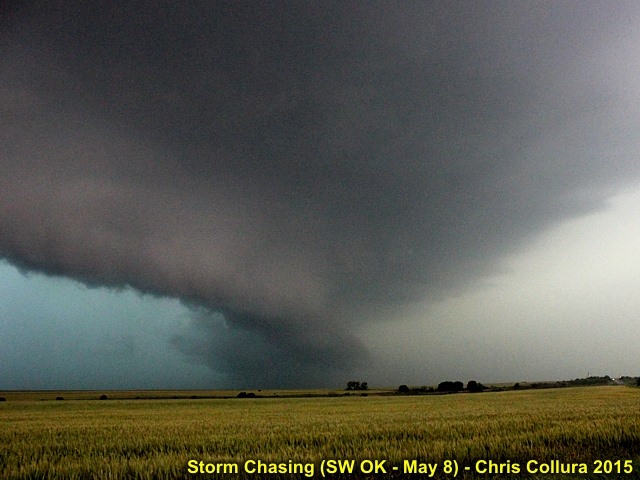
View into notch of HP storm near Grandfield, Oklahoma - May 8, 2015.
Posted: May 9, 2015, 10:03 AM
Brief tornado (lower left just right of support) in poor visibility and inside "bears cage" of HP storm near Grandfield, Oklahoma - May 8, 2015.
Posted: May 9, 2015, 10:04 AM
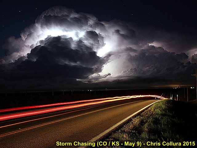
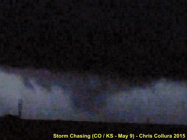
Hoxie Kansas tornadic supercell illuminated by lightning. May 9, 2015.
Posted: May 9, 2015, 11:59 PM
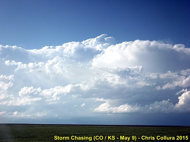
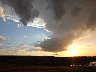
This is the supercell storm, 30 miles away, prolificly producing tornadoes I was too far away to see. View is NNW about 25 miles south of Cheyenne Wells, CO on May 9, 2015.
Posted: May 9, 2015, 11:59 PM
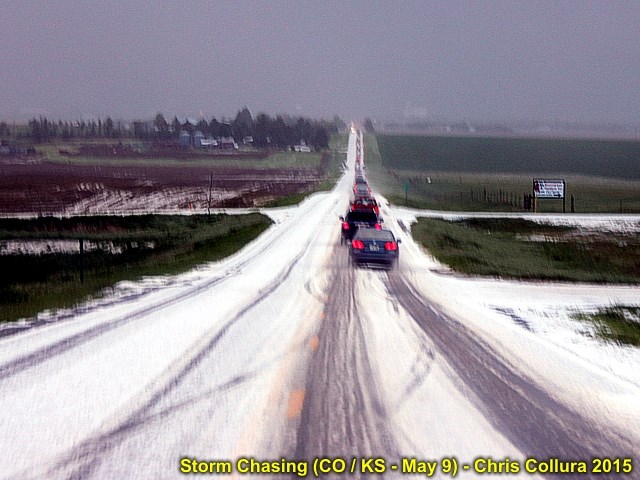
Hail covered ground south of I-70 and along highway 385 in Colorado. May 9, 2015.
Posted: May 9, 2015, 11:59 PM
Developing large tornado (poor frame grab from video), illuminated by lightning. This tornado was west of Hoxie, KS at about 9:30 PM CDT on May 9, 2015.
Posted: May 9, 2015, 11:59 PM
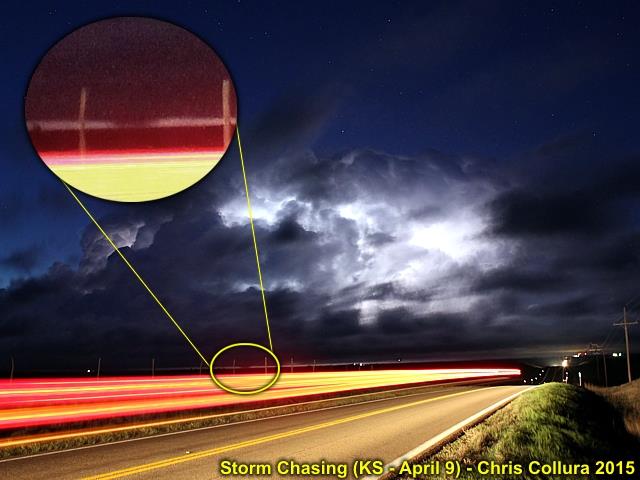
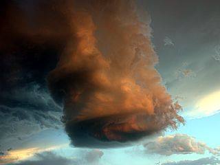
This is an annotated image of the Oakley / Grinnell to north-central Kansas supercell (time exposure of about 30 seconds illuminated by incredible lightning) and the large tornado is clearly visible under the cloud base. At one point, you could actually see two distinct tornadoes with this cell. May 9, 2015.
Posted: May 12, 2015, 5:30 AM
Posted: May 21, 2015, 1:57 PM
Posted: May 21, 2015, 1:57 PM
Posted: May 21, 2015, 1:57 PM
Posted: May 21, 2015, 1:57 PM
Posted: May 21, 2015, 1:57 PM
Posted: May 21, 2015, 1:57 PM
Posted: May 21, 2015, 1:57 PM
Posted: May 21, 2015, 1:57 PM
Posted: May 21, 2015, 1:57 PM
Posted: May 21, 2015, 1:57 PM

Posted: May 21, 2015, 1:57 PM
Posted: May 21, 2015, 1:57 PM
Posted: May 21, 2015, 1:57 PM
Posted: May 22, 2015, 8:13 PM
Posted: May 22, 2015, 8:13 PM
Posted: May 22, 2015, 8:13 PM
Posted: May 22, 2015, 8:13 PM
Posted: May 22, 2015, 8:13 PM
Posted: May 22, 2015, 8:13 PM
Posted: May 22, 2015, 8:13 PM
Posted: May 22, 2015, 8:13 PM
Posted: May 24, 2015, 8:12 AM
Posted: May 24, 2015, 8:12 AM
Posted: May 24, 2015, 8:12 AM
Posted: May 24, 2015, 8:12 AM
Posted: May 25, 2015, 9:32 PM
Posted: May 25, 2015, 9:32 PM
Changing oil in Wichita for off day (5/24 ... Should have chased this day, yes).
Posted: May 25, 2015, 9:32 PM
Posted: May 25, 2015, 9:32 PM

Posted: Jun 9, 2015, 6:01 PM
Posted: Jun 9, 2015, 6:01 PM
Posted: Jun 9, 2015, 6:01 PM
Posted: Jun 9, 2015, 6:01 PM
Posted: Jun 9, 2015, 6:01 PM
Posted: Jun 9, 2015, 6:01 PM
Posted: Jun 9, 2015, 6:01 PM
Posted: Jun 9, 2015, 6:01 PM
Posted: Jun 9, 2015, 6:01 PM
Posted: Jun 9, 2015, 6:01 PM
Posted: Jun 9, 2015, 6:01 PM
Posted: Jun 9, 2015, 6:01 PM
Posted: Jun 9, 2015, 6:01 PM
Posted: Jun 9, 2015, 6:01 PM
Posted: Jun 9, 2015, 6:01 PM
Posted: Jun 9, 2015, 6:01 PM
Posted: Jun 9, 2015, 6:01 PM
Posted: Jun 9, 2015, 6:01 PM
Posted: Jun 9, 2015, 6:01 PM
Posted: Jun 9, 2015, 6:01 PM
Posted: Jun 9, 2015, 6:01 PM
Posted: Jun 9, 2015, 6:01 PM
Posted: Jun 9, 2015, 6:02 PM
Posted: Jun 9, 2015, 6:02 PM
Posted: Jun 9, 2015, 6:02 PM
Posted: Jun 9, 2015, 6:02 PM
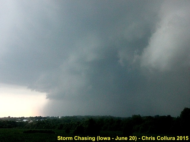
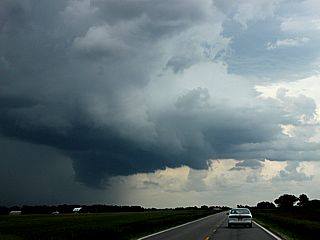
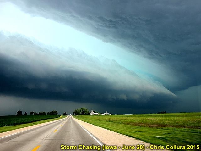
Poweful outflow and gust front racing eastward towards Fairfield, Iowa on June 20, 2015.
Posted: Jun 21, 2015, 7:34 AM
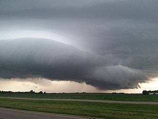
Another view of gust front / shelf cloud associated with elevated severe storms to the north of Tipton, Iowa on June 20, 2015.
Posted: Jun 21, 2015, 7:34 AM
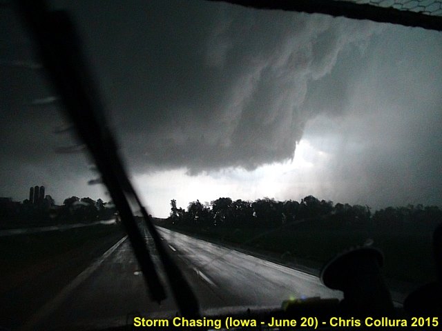
Mesocyclone just prior to being undercut by outflow near Oskaloosa, Iowa on June 20, 2015.
Posted: Jun 21, 2015, 7:34 AM
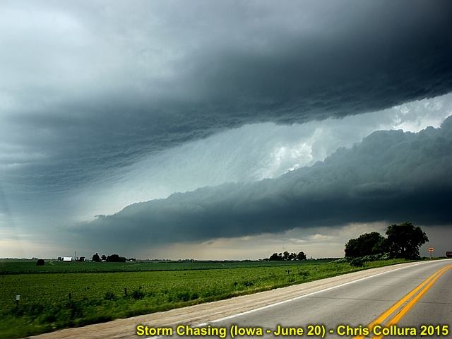
Gust front / shelf cloud associated with elevated severe storms to the north of Tipton, Iowa on June 20, 2015.
Posted: Jun 21, 2015, 7:34 AM
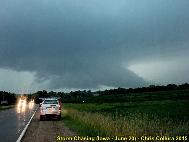
Wall cloud on embedded supercell storm before undercut by outflow near Oskaloosa, Iowa on June 20, 2015.
Posted: Jun 21, 2015, 7:34 AM
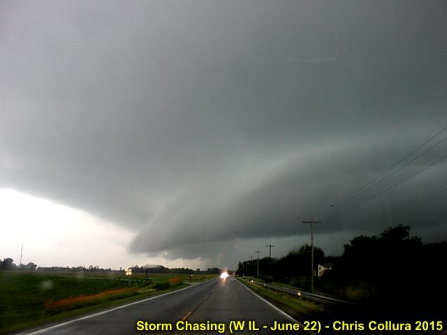
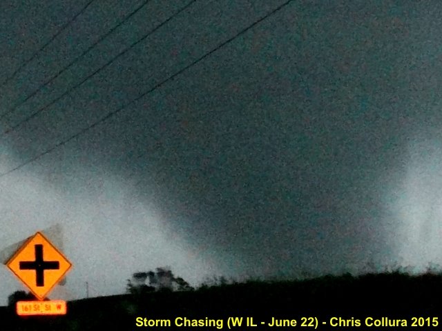
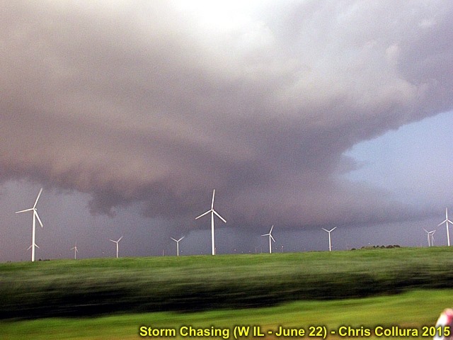
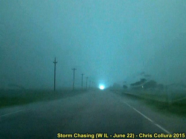
Approaching tornadic supercell storm near Illinois City, IL on June 22, 2015.
Posted: Jun 22, 2015, 11:02 PM
Wall cloud near Woodhull, IL on June 22, 2015. Second tornado formed from this cycle.
Posted: Jun 22, 2015, 11:03 PM

Developing mesocyclone (RFD to the left) near Illinois City, IL on June 22, 2015.
Posted: Jun 22, 2015, 11:03 PM
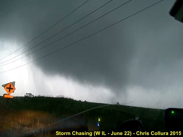
Multi-vortex nature of tornado east of Illinois City, IL on June 22, 2015.
Posted: Jun 22, 2015, 11:03 PM
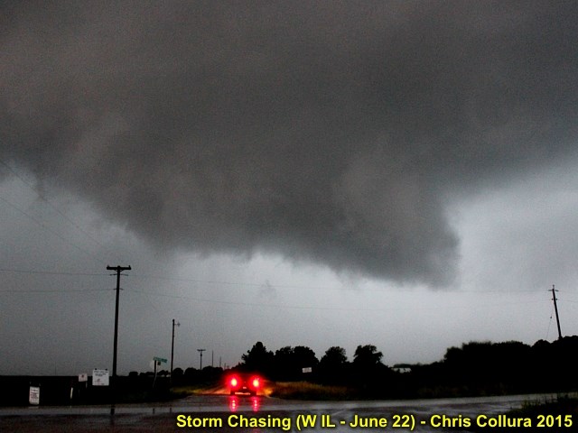
Wall cloud near ground near Illinois City, IL on June 22, 2015. First tornado about to form after this.
Posted: Jun 22, 2015, 11:03 PM
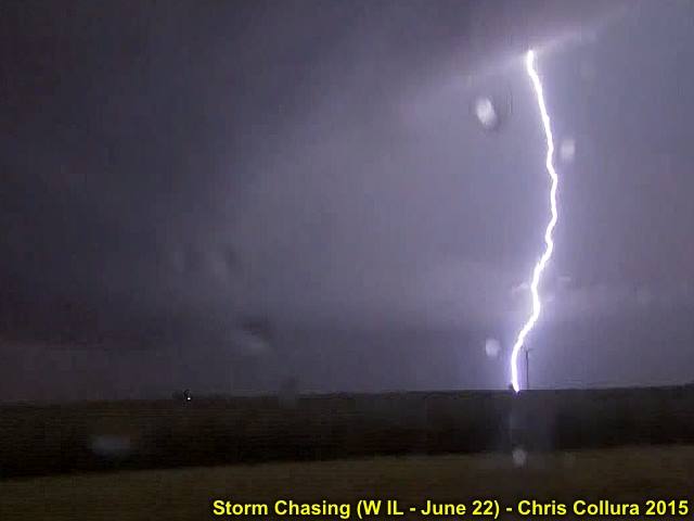
Lightning near Altona, IL on June 22, 2015.
Posted: Jun 22, 2015, 11:03 PM
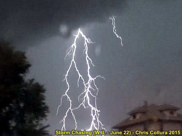
Lightning frame capture near Altona, IL on June 22, 2015.
Posted: Jun 22, 2015, 11:03 PM
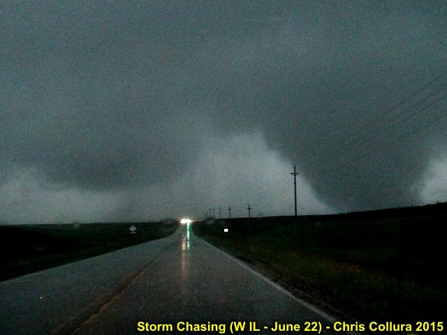
Close up of wedge tornado near Illinois City, IL on June 22, 2015.
Posted: Jun 22, 2015, 11:03 PM
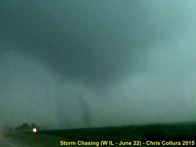
First touchdown of tornado east of Illinois City, IL on June 22, 2015.
Posted: Jun 22, 2015, 11:03 PM
Weakening cyclic supercell near Altona, IL on June 22, 2015.
Posted: Jun 22, 2015, 11:03 PM
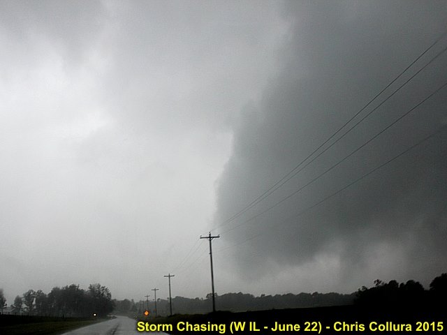
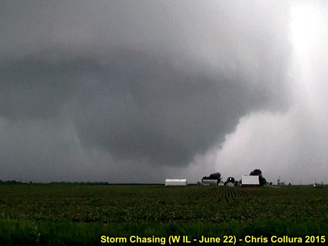
Tornado widening to wedge phase east of Illinois City, IL on June 22, 2015.
Posted: Jun 22, 2015, 11:03 PM
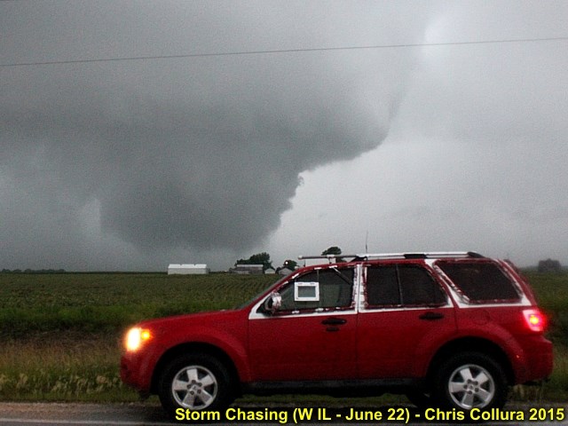
My vehicle and second tornado developing near Woodhull, IL on June 22, 2015
Posted: Jun 22, 2015, 11:03 PM
Second tornado near Woodhull, IL on June 15, 2015.
Posted: Jun 22, 2015, 11:03 PM
Power flash as tornado crosses road east of Illinois City, IL on June 22, 2015. Tornado rain wrapped at this point.
Posted: Jun 22, 2015, 11:03 PM
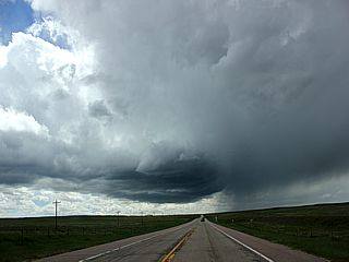
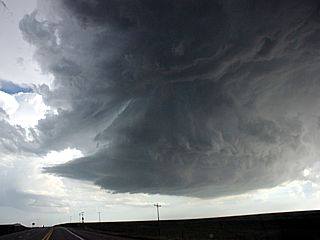
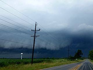
Intense RFD clear slot developing with the classic to HP supercell storm east of Harvard, IL on July 18, 2015.
Posted: Jul 20, 2015, 4:50 PM
Weakening storm becomes outflow dominant with a well developed shelf cloud and gust front as it evolves to a cluster of severe thunderstorms north of Woodstock, IL on July 18, 2015.
Posted: Jul 20, 2015, 4:50 PM
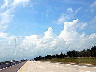
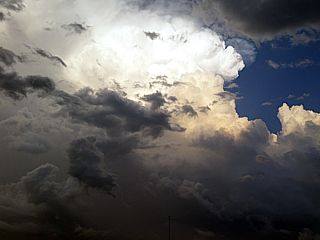
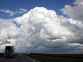
Towering cumulus along a NW to SE oriented outflow boundary (looking west on I-90 west of Rockford, IL). This was the start of strong and severe storms that will eventually produce severe weather in the area, including a weak tornado in McHenry County, IL. July 18, 2015.
Posted: Jul 20, 2015, 4:50 PM
Intensifying rotating updraft base of supercell storm near Harvard, IL on July 18, 2015.
Posted: Jul 20, 2015, 4:50 PM
Weak tornado (to the far left in the photo) forms and does damage to trees and some farm buildings over McHenry County, IL and ENE towards the IL / WI border before weakening as the storm merged with other storms in the cluster of thunderstorms. July 18, 2015.
Posted: Jul 20, 2015, 4:50 PM
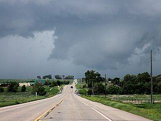
View to the east near Highway 14 approaching McHenry County, IL with explosively developing supercell storm looking to the east. This was part of a storm cluster, and will eventually produce a weak tornado on July 18, 2015.
Posted: Jul 20, 2015, 4:50 PM
View of developing weak tornado over rural areas of McHenry County, IL east of Harvard, IL on July 18, 2015.
Posted: Jul 20, 2015, 4:50 PM
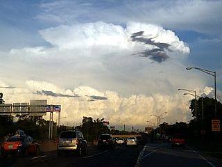
Here is a view of a supercell storm looming over the horizon and distant Chicago (IL) skyline on July 17, 2015.
Posted: Jul 20, 2015, 4:50 PM
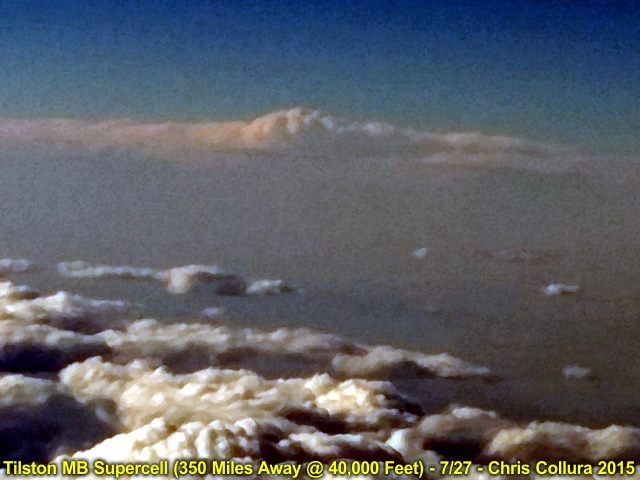
Looking north from over far NW Nebraska at 40,000 feet, a highly zoomed shot (350 miles away), we see the Tilston, Manitoba supercell looming over the horizon to the north of the US Canadian border late in the day on July 27, 2015. The storm produced a violent long track tornado that was on the ground for a staggering 2-4 HOURS!
Posted: Jul 29, 2015, 4:55 PM
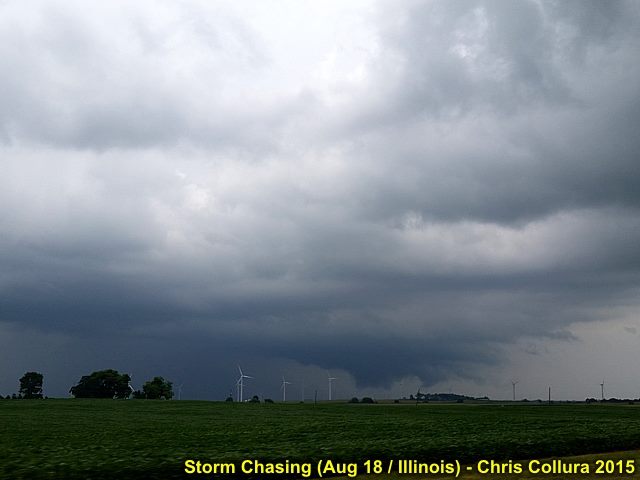
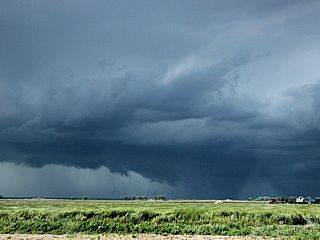
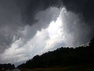
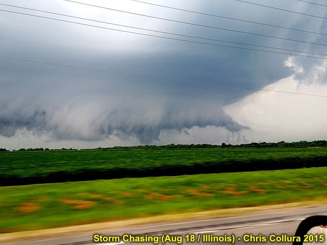
Rotating wall cloud near Mazon (Grundy County), IL on August 18, 2015.
Posted: Aug 18, 2015, 7:48 PM
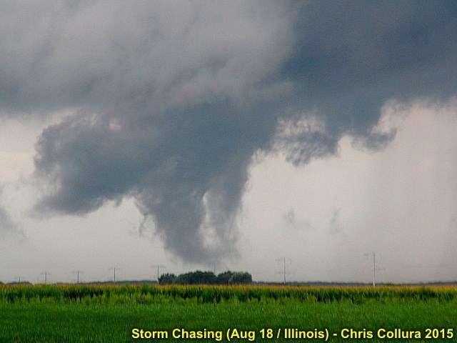
Close up of brief weak tornado west of Mazon, IL on August 18, 2015.
Posted: Aug 18, 2015, 7:48 PM
Funnel reaching the ground as a tornado with striking supercell structure looking NW from Highway 17 near Mazon, IL. August 18, 2015 during the evening (6:05 PM CDT).
Posted: Aug 18, 2015, 7:48 PM
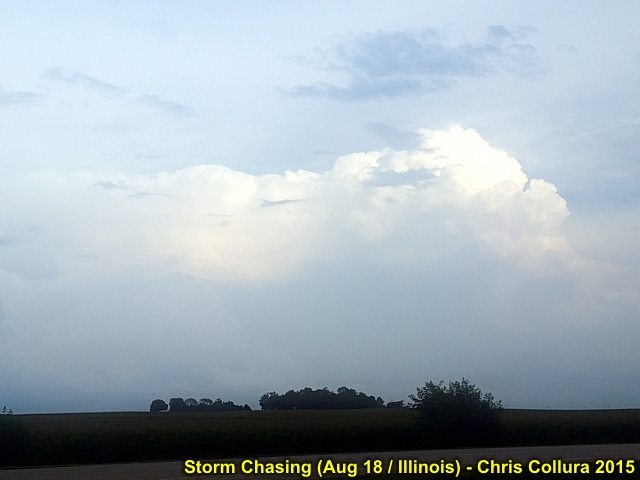
Tornadic supercell developing from 40 miles away over Grundy County, IL on August 18, 2015.
Posted: Aug 18, 2015, 7:48 PM
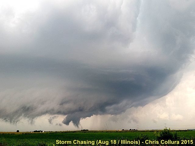
Another view of tornadic supercell west of Mazon, IL on August 18, 2015.
Posted: Aug 18, 2015, 7:48 PM
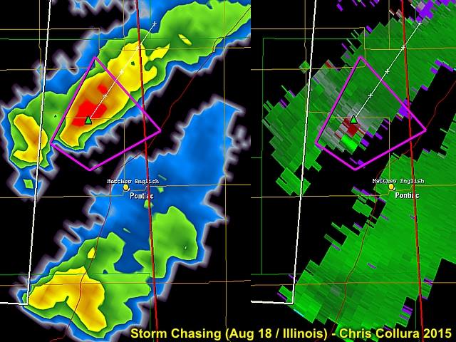
Radar images (left is reflectivity and right is the velocity) of two supercell storms (the northern one was the one affecting Grundy County / Mazon). Aug 18, 2015 at about 6 PM CDT.
Posted: Aug 18, 2015, 7:57 PM

Lightning as storm passes over the southern parts of Chicago on Aug 18, 2015. Still tornado warned.
Posted: Aug 18, 2015, 8:13 PM
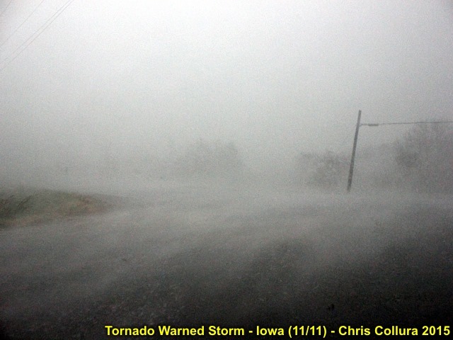
Powerful rain wrap / RFD blast as tornadic circlulation passes to my north - Near Hiteman, Iowa on November 11, 2015.
Posted: Nov 11, 2015, 9:22 PM
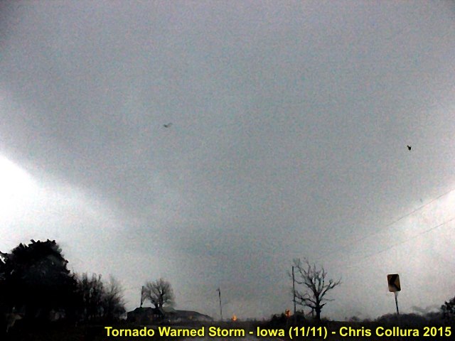
Base of tornadic supercell storm near Hiteman, Iowa on Nov 11, 2015 passing just to my north and northwest.
Posted: Nov 11, 2015, 9:22 PM
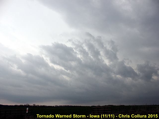
Approaching tornado warned storm near Hiteman, Iowa on Nov 11, 2015. Inflow features and extremely sheared cloud formations.
Posted: Nov 11, 2015, 9:22 PM
Generated by Chris Collura on Wednesday, April 15, 2020 at 11:31 AM UTC-07:00
HTML File "index32.htm" (Facebook) - Developed By Chris Collura
To Return To The HOME Page Of This Site Click The "INDEX.HTM" Link Here!