
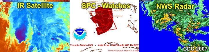
| This area shows pictures taken from the observations of tropical storm Barry in South Florida. The storm began as a tropical disturbance between Cuba and the Yucatan Penninsula and intensified into a tropical depression. Moving slowly northward, the system reached tropical storm status, and became named as tropical storm "Barry", the second named storm of the Atlantic Hurricane Season of 2007. Even more ironically, the storm was named on June 1, which is also the official start date of the season as well! Tropical storm barry moved northward and encountered wind-shear from a low-pressure trough over the central United States. This effectively took 90% of the convection, including the winds and rain, and displaced it a couple of hundred miles to the east of the actual center. The center of Barry became "exposed" and weakening ensued, and Barry made landfall north of Tampa, FL a day later on June 2 as a weakening tropical depression. The strongest Barry got was with 50 MPH sustained winds, mainly east of the poorly-organized center. I just happend to be visiting southern FL after working in Ohio the prior week, so with the storm's poorly-organized structure in mind, just the rains and coastal effects were of interest for an impromptu "chase" of Barry and its effects were on the agenda. Barry did, to great appreciation, dump a lot of precipitation over Florida as nearly all its weather was on it's eastern (right) semi-circle, making for terrific drough relief (about 5 to 10 inches of rain). |
| CHASER NAME | HOME CITY | CALLSIGN | OCCUPATION |
| CHRIS COLLURA | MIRAMAR, FL | KG4PJN | COMPUTER ANALYST |
![]() Video Clips Coming Soon!
Video Clips Coming Soon!
|
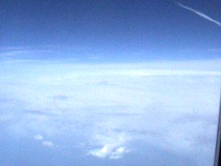
The last thing you might think of with something like a tropical storm observation is a picture from an airplane. This is a flight from Baltimore, MD to Fort Lauderdale, FL on June 1 in a Boeing 717 at roughly 34,000 feet over South Carolina. The key feature here is the "band" of white, thick high clouds on the horizon. This is the outflow "plume" from Tropical Storm Barry being wafted by the high altitude winds. This is pretty much the last blue sky of this flight, before we entered the high clouds. Conditions of the flight were to only deteriorate gradually at first (light turbulence) then more dramatically during descent into Fort Lauderdale, FL. |
|
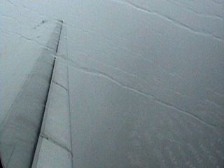
Here is a picture "breaking through" the heavy showers and thunderstorms about 10-15 miles west of Fort Lauderdale airport. Rain is so heavy you can hear it pounding the aircraft. Turbulence is moderate, and the pilot is doing a great job finding a "soft spot" between the feeder bands of TS Barry, even aborting one approach and "circling" once! In this picture, you can barely make out the city blocks to the lower right. Everything takes on a dark "stormy" hue, and water races across all the aircraft's windows. |
|
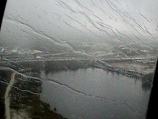
Almost there ... On final approach to Fort Lauderdale Airport, we are now under the low, dark clouds of the feeder bands of TS Barry and about a minute from touching down. Water continues to race across the aircraft's windows, visibility is bad, as the cool-handed pilot still performs a near perfect landing into a 20-30 Knot head-wind! |
|
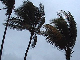
Palm trees blown in the 30 MPH on-shore winds at Deerfield Beach, FL on the evening of June 1. |
|
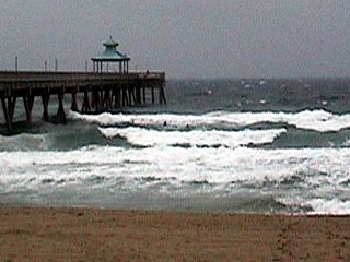
The seas kicked up by this portion of TS Barry cause some minor beach erosion and make for waves uo to 8 feet high at the Deerfield Beach fishing pier late on June 1. |
|
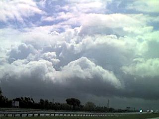
One of the feeder bands from TS Barry pushes across Fort Lauderdale, Florida early on June 2. These thunderstorm lines can sometimes spawn tornadoes if conditions are just right. The band here produced some heavy rains and strong winds. |
|
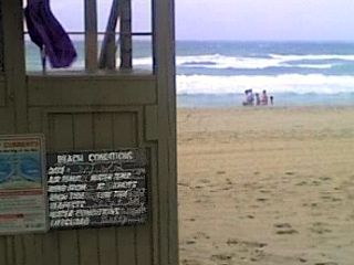
A much calmer day prevailed at Deerfield Beach on June 2 as the winds started to subside as TS Barry weakened. Funny enough, on the blackboard on the lifeguard stand to the left, the bottom line says "Lifeguard: Barry". |
HTML File "ba07.htm" - Developed By Chris Collura
To Return To The HOME Page Of This Site Click The "INDEX.HTM" Link Here!