
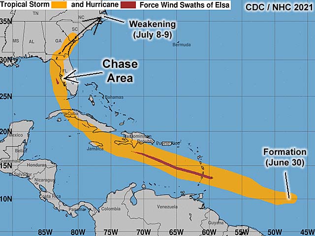
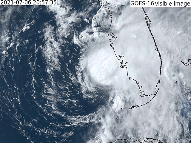
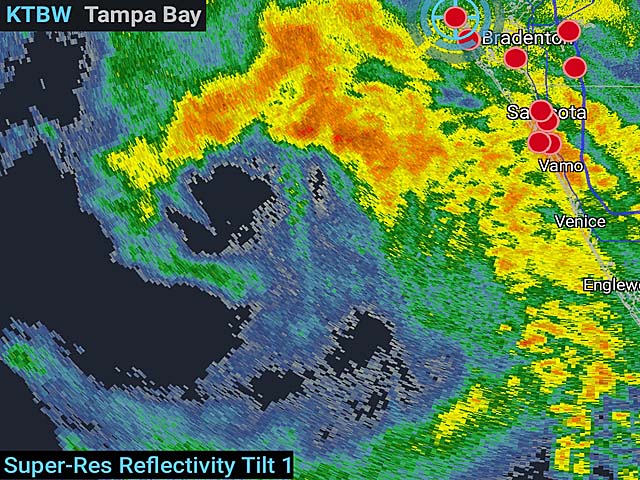
| This area shows pictures taken from the observations of tropical storm / hurricane Elsa as it came within 25 miles of the Tampa area on the west coast of Florida during the late evening of July 6, 2021 and into the morning of July 7. This tropical system formed from a Cape Verde African wave around June 30, becoming a minimal hurricane as it moved across the windward islands near Barbados on July 2. The storm flucuated and continued west and west-northwest across the Caribbean Sea between Haiti and Jamaica. As a strong tropical storm, Elsa rounded the western edge of a subtropical ridge, crossing the west-central end of Cuba near Havana late on July 5. Re-emerging over the SE Gulf of Mexico, the storm passeed west of the lower FL Keys and made its closest aproach to the FL west coast near Tampa / Pinellas County coast during the overnight hours of July 6-7, briefly regaining minimal hurricane strength there. This was the area I decided to observe the storm, anticipating a right turn and landfall near or north of the Tampa / Clearwater area. The storm weakened again and jogged west, suffering from the effects of dry air and some vertical wind shear. As a 60-65 MPH storm, Elsa came ashore in the FL Panhandle near Tylor County by late morning on July 7. The storm moved northeast, completing a full re-curverature, and continued across the eastern USA and eventually to the northeast USA as a minimal tropical storm and extratopical towards the Canadian Maritimes by July 9. My chase of this system was mainly to the east of the storm as it was briefly a hurricane during the overnight hours of July 6-7, as it made its closest approach to the Florida west coast from near Anne Maria Island and into Pinellas County. The main core and eye of this minimal hurricane remained 20 to 25 miles west of the area. I did not penetrate the storm later on July 7 when it weakened and made landfall in the FL panhandle. Tropical storm forced winds and coastal effects were observed. The chase vehicle was a 2021 Nissan Rouge rental, as I happened to be in Florida for a couple of weeks between business trips. |
| CHASER NAME | HOME CITY | CALLSIGN | OCCUPATION |
| CHRIS COLLURA | DEERFIELD BEACH, FL | KG4PJN | COMPUTER ANALYST |
|
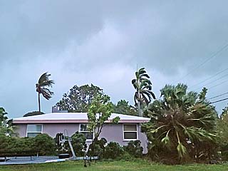
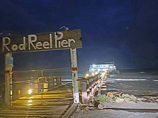
Tropical storm forced winds come ashore during the early evening of July 6 near Bradenton Beach, FL. |
|
Strong winds and some waves on the north side of Sarasota Bay. |
|
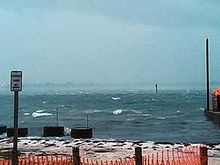
Rough conditions looking west across the Gulf of Mexico between Bradenton Beach and Anne Maria Island. |
|
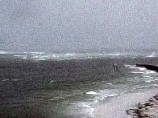
View of strong winds and waves on the northern tip of Anne Maria Island and looking into the mouth of the Tampa Bay. |

|
While returning back east from the storm, a powerful band of thunderstorms was penetrated, with 60 MPH+ winds and frequent lightning. Here torrential rains are illuminated by a bright flash of lightning along I-75 near Charlotte Harbor, FL. |
HTML File "elsa21.htm" - Developed By Chris Collura
To Return To The HOME Page Of This Site Click The "INDEX.HTM" Link Here!